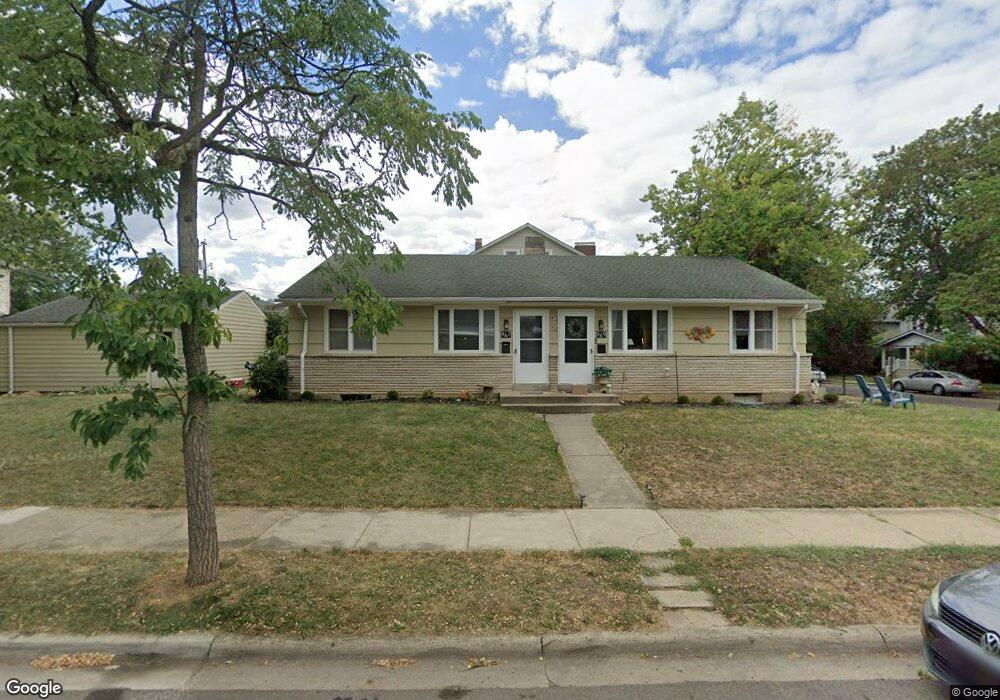
967 Thomas Rd Unit 969 Columbus, OH 43212
Estimated Value: $425,000 - $518,000
4
Beds
2
Baths
1,421
Sq Ft
$338/Sq Ft
Est. Value
About This Home
This home is located at 967 Thomas Rd Unit 969, Columbus, OH 43212 and is currently estimated at $480,223, approximately $337 per square foot. 967 Thomas Rd Unit 969 is a home located in Franklin County with nearby schools including Robert Louis Stevenson Elementary School, Larson Middle School, and Grandview Heights High School.
Ownership History
Date
Name
Owned For
Owner Type
Purchase Details
Closed on
Jul 19, 2001
Sold by
Dodson Barney M
Bought by
Dodson Beverly B
Current Estimated Value
Home Financials for this Owner
Home Financials are based on the most recent Mortgage that was taken out on this home.
Original Mortgage
$90,000
Interest Rate
7%
Purchase Details
Closed on
Feb 5, 1982
Bought by
Dodson Barney M
Create a Home Valuation Report for This Property
The Home Valuation Report is an in-depth analysis detailing your home's value as well as a comparison with similar homes in the area
Home Values in the Area
Average Home Value in this Area
Purchase History
| Date | Buyer | Sale Price | Title Company |
|---|---|---|---|
| Dodson Beverly B | -- | Stewart Title Agency Of Colu | |
| Dodson Barney M | -- | -- |
Source: Public Records
Mortgage History
| Date | Status | Borrower | Loan Amount |
|---|---|---|---|
| Closed | Dodson Beverly B | $90,000 |
Source: Public Records
Tax History Compared to Growth
Tax History
| Year | Tax Paid | Tax Assessment Tax Assessment Total Assessment is a certain percentage of the fair market value that is determined by local assessors to be the total taxable value of land and additions on the property. | Land | Improvement |
|---|---|---|---|---|
| 2024 | $7,724 | $130,030 | $68,290 | $61,740 |
| 2023 | $6,783 | $130,025 | $68,285 | $61,740 |
| 2022 | $10,504 | $116,730 | $57,820 | $58,910 |
| 2021 | $6,705 | $116,730 | $57,820 | $58,910 |
| 2020 | $6,604 | $116,730 | $57,820 | $58,910 |
| 2019 | $6,592 | $103,110 | $57,820 | $45,290 |
| 2018 | $5,802 | $103,110 | $57,820 | $45,290 |
| 2017 | $6,154 | $103,110 | $57,820 | $45,290 |
| 2016 | $5,036 | $72,210 | $34,580 | $37,630 |
| 2015 | $5,037 | $72,210 | $34,580 | $37,630 |
| 2014 | $5,052 | $72,210 | $34,580 | $37,630 |
| 2013 | $2,223 | $65,660 | $31,465 | $34,195 |
Source: Public Records
Map
Nearby Homes
- 1129 Mulford Rd
- 932 Mcclain Rd
- 1081 W 3rd Ave
- 1081 Northwest Blvd Unit 2
- 945 Northwest Blvd Unit 947
- 1111 Northwest Blvd Unit 113
- 922 Northwest Blvd
- 910-912 Northwest Blvd
- 1225 Eastview Ave
- 1240 Oxley Rd
- 1083 W 3rd Ave
- 1242 Oxley Rd
- 1093 W 3rd Ave
- 1095 W 3rd Ave
- 1297 Doten Ave
- 1475 W 3rd Ave Unit 204
- 1000 Urlin Ave Unit 2007
- 1000 Urlin Ave Unit 520
- 1000 Urlin Ave Unit 605
- 1000 Urlin Ave Unit 511
- 1107 Mulford Rd Unit 109
- 1107 Mulford Rd Unit 9
- 1089 Mulford Rd
- 1113 Mulford Rd Unit 115
- 955 Thomas Rd
- 947 Thomas Rd
- 1081 Mulford Rd Unit 85
- 1119 Mulford Rd
- 1119 Mulford Ave
- 954 Thomas Rd Unit 954
- 950 Thomas Rd Unit 950
- 1100 Mulford Rd Unit 102
- 1100-1102 Mulford Rd
- 945 Thomas Rd
- 1094 Mulford Rd Unit 96
- 1106 Mulford Rd Unit 108
- 1106 Mulford Rd Unit 1106 and 1108
- 1075 Mulford Rd Unit 77
- 1090 Mulford Rd Unit 92
- 1110 Mulford Rd Unit 112