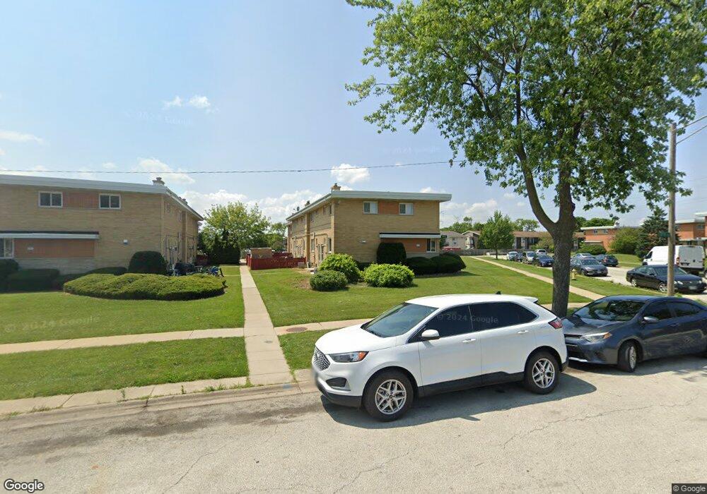
9670 Lois Dr Unit 71 Des Plaines, IL 60016
Estimated Value: $247,498 - $317,000
3
Beds
--
Bath
1,784
Sq Ft
$161/Sq Ft
Est. Value
About This Home
This home is located at 9670 Lois Dr Unit 71, Des Plaines, IL 60016 and is currently estimated at $287,625, approximately $161 per square foot. 9670 Lois Dr Unit 71 is a home located in Cook County with nearby schools including Washington Elementary School, Gemini Middle School, and Maine East High School.
Ownership History
Date
Name
Owned For
Owner Type
Purchase Details
Closed on
Aug 15, 2013
Sold by
Parkway Bnk And Trust Co
Bought by
Ahmed Elizabeth
Current Estimated Value
Purchase Details
Closed on
Mar 31, 2011
Sold by
Ahmed Rakib
Bought by
Parkway Bank & Trust Company and Trust #14954
Create a Home Valuation Report for This Property
The Home Valuation Report is an in-depth analysis detailing your home's value as well as a comparison with similar homes in the area
Home Values in the Area
Average Home Value in this Area
Purchase History
| Date | Buyer | Sale Price | Title Company |
|---|---|---|---|
| Ahmed Elizabeth | -- | None Available | |
| Parkway Bank & Trust Company | -- | None Available |
Source: Public Records
Tax History
| Year | Tax Paid | Tax Assessment Tax Assessment Total Assessment is a certain percentage of the fair market value that is determined by local assessors to be the total taxable value of land and additions on the property. | Land | Improvement |
|---|---|---|---|---|
| 2025 | $4,385 | $25,434 | $2,271 | $23,163 |
| 2024 | $4,385 | $20,286 | $1,845 | $18,441 |
| 2023 | $4,141 | $20,286 | $1,845 | $18,441 |
| 2022 | $4,141 | $20,286 | $1,845 | $18,441 |
| 2021 | $2,906 | $13,054 | $2,839 | $10,215 |
| 2020 | $2,907 | $13,054 | $2,839 | $10,215 |
| 2019 | $2,869 | $14,606 | $2,839 | $11,767 |
| 2018 | $1,731 | $9,383 | $2,484 | $6,899 |
| 2017 | $1,719 | $9,383 | $2,484 | $6,899 |
| 2016 | $1,841 | $9,383 | $2,484 | $6,899 |
| 2015 | $1,952 | $9,309 | $2,129 | $7,180 |
| 2014 | $1,901 | $9,309 | $2,129 | $7,180 |
| 2013 | $1,852 | $9,309 | $2,129 | $7,180 |
Source: Public Records
Map
Nearby Homes
- 8828 N Leslie Ln Unit 104D
- 8828 N Leslie Ln Unit 1F
- 8936 Northshore Dr Unit 104D
- 8809 W Golf Rd Unit 7H
- 9074 W Terrace Dr Unit 4N
- 3409 Fairlawn Dr Unit B
- 9078 W Heathwood Dr Unit 5
- 9078 W Heathwood Dr Unit 1M
- 9731 N Fox Glen Dr Unit 5C
- 9098 W Terrace Dr Unit 1L
- 9575 Terrace Place Unit 206F
- 9128 W Dr
- 9128 W Terrace Dr Unit 2D
- 9128 W Terrace Dr Unit 3M
- 9128 W Terrace Dr Unit 91283B
- 9319 Knight Ave
- 9701 N Dee Rd Unit 5E
- 9701 N Dee Rd Unit 6M
- 9356 N Parkside Dr
- 9326 Greenwood Ave
- 9670 Lois Dr Unit 75
- 9670 Lois Dr Unit 73
- 9670 Lois Dr Unit 76
- 9670 Lois Dr Unit 72
- 9670 Lois Dr Unit 74
- 9670 Lois Dr
- 9670 Lois Dr Unit E
- 9670 Lois Dr Unit F
- 9668 Lois Dr Unit B
- 9668 Lois Dr Unit 70
- 9668 Lois Dr Unit 68
- 9668 Lois Dr Unit 66
- 9668 Lois Dr Unit 65
- 9668 Lois Dr Unit 69
- 9668 Lois Dr Unit 67
- 9668 Lois Dr Unit B
- 9668 Lois Dr Unit A
- 9666 Lois Dr Unit 61
- 9666 Lois Dr Unit 64
- 9666 Lois Dr Unit 63
Your Personal Tour Guide
Ask me questions while you tour the home.