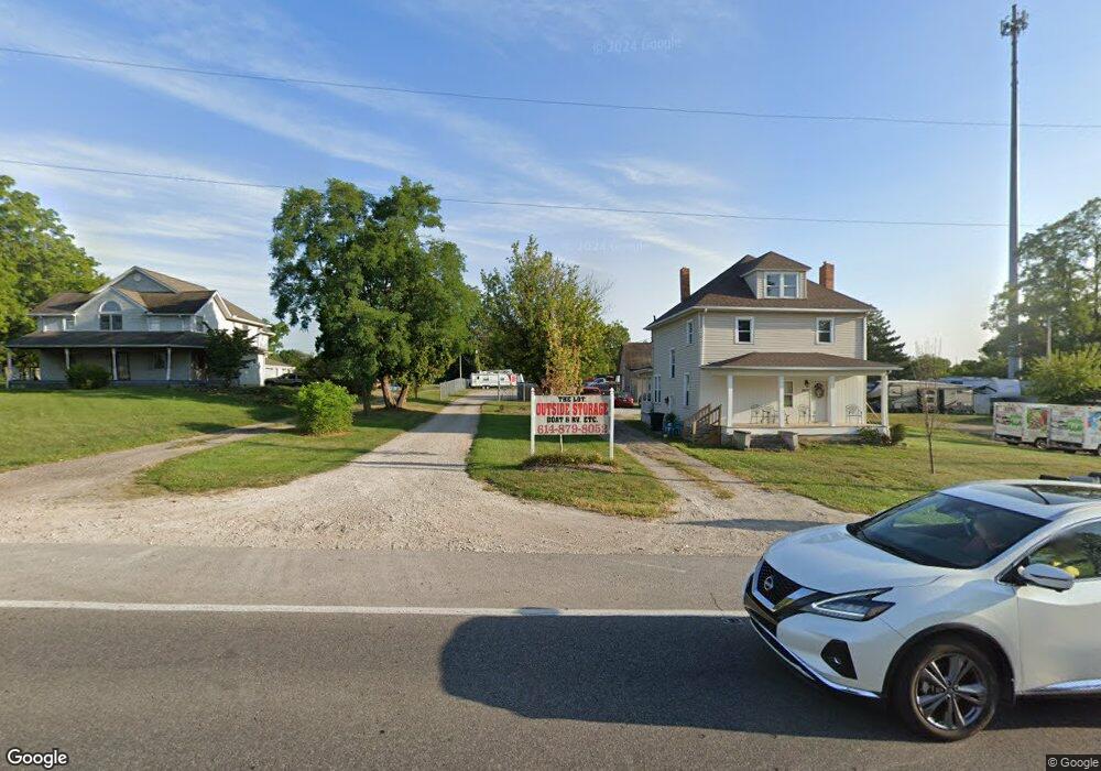
9677 Us Highway 40 West Jefferson, OH 43162
Estimated Value: $212,000 - $397,000
3
Beds
3
Baths
2,000
Sq Ft
$148/Sq Ft
Est. Value
About This Home
This home is located at 9677 Us Highway 40, West Jefferson, OH 43162 and is currently estimated at $296,994, approximately $148 per square foot. 9677 Us Highway 40 is a home located in Madison County with nearby schools including Norwood Elementary School, West Jefferson Middle School, and West Jefferson High School.
Ownership History
Date
Name
Owned For
Owner Type
Purchase Details
Closed on
Jul 10, 2009
Sold by
Wetzel Kevin G
Bought by
Castle Jimmie L
Current Estimated Value
Home Financials for this Owner
Home Financials are based on the most recent Mortgage that was taken out on this home.
Original Mortgage
$118,000
Outstanding Balance
$77,054
Interest Rate
5.32%
Mortgage Type
Purchase Money Mortgage
Estimated Equity
$219,941
Purchase Details
Closed on
Jun 18, 2008
Sold by
Wetzel Kevin G and Castle Jimmie L
Bought by
Department Of Transportation
Purchase Details
Closed on
Feb 28, 2006
Sold by
Tsm Investments Pll
Bought by
Wetzel Kevin G and Castle Jimmie L
Purchase Details
Closed on
Oct 4, 2001
Sold by
Est Estel Scott
Bought by
Tsm Investments
Home Financials for this Owner
Home Financials are based on the most recent Mortgage that was taken out on this home.
Original Mortgage
$200,000
Interest Rate
6.99%
Mortgage Type
New Conventional
Create a Home Valuation Report for This Property
The Home Valuation Report is an in-depth analysis detailing your home's value as well as a comparison with similar homes in the area
Home Values in the Area
Average Home Value in this Area
Purchase History
| Date | Buyer | Sale Price | Title Company |
|---|---|---|---|
| Castle Jimmie L | $45,000 | Midland Title | |
| Department Of Transportation | $2,401 | Attorney | |
| Wetzel Kevin G | $175,000 | None Available | |
| Tsm Investments | $200,000 | -- |
Source: Public Records
Mortgage History
| Date | Status | Borrower | Loan Amount |
|---|---|---|---|
| Open | Castle Jimmie L | $118,000 | |
| Previous Owner | Tsm Investments | $200,000 |
Source: Public Records
Tax History Compared to Growth
Tax History
| Year | Tax Paid | Tax Assessment Tax Assessment Total Assessment is a certain percentage of the fair market value that is determined by local assessors to be the total taxable value of land and additions on the property. | Land | Improvement |
|---|---|---|---|---|
| 2024 | $3,536 | $78,040 | $20,630 | $57,410 |
| 2023 | $3,536 | $78,040 | $20,630 | $57,410 |
| 2022 | $2,859 | $58,650 | $15,190 | $43,460 |
| 2021 | $2,870 | $58,650 | $15,190 | $43,460 |
| 2020 | $2,921 | $58,650 | $15,190 | $43,460 |
| 2019 | $2,541 | $50,250 | $17,770 | $32,480 |
| 2018 | $2,367 | $50,250 | $17,770 | $32,480 |
| 2017 | $2,221 | $50,250 | $17,770 | $32,480 |
| 2016 | $2,221 | $46,110 | $17,770 | $28,340 |
| 2015 | $2,221 | $46,110 | $17,770 | $28,340 |
| 2014 | $2,317 | $46,110 | $17,770 | $28,340 |
| 2013 | -- | $57,980 | $14,810 | $43,170 |
Source: Public Records
Map
Nearby Homes
- 270 State Route 142 NE
- 360 State Route 142 NE
- 74 S Chester St
- 63 Jones St
- 545 Trillium Dr
- 200 Smith St
- 248 London Rd
- 22 N Franklin St
- 312 Larkspur Dr
- 283 Madison Dr N
- 304 Middle Dr
- 430 Trillium Dr
- 435 Trillium Dr
- 70 Riverside Dr
- 10763 Southwood Rd
- 287 Greenlake St
- 555 Kirkwood Dr
- 8626 Fairbrook Ave
- 622 Brookdale Dr
- 8595 Abbot Cove Ave
- 9643 Us Highway 40
- 9695 Us Highway 40
- 9680 Us Highway 40
- 9565 W Broad St
- 242 Pc Geo Rd SE
- 242 Plain City Georgesville Rd SE
- 106 Pc Geo Rd SE
- 9651 Us Highway 40
- 106 Plain City Georgesville Rd SE
- 100 Pc Geo Rd SE
- 258 E Main St
- 104 Pc Geo Rd SE
- 254 E Main St
- 665 Heron Dr
- 244 Plain City Georgesville Rd SE
- 252 E Main St
- 239 E Main St
- 100 State Route 142 NE
- 237 E Main St Unit 237
- 244 E Main St