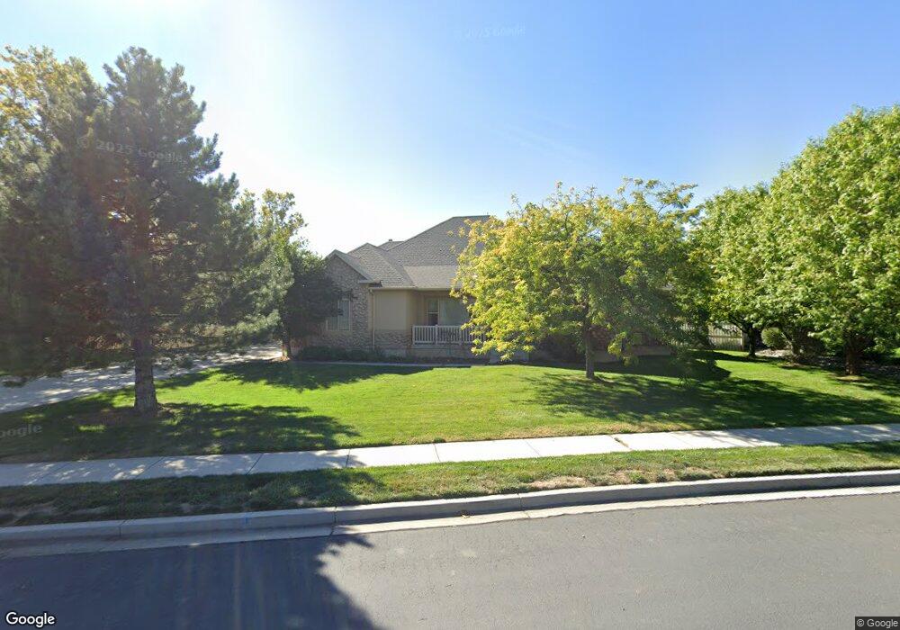
9679 N 6670 W Highland, UT 84003
Estimated Value: $944,000 - $1,174,835
3
Beds
2
Baths
2,268
Sq Ft
$468/Sq Ft
Est. Value
About This Home
This home is located at 9679 N 6670 W, Highland, UT 84003 and is currently estimated at $1,060,459, approximately $467 per square foot. 9679 N 6670 W is a home located in Utah County with nearby schools including Freedom Elementary School, Mountain Ridge Junior High School, and American Fork High School.
Ownership History
Date
Name
Owned For
Owner Type
Purchase Details
Closed on
Feb 24, 2016
Sold by
Peck Maylene and Roach Maylene
Bought by
Peck Maylene
Current Estimated Value
Home Financials for this Owner
Home Financials are based on the most recent Mortgage that was taken out on this home.
Original Mortgage
$382,500
Outstanding Balance
$305,436
Interest Rate
3.92%
Mortgage Type
New Conventional
Estimated Equity
$755,023
Purchase Details
Closed on
Dec 31, 2009
Sold by
Roach David A
Bought by
Roach Maylene
Purchase Details
Closed on
Jul 19, 2001
Sold by
Elby Development Lc
Bought by
Roach David A and Roach Maylene
Create a Home Valuation Report for This Property
The Home Valuation Report is an in-depth analysis detailing your home's value as well as a comparison with similar homes in the area
Home Values in the Area
Average Home Value in this Area
Purchase History
| Date | Buyer | Sale Price | Title Company |
|---|---|---|---|
| Peck Maylene | -- | True Concept Title | |
| Roach Maylene | -- | None Available | |
| Roach David A | -- | First American Title Insuran |
Source: Public Records
Mortgage History
| Date | Status | Borrower | Loan Amount |
|---|---|---|---|
| Open | Peck Maylene | $382,500 |
Source: Public Records
Tax History Compared to Growth
Tax History
| Year | Tax Paid | Tax Assessment Tax Assessment Total Assessment is a certain percentage of the fair market value that is determined by local assessors to be the total taxable value of land and additions on the property. | Land | Improvement |
|---|---|---|---|---|
| 2025 | $4,552 | $588,335 | $635,500 | $434,200 |
| 2024 | $4,552 | $562,210 | $0 | $0 |
| 2023 | $4,194 | $558,800 | $0 | $0 |
| 2022 | $4,237 | $547,470 | $0 | $0 |
| 2021 | $3,463 | $666,400 | $320,400 | $346,000 |
| 2020 | $3,323 | $627,200 | $291,300 | $335,900 |
| 2019 | $3,113 | $614,700 | $291,300 | $323,400 |
| 2018 | $2,801 | $525,500 | $244,300 | $281,200 |
| 2017 | $2,581 | $258,500 | $0 | $0 |
| 2016 | $2,711 | $253,770 | $0 | $0 |
| 2015 | $2,832 | $251,240 | $0 | $0 |
| 2014 | $2,662 | $234,080 | $0 | $0 |
Source: Public Records
Map
Nearby Homes
- 6692 W 9770 N
- 9435 N Aspen Hollow Cir
- 9924 N 6630 W Unit 9
- 9967 N 6670 W
- 1438 N 400 W
- 356 W 1300 N
- 287 W 1360 N
- 893 N 1580 E
- 6399 W 10150 N
- 3935 W 1000 N Unit 438
- 3983 W 1000 N Unit 442
- 4007 W 1000 N
- 3947 W 1000 N Unit 439
- 3959 W 1000 N
- 425 W 1120 N
- 6190 W 10050 N
- 471 W 1040 N
- 344 W 1080 N
- 179 W 1290 N
- 987 N 410 W
- 9679 N 6670 W Unit 3
- 9685 N 6670 W
- 9685 N 6670 W Unit 4
- 9645 N 6670 W
- 9645 N 6670 W Unit 2
- 6690 W 9600 N
- 9703 N 6670 W
- 9703 N 6670 W Unit 11
- 6654 W 9680 N
- 9621 N 6670 W
- 9621 N 6670 W Unit 1
- 9642 N 6670 W
- 9642 N 6670 W Unit 8
- 9702 N 6670 W
- 9721 N 6670 W
- 9721 N 6670 W Unit 12
- 9618 N 6670 W
- 9618 N 6670 W Unit 9
- 6624 W 9680 N
- 6624 W 9680 N Unit 6