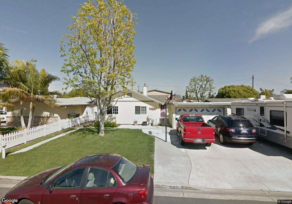
9682 Harvest Ln Anaheim, CA 92804
West Anaheim NeighborhoodEstimated Value: $912,000 - $1,029,000
3
Beds
2
Baths
1,290
Sq Ft
$741/Sq Ft
Est. Value
About This Home
This home is located at 9682 Harvest Ln, Anaheim, CA 92804 and is currently estimated at $956,285, approximately $741 per square foot. 9682 Harvest Ln is a home located in Orange County with nearby schools including Walt Disney Elementary School, Dale Jr High School, and Magnolia High.
Ownership History
Date
Name
Owned For
Owner Type
Purchase Details
Closed on
Mar 24, 2015
Sold by
Harris Donald R and Harris Sandra M
Bought by
Harris Family Trust
Current Estimated Value
Purchase Details
Closed on
Aug 4, 2010
Sold by
Harris Donald R and Harris Sandy M
Bought by
Harris Donald R and Harris Sandra M
Home Financials for this Owner
Home Financials are based on the most recent Mortgage that was taken out on this home.
Original Mortgage
$245,000
Interest Rate
4.65%
Mortgage Type
New Conventional
Create a Home Valuation Report for This Property
The Home Valuation Report is an in-depth analysis detailing your home's value as well as a comparison with similar homes in the area
Home Values in the Area
Average Home Value in this Area
Purchase History
| Date | Buyer | Sale Price | Title Company |
|---|---|---|---|
| Harris Family Trust | -- | None Available | |
| Harris Donald R | -- | None Available | |
| Harris Donald R | -- | First American Title Ins Co |
Source: Public Records
Mortgage History
| Date | Status | Borrower | Loan Amount |
|---|---|---|---|
| Closed | Harris Donald R | $245,000 |
Source: Public Records
Tax History Compared to Growth
Tax History
| Year | Tax Paid | Tax Assessment Tax Assessment Total Assessment is a certain percentage of the fair market value that is determined by local assessors to be the total taxable value of land and additions on the property. | Land | Improvement |
|---|---|---|---|---|
| 2025 | $2,713 | $216,998 | $116,181 | $100,817 |
| 2024 | $2,713 | $212,744 | $113,903 | $98,841 |
| 2023 | $2,669 | $208,573 | $111,670 | $96,903 |
| 2022 | $2,655 | $204,484 | $109,481 | $95,003 |
| 2021 | $2,589 | $200,475 | $107,334 | $93,141 |
| 2020 | $2,586 | $198,420 | $106,234 | $92,186 |
| 2019 | $2,534 | $194,530 | $104,151 | $90,379 |
| 2018 | $2,538 | $190,716 | $102,109 | $88,607 |
| 2017 | $2,428 | $186,977 | $100,107 | $86,870 |
| 2016 | $2,430 | $183,311 | $98,144 | $85,167 |
| 2015 | $2,381 | $180,558 | $96,670 | $83,888 |
| 2014 | $2,202 | $170,256 | $94,777 | $75,479 |
Source: Public Records
Map
Nearby Homes
- 9531 Orange Ave
- 958 S Crossbow Ln Unit 8
- 998 S Crossbow Ln Unit 12D
- 2217 W Orange Ave
- 2245 W Vancouver Dr
- 9791 Orange Ave
- 917 S Sutter Creek Rd Unit 46
- 938 S Sutter Creek Rd Unit 54
- 994 S Sutter Creek Rd Unit 60
- 2211 W Orange Ave
- 2209 W Orange Ave
- 2209 W Orange Ave Unit 16
- 927 S Webster Ave
- 2517 W Merle Place
- 2154 W Niobe Ave
- 13252 Brookhurst St Unit 26
- 13252 Brookhurst St Unit 25
- Plan 3 at Townes at Orange
- Plan 4X at Townes at Orange
- Plan 1 at Townes at Orange
- 9672 Harvest Ln
- 9692 Harvest Ln
- 9671 Parade St
- 9662 Harvest Ln
- 9702 Harvest Ln
- 9691 Parade St
- 9661 Parade St
- 9681 Harvest Ln
- 9651 Parade St
- 9701 Parade St
- 9671 Harvest Ln
- 9691 Harvest Ln
- 9652 Harvest Ln
- 9661 Harvest Ln
- 9701 Harvest Ln
- 9641 Parade St
- 9632 Harvest Ln
- 9651 Harvest Ln
- 9631 Parade St
- 9622 Stonybrook Dr