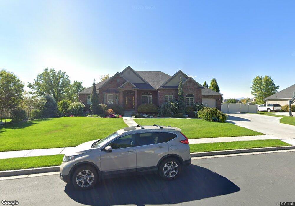
9685 N 6670 W Highland, UT 84003
Estimated Value: $1,001,000 - $1,488,595
3
Beds
3
Baths
2,256
Sq Ft
$522/Sq Ft
Est. Value
About This Home
This home is located at 9685 N 6670 W, Highland, UT 84003 and is currently estimated at $1,177,649, approximately $522 per square foot. 9685 N 6670 W is a home located in Utah County with nearby schools including Freedom Elementary School, Mountain Ridge Junior High School, and American Fork High School.
Ownership History
Date
Name
Owned For
Owner Type
Purchase Details
Closed on
Jun 20, 2011
Sold by
Sherratt Scott W
Bought by
Sherratt Scott W and Sherratt Ann Marie
Current Estimated Value
Home Financials for this Owner
Home Financials are based on the most recent Mortgage that was taken out on this home.
Original Mortgage
$260,000
Outstanding Balance
$183,644
Interest Rate
4.63%
Mortgage Type
New Conventional
Estimated Equity
$994,005
Purchase Details
Closed on
Jun 16, 2011
Sold by
Sherratt Scott W and Sherratt Ann Marie
Bought by
Sherratt Scott W
Home Financials for this Owner
Home Financials are based on the most recent Mortgage that was taken out on this home.
Original Mortgage
$260,000
Outstanding Balance
$183,644
Interest Rate
4.63%
Mortgage Type
New Conventional
Estimated Equity
$994,005
Purchase Details
Closed on
Mar 4, 2011
Sold by
Mann Carol
Bought by
Sherratt Scott W and Sherratt Ann Marie
Create a Home Valuation Report for This Property
The Home Valuation Report is an in-depth analysis detailing your home's value as well as a comparison with similar homes in the area
Home Values in the Area
Average Home Value in this Area
Purchase History
| Date | Buyer | Sale Price | Title Company |
|---|---|---|---|
| Sherratt Scott W | -- | Accommodation | |
| Sherratt Scott W | -- | Atlas Title Salt Lake | |
| Sherratt Scott W | -- | Equity Title West Jordan |
Source: Public Records
Mortgage History
| Date | Status | Borrower | Loan Amount |
|---|---|---|---|
| Open | Sherratt Scott W | $260,000 |
Source: Public Records
Tax History Compared to Growth
Tax History
| Year | Tax Paid | Tax Assessment Tax Assessment Total Assessment is a certain percentage of the fair market value that is determined by local assessors to be the total taxable value of land and additions on the property. | Land | Improvement |
|---|---|---|---|---|
| 2025 | $5,312 | $699,820 | $610,500 | $661,900 |
| 2024 | $5,312 | $656,095 | $0 | $0 |
| 2023 | $5,033 | $670,560 | $0 | $0 |
| 2022 | $4,954 | $640,035 | $0 | $0 |
| 2021 | $4,218 | $811,700 | $307,700 | $504,000 |
| 2020 | $3,942 | $744,000 | $279,700 | $464,300 |
| 2019 | $3,768 | $744,000 | $279,700 | $464,300 |
| 2018 | $3,564 | $668,700 | $234,600 | $434,100 |
| 2017 | $3,388 | $339,295 | $0 | $0 |
| 2016 | $3,202 | $299,695 | $0 | $0 |
| 2015 | $3,350 | $297,220 | $0 | $0 |
| 2014 | $2,976 | $261,635 | $0 | $0 |
Source: Public Records
Map
Nearby Homes
- 6692 W 9770 N
- 9924 N 6630 W Unit 9
- 9967 N 6670 W
- 9435 N Aspen Hollow Cir
- 1438 N 400 W
- 356 W 1300 N
- 6399 W 10150 N
- 287 W 1360 N
- 893 N 1580 E
- 6190 W 10050 N
- 3935 W 1000 N Unit 438
- 3983 W 1000 N Unit 442
- 4007 W 1000 N
- 3947 W 1000 N Unit 439
- 3959 W 1000 N
- 425 W 1120 N
- 471 W 1040 N
- 344 W 1080 N
- 179 W 1290 N
- 9780 N 6000 W
- 9685 N 6670 W Unit 4
- 9703 N 6670 W
- 9703 N 6670 W Unit 11
- 9679 N 6670 W
- 9679 N 6670 W Unit 3
- 6654 W 9680 N
- 9645 N 6670 W
- 9645 N 6670 W Unit 2
- 9702 N 6670 W
- 9721 N 6670 W
- 9721 N 6670 W Unit 12
- 6690 W 9600 N
- 6658 W 9720 N
- 9642 N 6670 W
- 9642 N 6670 W Unit 8
- 9621 N 6670 W
- 9621 N 6670 W Unit 1
- 6642 W 9720 N
- 6624 W 9680 N
- 6624 W 9680 N Unit 6