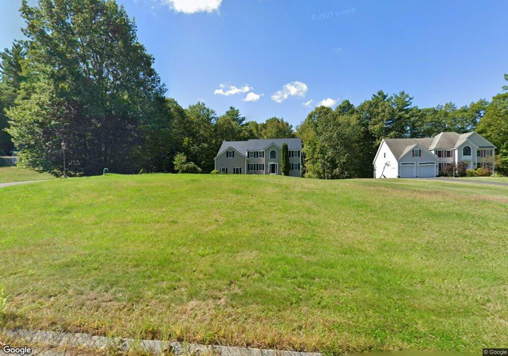
97 Adams St Dunstable, MA 01827
Estimated Value: $932,699 - $1,013,000
4
Beds
3
Baths
3,298
Sq Ft
$296/Sq Ft
Est. Value
About This Home
This home is located at 97 Adams St, Dunstable, MA 01827 and is currently estimated at $974,675, approximately $295 per square foot. 97 Adams St is a home located in Middlesex County with nearby schools including Groton Dunstable Regional High School, Pepperell Christian Academy, and Maple Dene & Moppet School.
Create a Home Valuation Report for This Property
The Home Valuation Report is an in-depth analysis detailing your home's value as well as a comparison with similar homes in the area
Home Values in the Area
Average Home Value in this Area
Tax History
| Year | Tax Paid | Tax Assessment Tax Assessment Total Assessment is a certain percentage of the fair market value that is determined by local assessors to be the total taxable value of land and additions on the property. | Land | Improvement |
|---|---|---|---|---|
| 2025 | $11,840 | $861,100 | $196,200 | $664,900 |
| 2024 | $11,496 | $823,500 | $193,100 | $630,400 |
| 2023 | $11,307 | $755,300 | $193,100 | $562,200 |
| 2022 | $10,250 | $672,100 | $193,100 | $479,000 |
| 2021 | $10,059 | $613,000 | $171,300 | $441,700 |
| 2020 | $9,882 | $586,800 | $163,500 | $423,300 |
| 2019 | $9,577 | $561,400 | $163,500 | $397,900 |
| 2018 | $9,396 | $535,700 | $163,500 | $372,200 |
| 2017 | $9,034 | $530,800 | $163,500 | $367,300 |
| 2016 | $8,407 | $508,000 | $140,200 | $367,800 |
| 2015 | $8,415 | $503,000 | $137,100 | $365,900 |
| 2014 | $7,932 | $503,000 | $137,100 | $365,900 |
Source: Public Records
Map
Nearby Homes
- 235 Kemp St
- 179 Wyman Rd
- 208 North St
- 11 Unkety Brook Way
- 12 Unkety Brook Way
- 319 Pleasant St
- 200 Nashua Rd
- 114 Groton St
- 29 Tarbell St
- 38 Tarbell St Unit 5B
- 38 Tarbell St Unit 1D
- 53 Mclains Woods Rd
- 27 Merrimac Dr
- 153 Off Pond St
- 28-30 Groton St
- 91 Chicopee Row
- 8 Casie Ln
- 31 Sawtell Dr
- 2 Wildflower Ln
- 113-115 Main St
Your Personal Tour Guide
Ask me questions while you tour the home.