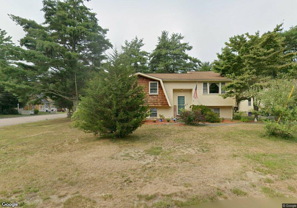
97 Burt St Norton, MA 02766
Estimated Value: $557,973 - $718,000
3
Beds
2
Baths
1,248
Sq Ft
$503/Sq Ft
Est. Value
About This Home
This home is located at 97 Burt St, Norton, MA 02766 and is currently estimated at $628,243, approximately $503 per square foot. 97 Burt St is a home located in Bristol County with nearby schools including L.G. Nourse Elementary School, Henri A. Yelle Elementary School, and Norton Middle School.
Create a Home Valuation Report for This Property
The Home Valuation Report is an in-depth analysis detailing your home's value as well as a comparison with similar homes in the area
Home Values in the Area
Average Home Value in this Area
Tax History
| Year | Tax Paid | Tax Assessment Tax Assessment Total Assessment is a certain percentage of the fair market value that is determined by local assessors to be the total taxable value of land and additions on the property. | Land | Improvement |
|---|---|---|---|---|
| 2025 | $62 | $479,000 | $185,100 | $293,900 |
| 2024 | $5,921 | $457,200 | $176,300 | $280,900 |
| 2023 | $5,601 | $431,200 | $166,300 | $264,900 |
| 2022 | $5,434 | $381,100 | $151,200 | $229,900 |
| 2021 | $3,765 | $347,300 | $144,000 | $203,300 |
| 2020 | $5,033 | $340,100 | $139,800 | $200,300 |
| 2019 | $4,778 | $320,700 | $134,500 | $186,200 |
| 2018 | $4,659 | $307,300 | $134,500 | $172,800 |
| 2017 | $4,485 | $291,800 | $134,500 | $157,300 |
| 2016 | $4,360 | $279,300 | $134,500 | $144,800 |
| 2015 | $4,205 | $273,200 | $131,800 | $141,400 |
| 2014 | $4,041 | $262,900 | $125,500 | $137,400 |
Source: Public Records
Map
Nearby Homes
- O Leonard St
- 9 Winnecunnet Dr Unit 9
- 35 Owen Rd
- 195 E Main St
- 103 King Philip Rd
- 0 S Washington St Unit 73437419
- 1 Wilbur Terrace Unit 6
- 104 Newcomb St Unit E
- 17 Lloyd Cir Unit 36
- 24 Lloyd Cir Unit 34
- 30 Samoset St
- 0 Kensington Rd
- Lot 3B Hill St
- 32 Olde Farm Rd
- 13 Lloyd Cir Unit 34
- 11 Lloyd Cir Unit 39
- 90 Pine St
- 29 Germain Way Unit 3
- 152 Pine St Unit 23
- 157 Highland St
Your Personal Tour Guide
Ask me questions while you tour the home.