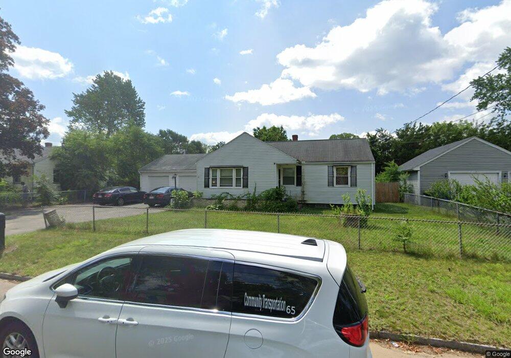
97 Cherokee Dr Springfield, MA 01109
Sixteen Acres NeighborhoodEstimated Value: $273,000 - $313,000
3
Beds
1
Bath
966
Sq Ft
$307/Sq Ft
Est. Value
About This Home
This home is located at 97 Cherokee Dr, Springfield, MA 01109 and is currently estimated at $296,934, approximately $307 per square foot. 97 Cherokee Dr is a home located in Hampden County with nearby schools including Frank H. Freedman School, John J Duggan Middle, and Springfield High School of Science and Technology.
Ownership History
Date
Name
Owned For
Owner Type
Purchase Details
Closed on
May 13, 2022
Sold by
Chui Cheung M and Chui-Chak Kwai C
Bought by
Chui Hoi L
Current Estimated Value
Home Financials for this Owner
Home Financials are based on the most recent Mortgage that was taken out on this home.
Original Mortgage
$182,700
Outstanding Balance
$171,529
Interest Rate
4.67%
Mortgage Type
Purchase Money Mortgage
Estimated Equity
$125,405
Purchase Details
Closed on
May 13, 2004
Sold by
Granger Eric J
Bought by
Chui Cheung Ming and Chak Kwai Ching
Home Financials for this Owner
Home Financials are based on the most recent Mortgage that was taken out on this home.
Original Mortgage
$113,520
Interest Rate
5.47%
Mortgage Type
Purchase Money Mortgage
Purchase Details
Closed on
Apr 6, 1990
Sold by
Johnson Tyrone L
Bought by
Granger Eric J
Home Financials for this Owner
Home Financials are based on the most recent Mortgage that was taken out on this home.
Original Mortgage
$90,565
Interest Rate
10.22%
Mortgage Type
Purchase Money Mortgage
Create a Home Valuation Report for This Property
The Home Valuation Report is an in-depth analysis detailing your home's value as well as a comparison with similar homes in the area
Home Values in the Area
Average Home Value in this Area
Purchase History
| Date | Buyer | Sale Price | Title Company |
|---|---|---|---|
| Chui Hoi L | $261,000 | None Available | |
| Chui Cheung Ming | $132,000 | -- | |
| Chui Cheung Ming | $132,000 | -- | |
| Granger Eric J | $89,000 | -- |
Source: Public Records
Mortgage History
| Date | Status | Borrower | Loan Amount |
|---|---|---|---|
| Open | Chui Hoi L | $182,700 | |
| Previous Owner | Chui Cheung Ming | $113,520 | |
| Previous Owner | Granger Eric J | $83,300 | |
| Previous Owner | Granger Eric J | $10,502 | |
| Previous Owner | Granger Eric J | $90,565 |
Source: Public Records
Tax History
| Year | Tax Paid | Tax Assessment Tax Assessment Total Assessment is a certain percentage of the fair market value that is determined by local assessors to be the total taxable value of land and additions on the property. | Land | Improvement |
|---|---|---|---|---|
| 2025 | $3,796 | $242,100 | $51,700 | $190,400 |
| 2024 | $3,673 | $228,700 | $51,700 | $177,000 |
| 2023 | $3,226 | $189,200 | $49,200 | $140,000 |
| 2022 | $3,325 | $176,700 | $49,200 | $127,500 |
| 2021 | $2,947 | $155,900 | $44,700 | $111,200 |
| 2020 | $2,836 | $145,200 | $44,700 | $100,500 |
| 2019 | $2,694 | $136,900 | $44,700 | $92,200 |
| 2018 | $2,602 | $132,200 | $44,700 | $87,500 |
| 2017 | $2,556 | $130,000 | $49,600 | $80,400 |
| 2016 | $2,501 | $127,200 | $49,600 | $77,600 |
| 2015 | $2,463 | $125,200 | $49,600 | $75,600 |
Source: Public Records
Map
Nearby Homes
- 30 W Hill Rd
- 55 Old Farm Rd
- 74 Valley Rd
- 73 Timber Ln
- 37 Chesterfield Ave
- 54 S Shore Dr
- 944 Wilbraham Rd
- 384 Abbott St
- 509 Plumtree Rd
- 63 Lawton St
- 101 Regal St
- 236 Pondview Dr
- 18 Riverton Rd
- 8 Putnam St
- 120 Bridle Path Rd
- 108 Birchland Ave
- 7 Ashbrook St
- 34 Elsie St
- 297 Breckwood Blvd
- 81 W Crystal Brook Dr
- 105 Cherokee Dr
- 128 Cheyenne Rd
- 118 Cheyenne Rd
- 136 Cheyenne Rd
- 98 Cherokee Dr
- 115 Cherokee Dr
- 81 Cherokee Dr
- 108 Cherokee Dr
- 110 Cheyenne Rd
- 144 Cheyenne Rd
- 82 Cherokee Dr
- 82 Cherokee Dr Unit 1
- 116 Cherokee Dr
- 73 Cherokee Dr
- 125 Cherokee Dr
- 117 Cheyenne Rd
- 135 Cheyenne Rd
- 152 Cheyenne Rd
- 102 Cheyenne Rd
- 74 Cherokee Dr
Your Personal Tour Guide
Ask me questions while you tour the home.