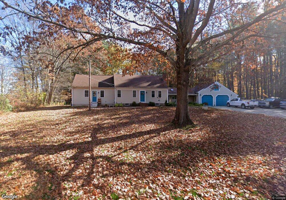
97 Exeter Rd South Hampton, NH 03827
Estimated Value: $618,000 - $932,000
3
Beds
3
Baths
3,889
Sq Ft
$207/Sq Ft
Est. Value
About This Home
This home is located at 97 Exeter Rd, South Hampton, NH 03827 and is currently estimated at $805,207, approximately $207 per square foot. 97 Exeter Rd is a home located in Rockingham County with nearby schools including South Hampton Barnard School, Winnacunnet High School, and Amesbury Seventh-Day Adventist School.
Ownership History
Date
Name
Owned For
Owner Type
Purchase Details
Closed on
Jun 19, 2018
Sold by
Westgate Amy D
Bought by
Losier Diane C
Current Estimated Value
Purchase Details
Closed on
Aug 30, 2017
Sold by
Westgate Amy D
Bought by
Westgate Amy D
Purchase Details
Closed on
Feb 14, 2003
Sold by
Losier Donald C and Losier Diana C
Bought by
Westgate Amy D
Home Financials for this Owner
Home Financials are based on the most recent Mortgage that was taken out on this home.
Original Mortgage
$110,000
Interest Rate
5.88%
Create a Home Valuation Report for This Property
The Home Valuation Report is an in-depth analysis detailing your home's value as well as a comparison with similar homes in the area
Home Values in the Area
Average Home Value in this Area
Purchase History
| Date | Buyer | Sale Price | Title Company |
|---|---|---|---|
| Losier Diane C | $241,069 | -- | |
| Westgate Amy D | -- | -- | |
| Westgate Amy D | $337,000 | -- |
Source: Public Records
Mortgage History
| Date | Status | Borrower | Loan Amount |
|---|---|---|---|
| Previous Owner | Westgate Amy D | $25,900 | |
| Previous Owner | Westgate Amy D | $110,000 |
Source: Public Records
Tax History Compared to Growth
Tax History
| Year | Tax Paid | Tax Assessment Tax Assessment Total Assessment is a certain percentage of the fair market value that is determined by local assessors to be the total taxable value of land and additions on the property. | Land | Improvement |
|---|---|---|---|---|
| 2024 | $10,287 | $745,400 | $242,300 | $503,100 |
| 2023 | $10,287 | $745,400 | $242,300 | $503,100 |
| 2022 | $8,792 | $442,700 | $146,300 | $296,400 |
| 2021 | $8,658 | $434,400 | $146,300 | $288,100 |
| 2020 | $8,249 | $434,400 | $146,300 | $288,100 |
| 2019 | $7,654 | $428,800 | $146,300 | $282,500 |
| 2018 | $7,148 | $428,800 | $146,300 | $282,500 |
| 2017 | $6,990 | $363,300 | $132,100 | $231,200 |
| 2016 | $6,623 | $363,300 | $132,100 | $231,200 |
| 2015 | $7,241 | $363,300 | $132,100 | $231,200 |
| 2012 | $6,177 | $418,800 | $165,000 | $253,800 |
Source: Public Records
Map
Nearby Homes
- 51 Locust St
- 253 Amesbury Rd
- 2 Adder Ln
- 1 Brown Ave Unit 1-37
- 1 Brown Ave Unit 3-78
- 1 Brown Ave Unit 3-80
- 3 Brown Ave Unit 75
- 25 Whittier Meadows Dr
- 1 Stacey Ln
- 84 Blacksnake Rd Unit A
- 57 Clinton St
- 2 Locke Hill Ln
- 22 Maple Ridge Rd
- 28 Powderhouse Ct Unit 28
- 105 Market St Unit B
- 103 Market St Unit A
- 101 Market St Unit B
- 101 Market St Unit A
- 3 Arlington St
- 10 Mason Ct Unit 10