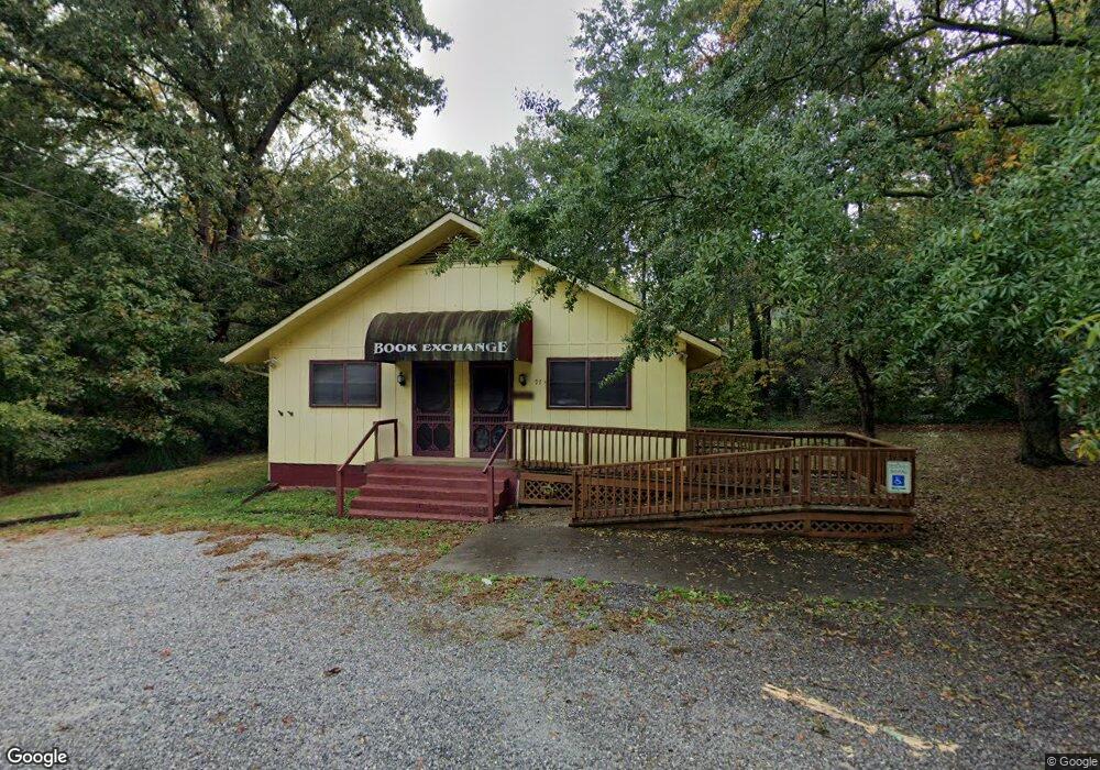
97 Phil Watson Rd Anderson, SC 29625
Estimated Value: $90,523
--
Bed
--
Bath
1,625
Sq Ft
$56/Sq Ft
Est. Value
About This Home
This home is located at 97 Phil Watson Rd, Anderson, SC 29625 and is currently estimated at $90,523, approximately $55 per square foot. 97 Phil Watson Rd is a home located in Anderson County with nearby schools including Whitehall Elementary School, Westside High School, and Anderson Institute of Technology.
Ownership History
Date
Name
Owned For
Owner Type
Purchase Details
Closed on
Mar 10, 2023
Sold by
Holtzendorff V Preston Brooks
Bought by
E & A Properties Llc
Current Estimated Value
Purchase Details
Closed on
May 25, 2022
Sold by
Frances Brown Cynthia
Bought by
Hoitzendorff Preston Brooks and Holtzendorff Erik Scott
Purchase Details
Closed on
Oct 26, 2010
Sold by
Estate Of Preston B Holtzendorff Iv and Holtzendorff V Preston Brooks
Bought by
Brown Cynthia Frances and Preston Brooks Holtzendorff V
Purchase Details
Closed on
Jul 1, 2004
Sold by
Goolsby Mary B and Holtzendorff Mary B
Bought by
Holtzendorff Preston B
Create a Home Valuation Report for This Property
The Home Valuation Report is an in-depth analysis detailing your home's value as well as a comparison with similar homes in the area
Home Values in the Area
Average Home Value in this Area
Purchase History
| Date | Buyer | Sale Price | Title Company |
|---|---|---|---|
| E & A Properties Llc | $75,000 | -- | |
| Hoitzendorff Preston Brooks | -- | Jones Law Firm Pa | |
| Brown Cynthia Frances | -- | -- | |
| Holtzendorff Preston B | -- | -- |
Source: Public Records
Tax History Compared to Growth
Tax History
| Year | Tax Paid | Tax Assessment Tax Assessment Total Assessment is a certain percentage of the fair market value that is determined by local assessors to be the total taxable value of land and additions on the property. | Land | Improvement |
|---|---|---|---|---|
| 2024 | $1,442 | $4,500 | $3,000 | $1,500 |
| 2023 | $1,442 | $4,800 | $3,300 | $1,500 |
| 2022 | $2,080 | $7,380 | $3,300 | $4,080 |
| 2021 | $2,023 | $6,220 | $3,300 | $2,920 |
| 2020 | $1,994 | $6,220 | $3,300 | $2,920 |
| 2019 | $1,994 | $6,220 | $3,300 | $2,920 |
| 2018 | $1,966 | $6,220 | $3,300 | $2,920 |
| 2017 | -- | $6,220 | $3,300 | $2,920 |
| 2016 | $1,834 | $5,920 | $3,000 | $2,920 |
| 2015 | $1,853 | $5,920 | $3,000 | $2,920 |
| 2014 | $1,826 | $5,920 | $3,000 | $2,920 |
Source: Public Records
Map
Nearby Homes
- 211 Phil Watson Rd
- 4214 Hembree Creek Rd
- 212 Middleton Shores Dr
- 402 Long Forest Cir
- 505 Brookgreen Ct
- 408 Greenbriar Ln
- 103 Northlake Dr
- 401 Phil Watson Rd
- 203 Northlake Dr Unit 2C
- 202 Northlake Dr Unit 2B
- 1602 Northlake Dr
- 4314 Old Mill Rd
- 105-107 Independence Path
- 302 Northlake Dr Unit 3B
- 404 Northlake Dr Unit 4D
- 1210 Northlake Dr Unit 12 J
- 1106 Northlake Dr Unit 11F
- 505 Northlake Dr
- 1011 Northlake Dr Unit 10K
- 707 Northlake Dr Unit 7G
- 109 Phil Watson Rd
- 4200 Hembree Creek Rd
- 4105 Aloha Dr
- 00 Hembree Creek Rd
- 00 Phil Watson Rd
- 201 Woodfern Cir
- 200 Woodfern Cir
- 4100 Aloha Dr
- 202 Phil Watson Rd
- 4109 Aloha Dr
- 203 Woodfern Cir
- 4104 Aloha Dr
- 4200 Ridge Rd
- 204 Phil Watson Rd
- 4106 Aloha Dr
- 101 Huntington Dr
- 4208 Hembree Creek Rd
- 4144 Clemson Blvd
- 301 Woodfern Cir
- 4207 Hembree Creek Rd