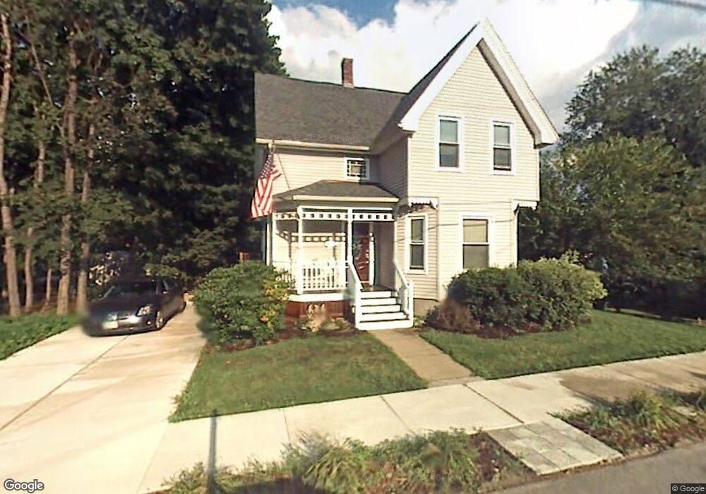
97 Riley Ave Manchester, NH 03103
Somerville NeighborhoodEstimated Value: $405,095 - $493,000
3
Beds
1
Bath
1,449
Sq Ft
$304/Sq Ft
Est. Value
About This Home
This home is located at 97 Riley Ave, Manchester, NH 03103 and is currently estimated at $440,274, approximately $303 per square foot. 97 Riley Ave is a home located in Hillsborough County with nearby schools including Jewett Street Elementary School, Southside Middle School, and Manchester Memorial High School.
Ownership History
Date
Name
Owned For
Owner Type
Purchase Details
Closed on
Dec 2, 2015
Sold by
Matheson Lois A
Bought by
Lois Ann Matheson Ret and Matheson Lois A
Current Estimated Value
Purchase Details
Closed on
May 10, 2007
Sold by
Armour Douglas
Bought by
Matheson Lois Ann
Home Financials for this Owner
Home Financials are based on the most recent Mortgage that was taken out on this home.
Original Mortgage
$20,000
Interest Rate
6.21%
Mortgage Type
Unknown
Create a Home Valuation Report for This Property
The Home Valuation Report is an in-depth analysis detailing your home's value as well as a comparison with similar homes in the area
Home Values in the Area
Average Home Value in this Area
Purchase History
| Date | Buyer | Sale Price | Title Company |
|---|---|---|---|
| Lois Ann Matheson Ret | -- | -- | |
| Matheson Lois Ann | $20,000 | -- |
Source: Public Records
Mortgage History
| Date | Status | Borrower | Loan Amount |
|---|---|---|---|
| Previous Owner | Matheson Lois Ann | $20,000 | |
| Previous Owner | Matheson Lois Ann | $100,000 |
Source: Public Records
Tax History Compared to Growth
Tax History
| Year | Tax Paid | Tax Assessment Tax Assessment Total Assessment is a certain percentage of the fair market value that is determined by local assessors to be the total taxable value of land and additions on the property. | Land | Improvement |
|---|---|---|---|---|
| 2024 | $5,292 | $270,300 | $86,600 | $183,700 |
| 2023 | $5,098 | $270,300 | $86,600 | $183,700 |
| 2022 | $4,930 | $270,300 | $86,600 | $183,700 |
| 2021 | $4,779 | $270,300 | $86,600 | $183,700 |
| 2020 | $4,404 | $178,600 | $59,700 | $118,900 |
| 2019 | $4,341 | $178,500 | $59,700 | $118,800 |
| 2018 | $4,227 | $178,500 | $59,700 | $118,800 |
| 2017 | $4,163 | $178,500 | $59,700 | $118,800 |
| 2016 | $4,130 | $178,500 | $59,700 | $118,800 |
| 2015 | $4,217 | $179,900 | $59,700 | $120,200 |
| 2014 | $4,228 | $179,900 | $59,700 | $120,200 |
| 2013 | $4,078 | $179,900 | $59,700 | $120,200 |
Source: Public Records
Map
Nearby Homes
- 201 Jewett St
- 80 Jewett St
- 335 Cypress St Unit 4A
- 335 Cypress St Unit 2P
- 335 Cypress St Unit 3B
- 165 Taylor St
- 53 Jewett St
- 75 Fremont St
- 167 Mammoth Rd
- 39 Richard St
- 82 S Jewett St
- 52 Mammoth Rd
- 618 Prescott St
- 63 Maynard Ave
- 615 Clay St
- 594 Dix St Unit 2
- 146 Woodbine Ave
- 552 Spruce St
- 600 Spruce St
- 631 Lake Ave
- 113 Riley Ave
- 128 Sunnyside St
- 128 Sunnyside St Unit A
- 128 Sunnyside St Unit B
- 81 Riley Ave
- 132 Sunnyside St
- 110 Sunnyside St
- 106 Riley Ave
- 90 Riley Ave
- 123 Riley Ave
- 82 Riley Ave
- 91 Prout Ave
- 122 Riley Ave
- 99 Prout Ave
- 146 Sunnyside St
- 94 Sunnyside St
- 105 Prout Ave
- 74 Riley Ave
- 65 Riley Ave
- 119 Sunnyside St