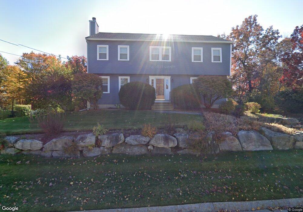
97 Shepherd Rd Manchester, NH 03104
Wellington NeighborhoodEstimated Value: $603,000 - $667,000
3
Beds
3
Baths
2,100
Sq Ft
$299/Sq Ft
Est. Value
About This Home
This home is located at 97 Shepherd Rd, Manchester, NH 03104 and is currently estimated at $627,033, approximately $298 per square foot. 97 Shepherd Rd is a home located in Hillsborough County with nearby schools including Weston School, Henry J. McLaughlin Middle School, and Manchester Memorial High School.
Ownership History
Date
Name
Owned For
Owner Type
Purchase Details
Closed on
Mar 19, 2025
Sold by
Turcotte Patricia A and Turcotte Patricia A
Bought by
Patricia Ann Turcotte Ret and Turcotte
Current Estimated Value
Purchase Details
Closed on
Jun 17, 1997
Sold by
Juneau James J and Juneau Margaret A
Bought by
Turcotte Leo R and Turcotte Patricia A
Home Financials for this Owner
Home Financials are based on the most recent Mortgage that was taken out on this home.
Original Mortgage
$125,200
Interest Rate
7.97%
Create a Home Valuation Report for This Property
The Home Valuation Report is an in-depth analysis detailing your home's value as well as a comparison with similar homes in the area
Home Values in the Area
Average Home Value in this Area
Purchase History
| Date | Buyer | Sale Price | Title Company |
|---|---|---|---|
| Patricia Ann Turcotte Ret | -- | None Available | |
| Patricia Ann Turcotte Ret | -- | None Available | |
| Turcotte Leo R | $156,500 | -- | |
| Turcotte Leo R | $156,500 | -- |
Source: Public Records
Mortgage History
| Date | Status | Borrower | Loan Amount |
|---|---|---|---|
| Previous Owner | Turcotte Leo R | $304,800 | |
| Previous Owner | Turcotte Leo R | $304,800 | |
| Previous Owner | Turcotte Leo R | $125,200 |
Source: Public Records
Tax History Compared to Growth
Tax History
| Year | Tax Paid | Tax Assessment Tax Assessment Total Assessment is a certain percentage of the fair market value that is determined by local assessors to be the total taxable value of land and additions on the property. | Land | Improvement |
|---|---|---|---|---|
| 2024 | $8,030 | $410,100 | $122,100 | $288,000 |
| 2023 | $7,734 | $410,100 | $122,100 | $288,000 |
| 2022 | $7,480 | $410,100 | $122,100 | $288,000 |
| 2021 | $7,251 | $410,100 | $122,100 | $288,000 |
| 2020 | $7,289 | $295,600 | $84,300 | $211,300 |
| 2019 | $7,189 | $295,600 | $84,300 | $211,300 |
| 2018 | $7,000 | $295,600 | $84,300 | $211,300 |
| 2017 | $6,893 | $295,600 | $84,300 | $211,300 |
| 2016 | $6,840 | $295,600 | $84,300 | $211,300 |
| 2015 | $6,716 | $286,500 | $84,300 | $202,200 |
| 2014 | $6,733 | $286,500 | $84,300 | $202,200 |
| 2013 | $6,495 | $286,500 | $84,300 | $202,200 |
Source: Public Records
Map
Nearby Homes
- 135 Brookview Dr
- TBD Wellington Rd
- 162 Tiffany Ln
- 50 Edward J Roy Dr Unit 50
- 534 Fox Hollow Way
- 192 Karatzas Ave
- 90 Karatzas Ave
- 265 Edward J Roy Dr Unit 207
- 302 Karatzas Ave Unit Lot 0
- 310 Karatzas Ave Unit Lot 2
- 304 Karatzas Ave Unit Lot 1
- 230 Eastern Ave Unit 303
- 317 Karatzas Ave Unit Lot 18
- 313 Karatzas Ave Unit Lot 19
- 309 Karatzas Ave Unit Lot 20
- 305 Karatzas Ave Unit Lot 21
- 124 Eastern Ave Unit 103
- 15 Johns Dr
- 312 Whittington St
- 29 Golden Gate Dr