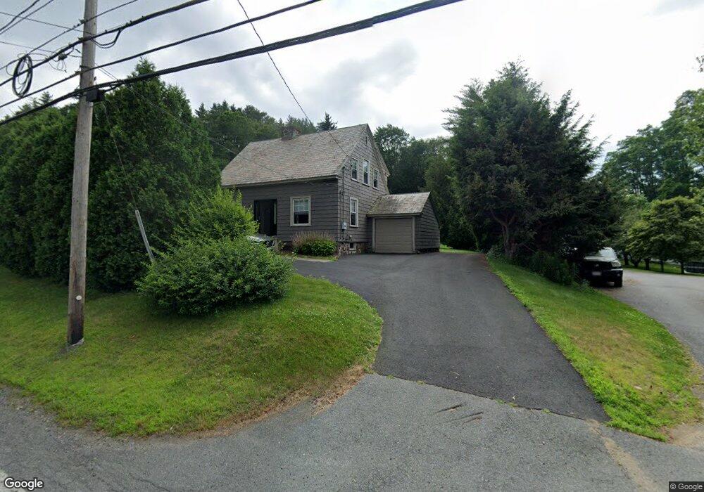
970 Bernardston Rd Greenfield, MA 01301
Estimated Value: $309,000 - $344,574
3
Beds
1
Bath
1,239
Sq Ft
$264/Sq Ft
Est. Value
About This Home
This home is located at 970 Bernardston Rd, Greenfield, MA 01301 and is currently estimated at $326,894, approximately $263 per square foot. 970 Bernardston Rd is a home located in Franklin County with nearby schools including Greenfield Center School, Cornerstone Christian School, and Stoneleigh-Burnham School.
Ownership History
Date
Name
Owned For
Owner Type
Purchase Details
Closed on
Jul 8, 2008
Sold by
Lesueur-Klaver Susan
Bought by
Billiel Andrew F and Billiel Meghan A
Current Estimated Value
Home Financials for this Owner
Home Financials are based on the most recent Mortgage that was taken out on this home.
Original Mortgage
$195,000
Interest Rate
6.01%
Mortgage Type
VA
Purchase Details
Closed on
Jul 1, 2004
Sold by
Lutsch Janice and Lutsch Walter
Bought by
Klaver Susan Lesueur
Purchase Details
Closed on
Nov 17, 1998
Sold by
Est Hall Glenn T and Weatherhead Marie J
Bought by
Lutsch Walter and Lutsch Janice
Home Financials for this Owner
Home Financials are based on the most recent Mortgage that was taken out on this home.
Original Mortgage
$79,000
Interest Rate
6.65%
Mortgage Type
Purchase Money Mortgage
Create a Home Valuation Report for This Property
The Home Valuation Report is an in-depth analysis detailing your home's value as well as a comparison with similar homes in the area
Home Values in the Area
Average Home Value in this Area
Purchase History
| Date | Buyer | Sale Price | Title Company |
|---|---|---|---|
| Billiel Andrew F | $195,000 | -- | |
| Billiel Andrew F | $195,000 | -- | |
| Klaver Susan Lesueur | $155,000 | -- | |
| Klaver Susan Lesueur | $155,000 | -- | |
| Lutsch Walter | $89,000 | -- | |
| Lutsch Walter | $89,000 | -- |
Source: Public Records
Mortgage History
| Date | Status | Borrower | Loan Amount |
|---|---|---|---|
| Open | Lutsch Walter | $194,970 | |
| Closed | Billiel Andrew F | $195,000 | |
| Previous Owner | Lutsch Walter | $79,000 |
Source: Public Records
Tax History Compared to Growth
Tax History
| Year | Tax Paid | Tax Assessment Tax Assessment Total Assessment is a certain percentage of the fair market value that is determined by local assessors to be the total taxable value of land and additions on the property. | Land | Improvement |
|---|---|---|---|---|
| 2025 | $4,395 | $224,700 | $78,200 | $146,500 |
| 2024 | $5,000 | $245,200 | $66,600 | $178,600 |
| 2023 | $4,525 | $230,300 | $66,600 | $163,700 |
| 2022 | $4,669 | $209,200 | $66,700 | $142,500 |
| 2021 | $4,470 | $192,500 | $70,500 | $122,000 |
| 2020 | $4,313 | $188,100 | $70,500 | $117,600 |
| 2019 | $4,002 | $179,000 | $61,400 | $117,600 |
| 2018 | $3,936 | $175,500 | $60,200 | $115,300 |
| 2017 | $3,814 | $175,500 | $60,200 | $115,300 |
| 2016 | $3,812 | $174,800 | $60,200 | $114,600 |
| 2015 | $3,818 | $169,600 | $61,800 | $107,800 |
| 2014 | $3,486 | $169,800 | $61,800 | $108,000 |
Source: Public Records
Map
Nearby Homes
- 971 Bernardston Rd
- 31 Lovers Ln
- 793 Bernardston Rd
- 001 Adams Rd
- Lot 16 Country Club Rd
- 72 Meadowood Dr
- 34 Brookside Ave
- 83 Eden Trail Branch
- 79 Burnham Rd
- 16 Coolidge Ave
- 87 Oakland St
- 44 Wildwood Ave
- 2 G St
- 47 Cross St
- 14 Warner St
- 187 L St
- 335 Federal St
- 4 Silver Crest Ln
- 35-37 Shattuck St
- 35 Shattuck St Unit 37
- 966 Bernardston Rd
- 980 Bernardston Rd
- 975 Bernardston Rd
- 950 Bernardston Rd
- 987 Bernardston Rd
- 1000 Bernardston Rd
- 948 Bernardston Rd
- 1001 Bernardston Rd
- 1003 Bernardston Rd
- 976 Bernardston Rd
- 946 Bernardston Rd
- Lot 10 Off Log Plain Rd E
- Lot 7 Off Log Plain Rd E
- Lot 1 Off Log Plain Rd E
- 930 Bernardston Rd
- 1012 Bernardston Rd
- 0 Wayland Dr
- 924 Bernardston Rd
- 921 Bernardston Rd
- 18 Newell Pond Place