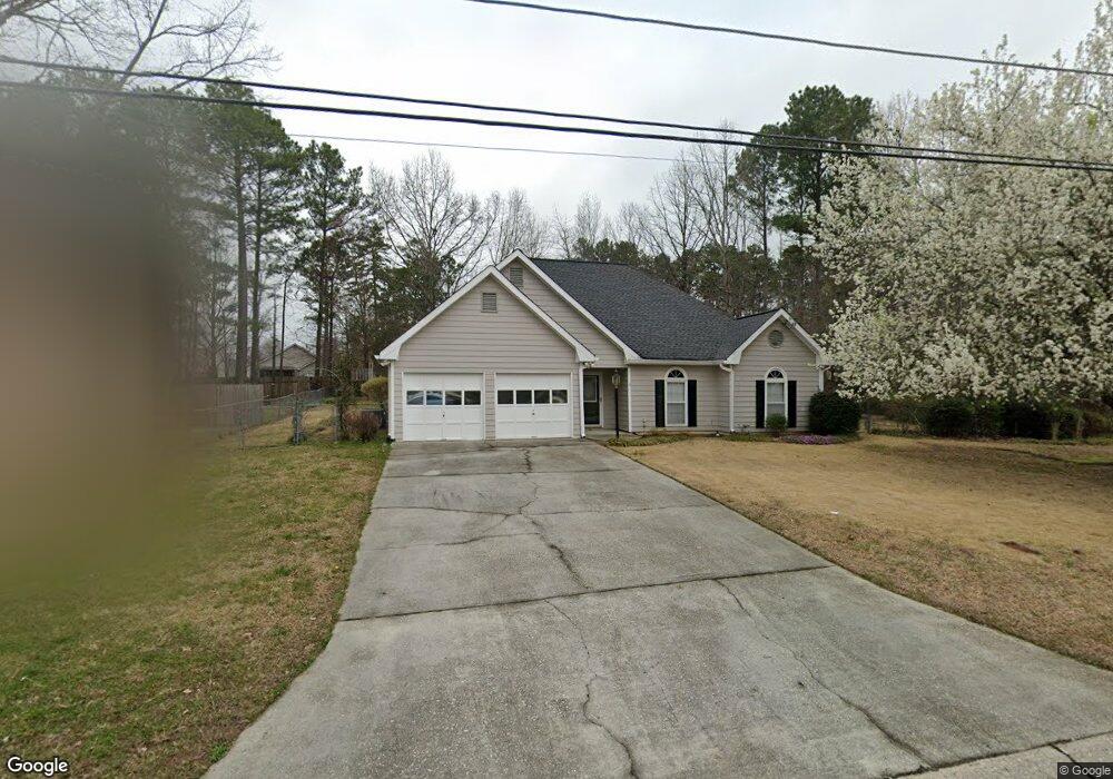
970 Burning Bush Dr Unit 2 Loganville, GA 30052
Estimated Value: $334,000 - $355,000
3
Beds
2
Baths
1,752
Sq Ft
$197/Sq Ft
Est. Value
About This Home
This home is located at 970 Burning Bush Dr Unit 2, Loganville, GA 30052 and is currently estimated at $344,468, approximately $196 per square foot. 970 Burning Bush Dr Unit 2 is a home located in Gwinnett County with nearby schools including Magill Elementary School, Grace Snell Middle School, and South Gwinnett High School.
Ownership History
Date
Name
Owned For
Owner Type
Purchase Details
Closed on
Aug 29, 2000
Sold by
Cohen Donna H and Cohen William L
Bought by
Hilliard Crystal A
Current Estimated Value
Home Financials for this Owner
Home Financials are based on the most recent Mortgage that was taken out on this home.
Original Mortgage
$109,513
Outstanding Balance
$39,942
Interest Rate
8.11%
Mortgage Type
New Conventional
Estimated Equity
$304,526
Create a Home Valuation Report for This Property
The Home Valuation Report is an in-depth analysis detailing your home's value as well as a comparison with similar homes in the area
Home Values in the Area
Average Home Value in this Area
Purchase History
| Date | Buyer | Sale Price | Title Company |
|---|---|---|---|
| Hilliard Crystal A | $112,900 | -- |
Source: Public Records
Mortgage History
| Date | Status | Borrower | Loan Amount |
|---|---|---|---|
| Open | Hilliard Crystal A | $109,513 |
Source: Public Records
Tax History Compared to Growth
Tax History
| Year | Tax Paid | Tax Assessment Tax Assessment Total Assessment is a certain percentage of the fair market value that is determined by local assessors to be the total taxable value of land and additions on the property. | Land | Improvement |
|---|---|---|---|---|
| 2024 | $3,368 | $123,320 | $30,000 | $93,320 |
| 2023 | $3,368 | $116,560 | $29,680 | $86,880 |
| 2022 | $2,901 | $102,680 | $19,200 | $83,480 |
| 2021 | $2,222 | $68,680 | $12,000 | $56,680 |
| 2020 | $2,236 | $68,680 | $12,000 | $56,680 |
| 2019 | $2,145 | $66,880 | $11,200 | $55,680 |
| 2018 | $2,049 | $62,520 | $8,000 | $54,520 |
| 2016 | $1,826 | $51,200 | $7,200 | $44,000 |
| 2015 | $1,638 | $42,040 | $7,200 | $34,840 |
| 2014 | -- | $48,200 | $7,200 | $41,000 |
Source: Public Records
Map
Nearby Homes
- 1010 Burning Bush Dr Unit 2
- 3715 Heron Creek Ct
- 3705 Heron Creek Ct
- 3405 Linstead Ct
- 1361 Stephens View Dr
- 1371 Stephens View Dr
- 3633 Squires Park Ln
- 3623 Squires Park Ln
- 3604 Squires Park Ln
- 3725 Heron Creek Ct
- 1370 Compton Woods Dr
- 3315 Linstead Ct Unit 2A
- 3315 Linstead Ct
- 3614 Squires Park Ln
- 1471 Stephens View Dr
- 996 Lakeview Oaks Ct Unit 25-B
- 996 Lakeview Oaks Ct
- 943 Ulster Ct
- 1385 Compton Woods Dr
- 1107 Kingston Hill Dr
- 980 Burning Bush Dr
- 960 Burning Bush Dr Unit 2
- 965 Burning Bush Dr
- 985 Burning Bush Dr
- 985 Burning Bush Dr Unit 2
- 950 Burning Bush Dr
- 990 Burning Bush Dr Unit 2
- 1385 Shamrock Hill Cir
- 955 Burning Bush Dr
- 1375 Shamrock Hill Cir Unit 1
- 995 Burning Bush Dr
- 1225 Burning Bush Dr
- 1225 Burning Bush Dr Unit 1
- 1215 Burning Bush Dr Unit 1
- 1000 Burning Bush Dr
- 940 Burning Bush Dr Unit 2
- 945 Burning Bush Dr
- 1235 Burning Bush Dr
- 1365 Shamrock Hill Cir Unit 11
- 1365 Shamrock Hill Cir