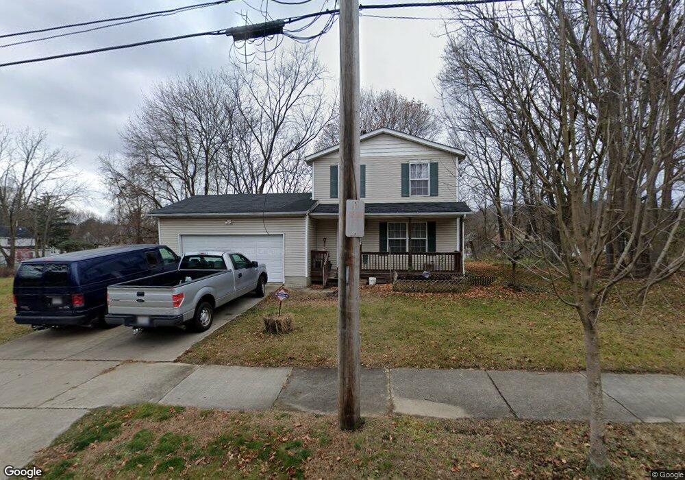
970 Haynes St Akron, OH 44307
Sherbondy Hill NeighborhoodEstimated Value: $84,000 - $116,000
3
Beds
2
Baths
1,092
Sq Ft
$94/Sq Ft
Est. Value
About This Home
This home is located at 970 Haynes St, Akron, OH 44307 and is currently estimated at $102,752, approximately $94 per square foot. 970 Haynes St is a home located in Summit County with nearby schools including St. Bernard-St. Mary Elementary School.
Ownership History
Date
Name
Owned For
Owner Type
Purchase Details
Closed on
Apr 21, 2003
Sold by
Urban Neighborhood Development Corp
Bought by
Temple Ronald
Current Estimated Value
Home Financials for this Owner
Home Financials are based on the most recent Mortgage that was taken out on this home.
Original Mortgage
$71,900
Outstanding Balance
$31,499
Interest Rate
6.02%
Mortgage Type
Purchase Money Mortgage
Estimated Equity
$71,253
Create a Home Valuation Report for This Property
The Home Valuation Report is an in-depth analysis detailing your home's value as well as a comparison with similar homes in the area
Home Values in the Area
Average Home Value in this Area
Purchase History
| Date | Buyer | Sale Price | Title Company |
|---|---|---|---|
| Temple Ronald | $71,900 | Landamerica/Lawyers Title |
Source: Public Records
Mortgage History
| Date | Status | Borrower | Loan Amount |
|---|---|---|---|
| Open | Temple Ronald | $71,900 | |
| Closed | Temple Ronald | $5,000 |
Source: Public Records
Tax History Compared to Growth
Tax History
| Year | Tax Paid | Tax Assessment Tax Assessment Total Assessment is a certain percentage of the fair market value that is determined by local assessors to be the total taxable value of land and additions on the property. | Land | Improvement |
|---|---|---|---|---|
| 2025 | $1,102 | $18,208 | $4,932 | $13,276 |
| 2024 | $1,102 | $18,208 | $4,932 | $13,276 |
| 2023 | $1,102 | $18,208 | $4,932 | $13,276 |
| 2022 | $867 | $10,711 | $2,902 | $7,809 |
| 2021 | $868 | $10,711 | $2,902 | $7,809 |
| 2020 | $857 | $10,710 | $2,900 | $7,810 |
| 2019 | $1,134 | $13,650 | $4,020 | $9,630 |
| 2018 | $1,120 | $13,650 | $4,020 | $9,630 |
| 2017 | $1,156 | $13,650 | $4,020 | $9,630 |
| 2016 | $1,157 | $13,930 | $4,020 | $9,910 |
| 2015 | $1,156 | $13,930 | $4,020 | $9,910 |
| 2014 | $1,148 | $13,930 | $4,020 | $9,910 |
| 2013 | $1,250 | $15,740 | $4,020 | $11,720 |
Source: Public Records
Map
Nearby Homes
- 949 Raymond St
- 364 Campbell St
- 1063 Raymond St
- 817 Raymond St
- 1001 Celina Ave
- 677 Vernon Odom Blvd
- 1132 Bristol Terrace
- 721 Vernon Odom Blvd
- 794 Ruth Ave
- 834 Kenyon St
- 737 Vernon Odom Blvd
- 639 Bellevue Ave
- 564 Euclid Ave
- 810 Amherst St
- 963 Penn Ave
- 670 Euclid Ave
- 776 Krause Ct
- 1174 La Croix Ave
- 985 Diana Ave
- 849 Amherst St