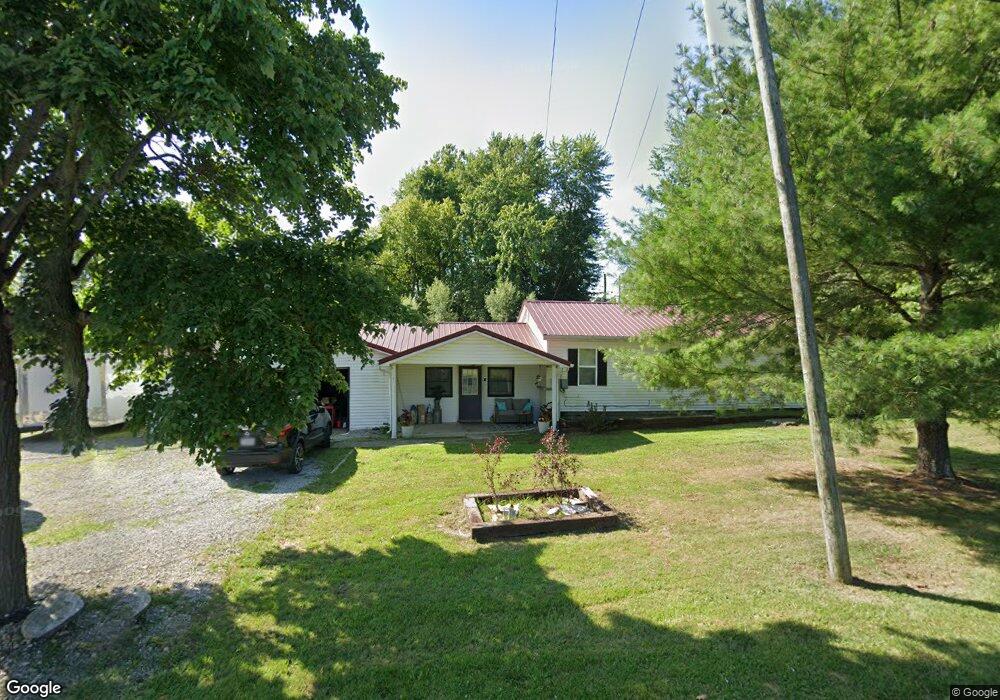
9700 State Route 41 West Union, OH 45693
Estimated Value: $155,408 - $161,000
4
Beds
1
Bath
1,224
Sq Ft
$129/Sq Ft
Est. Value
About This Home
This home is located at 9700 State Route 41, West Union, OH 45693 and is currently estimated at $158,102, approximately $129 per square foot. 9700 State Route 41 is a home located in Adams County with nearby schools including West Union Elementary School, West Union High School, and Adams County Christian School.
Ownership History
Date
Name
Owned For
Owner Type
Purchase Details
Closed on
Nov 22, 2019
Sold by
Deskins Adam A and Deskins Amy R
Bought by
Burns Quintell Ellsworth and Burns Sonja Dawn
Current Estimated Value
Home Financials for this Owner
Home Financials are based on the most recent Mortgage that was taken out on this home.
Original Mortgage
$80,000
Outstanding Balance
$74,351
Interest Rate
7%
Mortgage Type
Land Contract Argmt. Of Sale
Estimated Equity
$83,751
Purchase Details
Closed on
Oct 23, 2009
Sold by
Young Rachel D
Bought by
Deskins Adam A and Deskins Amy R
Home Financials for this Owner
Home Financials are based on the most recent Mortgage that was taken out on this home.
Original Mortgage
$85,714
Interest Rate
5.11%
Mortgage Type
Future Advance Clause Open End Mortgage
Purchase Details
Closed on
Sep 4, 2001
Sold by
Copas Dewey
Bought by
Young Robert J
Purchase Details
Closed on
Jul 15, 1997
Bought by
Poole Robbin E
Create a Home Valuation Report for This Property
The Home Valuation Report is an in-depth analysis detailing your home's value as well as a comparison with similar homes in the area
Home Values in the Area
Average Home Value in this Area
Purchase History
| Date | Buyer | Sale Price | Title Company |
|---|---|---|---|
| Burns Quintell Ellsworth | $85,000 | None Available | |
| Deskins Adam A | $84,000 | None Available | |
| Young Rachel D | $72,000 | None Available | |
| Young Robert J | $60,400 | -- | |
| Poole Robbin E | -- | -- |
Source: Public Records
Mortgage History
| Date | Status | Borrower | Loan Amount |
|---|---|---|---|
| Open | Burns Quintell Ellsworth | $80,000 | |
| Closed | Deskins Adam A | $85,714 | |
| Closed | Young Rachel D | $85,714 |
Source: Public Records
Tax History Compared to Growth
Tax History
| Year | Tax Paid | Tax Assessment Tax Assessment Total Assessment is a certain percentage of the fair market value that is determined by local assessors to be the total taxable value of land and additions on the property. | Land | Improvement |
|---|---|---|---|---|
| 2024 | $1,136 | $33,920 | $3,680 | $30,240 |
| 2023 | $1,135 | $33,920 | $3,680 | $30,240 |
| 2022 | $1,135 | $28,840 | $2,730 | $26,110 |
| 2021 | $1,048 | $28,840 | $2,730 | $26,110 |
| 2020 | $1,070 | $28,840 | $2,730 | $26,110 |
| 2019 | $1,071 | $28,840 | $2,730 | $26,110 |
| 2018 | $892 | $24,500 | $2,730 | $21,770 |
| 2017 | $877 | $24,500 | $2,730 | $21,770 |
| 2016 | $875 | $24,500 | $2,730 | $21,770 |
| 2015 | $804 | $23,320 | $3,330 | $19,990 |
| 2014 | $804 | $23,320 | $3,330 | $19,990 |
Source: Public Records
Map
Nearby Homes
- 9598 State Route 41
- 40 Greenwood Ave
- 81 Evergreen St
- 1070 Eagle Creek Rd
- 271 Crawford Rd
- 223 Polk St
- 333 Crawford Rd
- 0 Cic Blvd
- 4423 Pumpkin Ridge Rd
- 144 ac Pumpkin Ridge Rd
- 0 State Route 41 1 Acre Lot
- 714 Panhandle Ave
- 286 & 290 S Market St
- 408 W South St
- 101 S Mound St
- 305 W Walnut St
- 216 S Market St
- 4700 Ohio 247
- 302 W Main St
- 93 Jose Dr
- 9728 State Route 41
- 9786 State Route 41
- 9777 State Route 41
- 9693 State Route 41
- 9693 S St Rt 41
- 9626 State Route 41
- 9660 State Route 41
- 9595 State Route 41
- 9889 State Route 41
- 9889 State Route 41
- 9898 State Route 41
- 9514 State Route 41
- 9909 State Route 41
- 55 Hale Dr
- 75 Hale Dr
- 70 Hale Dr
- 410 Roy Pence Rd
- 93 Hale Dr
- 90 Hale Dr
- 9430 State Route 41