Estimated Value: $153,000 - $167,000
--
Bed
--
Bath
--
Sq Ft
15.34
Acres
About This Home
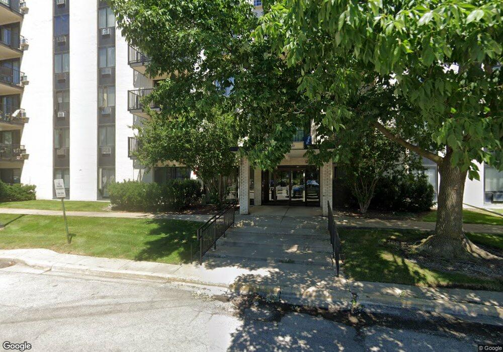
This home is located at 9701 N Dee Rd Unit 97015I, Niles, IL 60714 and is currently estimated at $162,759. 9701 N Dee Rd Unit 97015I is a home located in Cook County with nearby schools including Apollo Elementary School, Gemini Middle School, and Maine East High School.
Ownership History
Date
Name
Owned For
Owner Type
Purchase Details
Closed on
Mar 29, 2025
Sold by
Guststadt Ayala and Gutstadt Kenneth B
Bought by
Santos Divina Grace Dar
Current Estimated Value
Home Financials for this Owner
Home Financials are based on the most recent Mortgage that was taken out on this home.
Original Mortgage
$152,000
Outstanding Balance
$151,323
Interest Rate
6.63%
Mortgage Type
New Conventional
Estimated Equity
$11,436
Purchase Details
Closed on
Jun 16, 2001
Sold by
Balogh Kevin P
Bought by
Gutstadt Kenneth B and Gutstadt Ayala
Home Financials for this Owner
Home Financials are based on the most recent Mortgage that was taken out on this home.
Original Mortgage
$82,080
Interest Rate
7.11%
Mortgage Type
Balloon
Create a Home Valuation Report for This Property
The Home Valuation Report is an in-depth analysis detailing your home's value as well as a comparison with similar homes in the area
Home Values in the Area
Average Home Value in this Area
Purchase History
| Date | Buyer | Sale Price | Title Company |
|---|---|---|---|
| Santos Divina Grace Dar | $160,000 | Citywide Title | |
| Gutstadt Kenneth B | $103,000 | -- |
Source: Public Records
Mortgage History
| Date | Status | Borrower | Loan Amount |
|---|---|---|---|
| Open | Santos Divina Grace Dar | $152,000 | |
| Previous Owner | Gutstadt Kenneth B | $82,080 |
Source: Public Records
Tax History Compared to Growth
Tax History
| Year | Tax Paid | Tax Assessment Tax Assessment Total Assessment is a certain percentage of the fair market value that is determined by local assessors to be the total taxable value of land and additions on the property. | Land | Improvement |
|---|---|---|---|---|
| 2024 | $2,120 | $8,199 | $538 | $7,661 |
| 2023 | $1,992 | $8,199 | $538 | $7,661 |
| 2022 | $1,992 | $8,199 | $538 | $7,661 |
| 2021 | $2,039 | $6,969 | $827 | $6,142 |
| 2020 | $1,928 | $6,969 | $827 | $6,142 |
| 2019 | $1,863 | $7,672 | $827 | $6,845 |
| 2018 | $1,389 | $5,128 | $724 | $4,404 |
| 2017 | $1,379 | $5,128 | $724 | $4,404 |
| 2016 | $1,285 | $5,128 | $724 | $4,404 |
| 2015 | $967 | $3,534 | $620 | $2,914 |
| 2014 | $931 | $3,534 | $620 | $2,914 |
| 2013 | $915 | $3,534 | $620 | $2,914 |
Source: Public Records
Map
Nearby Homes
- 9701 N Dee Rd Unit 2I
- 9128 W Terrace Dr Unit 2N
- 9074 W Terrace Dr Unit 4N
- 9078 W Heathwood Dr Unit 1M
- 9821 Bianco Terrace Unit A
- 8966 W Heathwood Cir Unit C2
- 9330 Hamilton Ct Unit E
- 9275 Noel St Unit 3C
- 9275 Noel Ave Unit B3
- 9009 Golf Rd Unit 5B
- 8888 Steven Dr Unit 1H
- 9411 Harrison St Unit 471494
- 8916 Kenneth Dr Unit 1E
- 9485 Sumac Rd
- 9446 Dee Rd Unit 205E
- 8896 David Place Unit 1H
- 9428 N Oak Ave
- 8815 W Golf Rd Unit 11C
- 8815 W Golf Rd Unit 10C
- 8815 W Golf Rd Unit 3D
- 9701 N Dee Rd Unit 6A
- 9701 N Dee Rd Unit 1M
- 9701 N Dee Rd Unit 3A
- 9701 N Dee Rd Unit 5L
- 9701 N Dee Rd Unit 5G
- 9701 N Dee Rd Unit 97012F
- 9701 N Dee Rd Unit 97011A
- 9701 N Dee Rd Unit 97013A
- 9701 N Dee Rd Unit 97016N
- 9701 N Dee Rd Unit 97016L
- 9701 N Dee Rd Unit 97016G
- 9701 N Dee Rd Unit 97015N
- 9701 N Dee Rd Unit 97015L
- 9701 N Dee Rd Unit 97015H
- 9701 N Dee Rd Unit 97015D
- 9701 N Dee Rd Unit 97015C
- 9701 N Dee Rd Unit 97015B
- 9701 N Dee Rd Unit 97014K
- 9701 N Dee Rd Unit 97014H
- 9701 N Dee Rd Unit 97014D