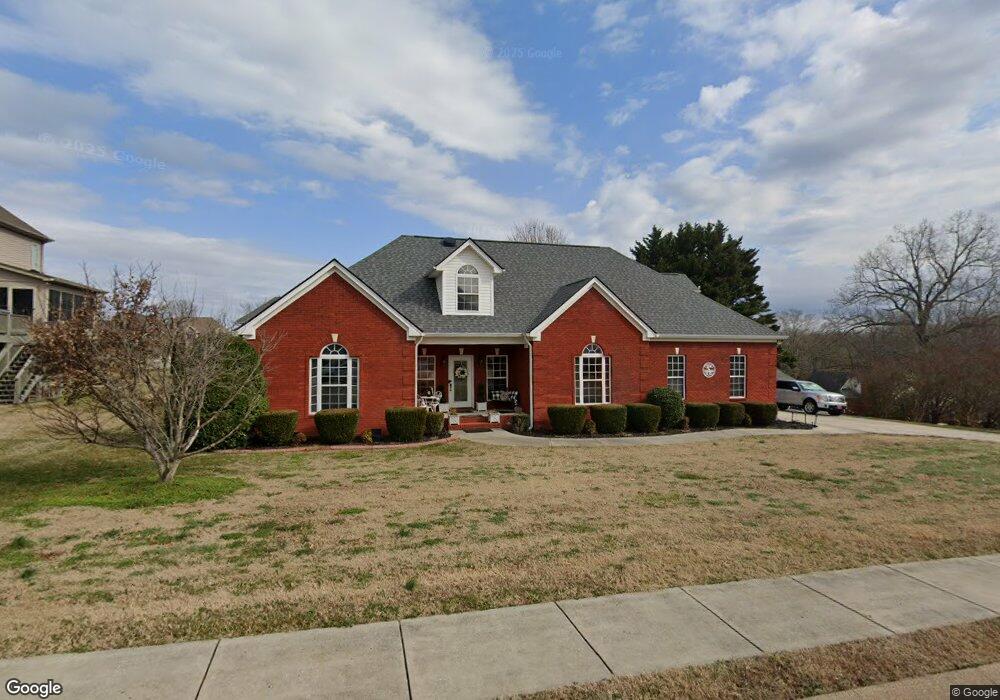
9706 Shoreline Heights Dr Soddy Daisy, TN 37379
Estimated Value: $507,000 - $563,000
3
Beds
3
Baths
2,935
Sq Ft
$179/Sq Ft
Est. Value
About This Home
This home is located at 9706 Shoreline Heights Dr, Soddy Daisy, TN 37379 and is currently estimated at $525,156, approximately $178 per square foot. 9706 Shoreline Heights Dr is a home located in Hamilton County with nearby schools including Loftis Middle School.
Ownership History
Date
Name
Owned For
Owner Type
Purchase Details
Closed on
Oct 27, 2006
Sold by
Bell William F and Bell Patricia A
Bought by
Sanders Danny P and Sanders Susan F
Current Estimated Value
Home Financials for this Owner
Home Financials are based on the most recent Mortgage that was taken out on this home.
Original Mortgage
$266,000
Outstanding Balance
$158,928
Interest Rate
6.39%
Mortgage Type
Unknown
Estimated Equity
$366,228
Purchase Details
Closed on
Mar 12, 2004
Sold by
Dunn Richard Eric and Dunn Tonya Renee
Bought by
Bell William F and Bell Patricia A
Home Financials for this Owner
Home Financials are based on the most recent Mortgage that was taken out on this home.
Original Mortgage
$180,000
Interest Rate
5.68%
Mortgage Type
Unknown
Purchase Details
Closed on
Oct 15, 2001
Sold by
Keyes Bobby
Bought by
Dunn Richard Eric and Dunn Tonya Renee
Create a Home Valuation Report for This Property
The Home Valuation Report is an in-depth analysis detailing your home's value as well as a comparison with similar homes in the area
Home Values in the Area
Average Home Value in this Area
Purchase History
| Date | Buyer | Sale Price | Title Company |
|---|---|---|---|
| Sanders Danny P | $280,000 | Northgate Title Escrow Inc | |
| Bell William F | $225,000 | -- | |
| Dunn Richard Eric | $25,000 | -- |
Source: Public Records
Mortgage History
| Date | Status | Borrower | Loan Amount |
|---|---|---|---|
| Open | Sanders Danny P | $266,000 | |
| Previous Owner | Bell William F | $180,000 |
Source: Public Records
Tax History Compared to Growth
Tax History
| Year | Tax Paid | Tax Assessment Tax Assessment Total Assessment is a certain percentage of the fair market value that is determined by local assessors to be the total taxable value of land and additions on the property. | Land | Improvement |
|---|---|---|---|---|
| 2024 | $1,879 | $83,975 | $0 | $0 |
| 2023 | $1,888 | $83,975 | $0 | $0 |
| 2022 | $1,888 | $83,975 | $0 | $0 |
| 2021 | $1,888 | $83,975 | $0 | $0 |
| 2020 | $2,028 | $73,000 | $0 | $0 |
| 2019 | $2,028 | $73,000 | $0 | $0 |
| 2018 | $2,028 | $73,000 | $0 | $0 |
| 2017 | $2,028 | $73,000 | $0 | $0 |
| 2016 | $1,809 | $0 | $0 | $0 |
| 2015 | $1,809 | $65,100 | $0 | $0 |
| 2014 | $1,809 | $0 | $0 | $0 |
Source: Public Records
Map
Nearby Homes
- 9802 Shoreline Heights Dr
- 2522 W Wind Dr
- 9824 Waterside Way
- 9901 Breeze Hill Ln
- 9955 Rolling Wind Dr
- 1834 Breeze Dr
- 11111 Hixson Pike
- 2033 Angler Dr
- 10041 Rolling Wind Dr
- 2316 Lakesite Dr
- 10105 Hixson Pike
- 2316 Green Valley Rd
- 2228 Lakesite Dr
- 2320 Collins Ln
- 2109 Millard Rd
- 2031 Millard Rd
- 2119 Collins Ln
- 1724 Magnum Ln
- 2221 Chimney Hills Dr
- 2607 Chimney Lake Cir
- 9714 Shoreline Heights Dr
- 2305 Watershore Dr
- 2301 Watershore Dr
- 9700 Shoreline Heights Dr
- 9707 Shoreline Heights Dr
- 9709 Shoreline Heights Dr
- 2309 Watershore Dr
- 9701 Shoreline Heights Dr
- 9719 Shoreline Heights Dr
- 9715 Shoreline Heights Dr
- 9721 Shoreline Heights Dr
- 9721 Shoreline Heights Dr Unit 38
- 2304 Watershore Dr
- 9713 Shoreline Heights Dr
- 2300 Watershore Dr
- 2313 Watershore Dr
- 2308 Watershore Dr
- 9715 Hixson Pike
- 2314 Watershore Dr
- 9728 Shoreline Heights Dr