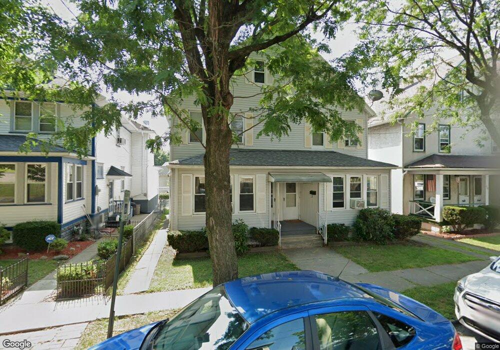
971 John St Scranton, PA 18510
Hill Section NeighborhoodEstimated Value: $27,012 - $147,000
Studio
--
Bath
--
Sq Ft
4,356
Sq Ft
About This Home
This home is located at 971 John St, Scranton, PA 18510 and is currently estimated at $106,753. 971 John St is a home located in Lackawanna County with nearby schools including William Prescott School, Northeast Scranton Intermediate School, and Scranton High School.
Ownership History
Date
Name
Owned For
Owner Type
Purchase Details
Closed on
Sep 14, 2020
Sold by
Perry Anthony Wayne and Perry Lorena
Bought by
Perry Lorena
Current Estimated Value
Purchase Details
Closed on
Mar 21, 2019
Sold by
Jeffers Michael
Bought by
Perry Anthony Wayne and Perry Lorena
Purchase Details
Closed on
Oct 29, 2018
Sold by
Beavers Christopher
Bought by
Jeffers Michael
Purchase Details
Closed on
Jun 22, 2010
Sold by
The Bank Of New York Mellon Trust Compan
Bought by
Sherwood Properties Llc
Purchase Details
Closed on
Jun 3, 2010
Sold by
Cruser Concetta M and Mills Francis
Bought by
The Bank Of New York Mellon Trust Compan
Create a Home Valuation Report for This Property
The Home Valuation Report is an in-depth analysis detailing your home's value as well as a comparison with similar homes in the area
Home Values in the Area
Average Home Value in this Area
Purchase History
| Date | Buyer | Sale Price | Title Company |
|---|---|---|---|
| Perry Lorena | -- | Reliable Abstract Co | |
| Perry Anthony Wayne | $17,000 | None Available | |
| Jeffers Michael | $5,000 | None Available | |
| Sherwood Properties Llc | $20,000 | None Available | |
| The Bank Of New York Mellon Trust Compan | $2,701 | None Available |
Source: Public Records
Tax History
| Year | Tax Paid | Tax Assessment Tax Assessment Total Assessment is a certain percentage of the fair market value that is determined by local assessors to be the total taxable value of land and additions on the property. | Land | Improvement |
|---|---|---|---|---|
| 2025 | $1,095 | $3,500 | $400 | $3,100 |
| 2024 | $999 | $3,500 | $400 | $3,100 |
| 2023 | $999 | $3,500 | $400 | $3,100 |
| 2022 | $977 | $3,500 | $400 | $3,100 |
| 2021 | $977 | $3,500 | $400 | $3,100 |
| 2020 | $958 | $3,500 | $400 | $3,100 |
| 2019 | $900 | $3,500 | $400 | $3,100 |
| 2018 | $900 | $3,500 | $400 | $3,100 |
| 2017 | $884 | $3,500 | $400 | $3,100 |
| 2016 | $250 | $3,500 | $400 | $3,100 |
| 2015 | $658 | $3,500 | $400 | $3,100 |
| 2014 | -- | $3,500 | $400 | $3,100 |
Source: Public Records
Map
Nearby Homes
- 2211 Ash St
- 1947 Myrtle St
- 810 Wheeler Ave
- 0 Colfax and Gibson Ave Unit GSBSC255175
- 1050 Prescott Ave
- 1017 Prescott Ave
- 1406 Ash St
- 1042 Taylor Ave
- 619 Arthur Ave
- 617 Arthur Ave
- 837 Matthew Ave
- 917 Taylor Ave
- 1050 Mark Ave
- 615 Arthur Ave
- 1018 N Webster Ave
- 616-618 Harrison Ave
- 7 Oakwood Place
- 812 Butler St
- 1318 Pine St
- 709 Meade St
Your Personal Tour Guide
Ask me questions while you tour the home.