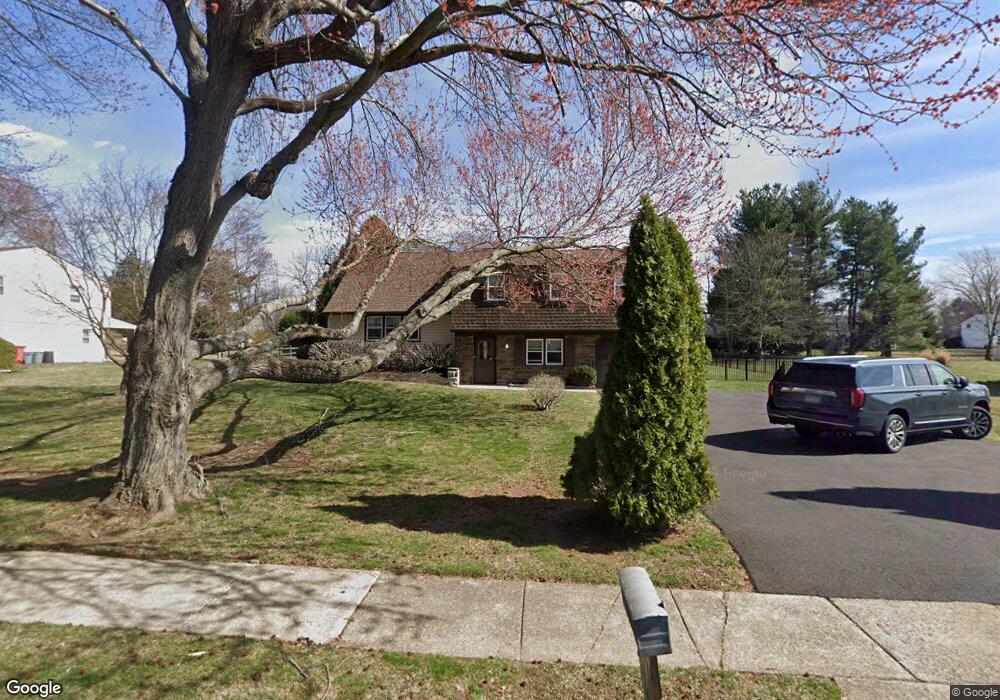
971 Sandy Ln Warminster, PA 18974
Estimated Value: $535,000 - $637,000
Studio
2
Baths
2,092
Sq Ft
$279/Sq Ft
Est. Value
About This Home
This home is located at 971 Sandy Ln, Warminster, PA 18974 and is currently estimated at $584,258, approximately $279 per square foot. 971 Sandy Ln is a home located in Bucks County with nearby schools including Willow Dale Elementary School, Log College Middle School, and William Tennent High School.
Ownership History
Date
Name
Owned For
Owner Type
Purchase Details
Closed on
Jul 24, 2015
Sold by
Shaughnessey Agnes Mary
Bought by
Nicely James and Nicely Susan
Current Estimated Value
Home Financials for this Owner
Home Financials are based on the most recent Mortgage that was taken out on this home.
Original Mortgage
$304,000
Outstanding Balance
$237,949
Interest Rate
3.97%
Mortgage Type
New Conventional
Estimated Equity
$346,309
Purchase Details
Closed on
Feb 16, 1972
Sold by
Miller & Son Paving Inc
Bought by
Shaughnessy Richard J and Agnes Mary
Create a Home Valuation Report for This Property
The Home Valuation Report is an in-depth analysis detailing your home's value as well as a comparison with similar homes in the area
Home Values in the Area
Average Home Value in this Area
Purchase History
| Date | Buyer | Sale Price | Title Company |
|---|---|---|---|
| Nicely James | -- | None Available | |
| Shaughnessy Richard J | -- | -- |
Source: Public Records
Mortgage History
| Date | Status | Borrower | Loan Amount |
|---|---|---|---|
| Open | Nicely James | $304,000 |
Source: Public Records
Tax History
| Year | Tax Paid | Tax Assessment Tax Assessment Total Assessment is a certain percentage of the fair market value that is determined by local assessors to be the total taxable value of land and additions on the property. | Land | Improvement |
|---|---|---|---|---|
| 2025 | $8,590 | $40,700 | $8,240 | $32,460 |
| 2024 | $8,590 | $40,700 | $8,240 | $32,460 |
| 2023 | $8,326 | $40,700 | $8,240 | $32,460 |
| 2022 | $8,148 | $40,700 | $8,240 | $32,460 |
| 2021 | $7,958 | $40,700 | $8,240 | $32,460 |
| 2020 | $7,846 | $40,700 | $8,240 | $32,460 |
| 2019 | $7,430 | $40,700 | $8,240 | $32,460 |
| 2018 | $7,252 | $40,700 | $8,240 | $32,460 |
| 2017 | $7,039 | $40,700 | $8,240 | $32,460 |
| 2016 | $7,039 | $40,700 | $8,240 | $32,460 |
| 2015 | $6,797 | $40,700 | $8,240 | $32,460 |
| 2014 | $6,797 | $40,700 | $8,240 | $32,460 |
Source: Public Records
Map
Nearby Homes
- 942 Stein Ct
- 909 Holden Ct
- 422 Brandywine Ct Unit YV422
- 982 Mueller Rd
- 745 Tennyson Dr
- 786 Boxwood Dr
- 737 Tennyson Dr
- 1167 W Bristol Rd
- Lot 19 Kennedy Way
- 992 Jamison St
- 1067 Log College Dr
- L:26 Street Rd
- 980 Marshall Dr
- 630 Whittier Dr
- 632 Longfellow Ct
- 641 Whittier Dr
- 1024 Gates Place
- 1493 Maguire Ln
- 916 Log College Dr
- 202 Strawberry Ct Unit 249
Your Personal Tour Guide
Ask me questions while you tour the home.