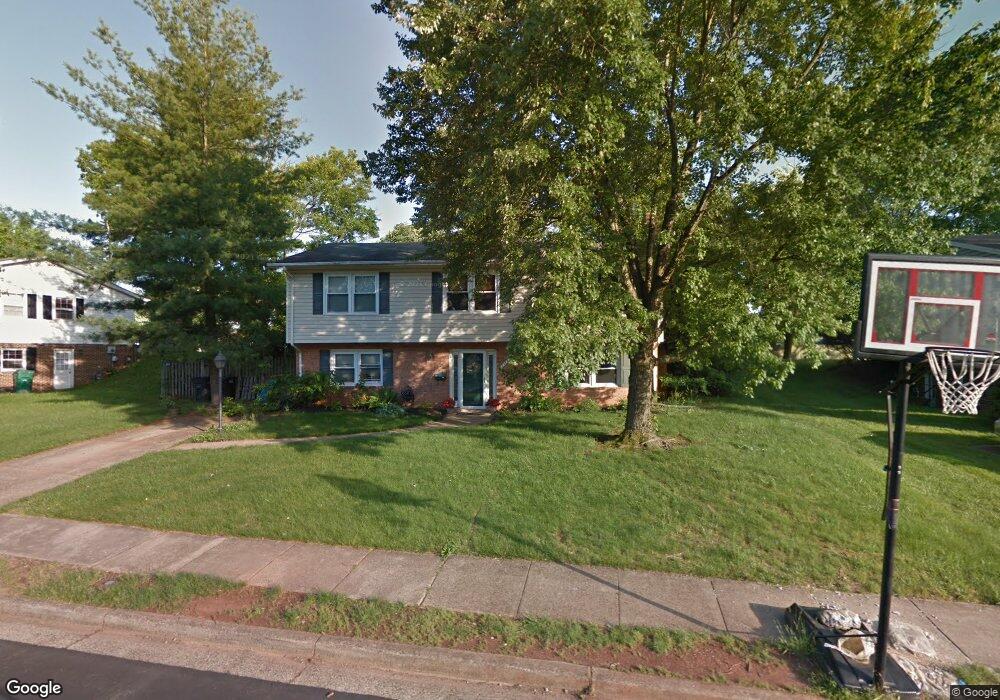
9711 Botsford Rd Manassas, VA 20109
Estimated Value: $496,401 - $574,000
4
Beds
3
Baths
1,247
Sq Ft
$442/Sq Ft
Est. Value
About This Home
This home is located at 9711 Botsford Rd, Manassas, VA 20109 and is currently estimated at $551,350, approximately $442 per square foot. 9711 Botsford Rd is a home located in Prince William County with nearby schools including Sudley Elementary School, Unity Braxton Middle School, and Unity Reed High School.
Ownership History
Date
Name
Owned For
Owner Type
Purchase Details
Closed on
Oct 2, 1995
Sold by
White Donald L
Bought by
Lee James P
Current Estimated Value
Home Financials for this Owner
Home Financials are based on the most recent Mortgage that was taken out on this home.
Original Mortgage
$152,440
Outstanding Balance
$1,100
Interest Rate
7.89%
Estimated Equity
$550,250
Create a Home Valuation Report for This Property
The Home Valuation Report is an in-depth analysis detailing your home's value as well as a comparison with similar homes in the area
Home Values in the Area
Average Home Value in this Area
Purchase History
| Date | Buyer | Sale Price | Title Company |
|---|---|---|---|
| Lee James P | $148,000 | -- |
Source: Public Records
Mortgage History
| Date | Status | Borrower | Loan Amount |
|---|---|---|---|
| Open | Lee James P | $152,440 |
Source: Public Records
Tax History Compared to Growth
Tax History
| Year | Tax Paid | Tax Assessment Tax Assessment Total Assessment is a certain percentage of the fair market value that is determined by local assessors to be the total taxable value of land and additions on the property. | Land | Improvement |
|---|---|---|---|---|
| 2025 | $4,316 | $455,000 | $140,700 | $314,300 |
| 2024 | $4,316 | $434,000 | $129,800 | $304,200 |
| 2023 | $4,330 | $416,100 | $125,000 | $291,100 |
| 2022 | $4,513 | $407,500 | $125,000 | $282,500 |
| 2021 | $4,575 | $372,900 | $113,700 | $259,200 |
| 2020 | $5,397 | $348,200 | $113,700 | $234,500 |
| 2019 | $5,104 | $329,300 | $113,700 | $215,600 |
| 2018 | $3,887 | $321,900 | $113,700 | $208,200 |
| 2017 | $3,836 | $308,800 | $113,700 | $195,100 |
| 2016 | $3,602 | $292,300 | $100,300 | $192,000 |
| 2015 | $3,206 | $284,600 | $96,800 | $187,800 |
| 2014 | $3,206 | $253,700 | $85,500 | $168,200 |
Source: Public Records
Map
Nearby Homes
- 9732 Copeland Dr
- 9724 Copeland Dr
- 9613 King George Dr
- 7608 Bland Dr
- 10102 Roslyn Ct
- 9929 Loudoun Ave
- 7530 Campbell Ct
- 7812 Amherst Dr
- 7726 Amherst Dr
- 7703 Amherst Dr
- 7823 Brookview Ct
- 7518 Quail Run Ln
- 7506 Todd Place
- 7832 Brookview Ct
- 7723 Appomattox Ave
- 10502 Oronoco Ln
- 7398 Barbados Ln
- 118 Mace St
- 7416 Rokeby Dr
- 7498 Tangier Way
- 9709 Botsford Rd
- 9713 Botsford Rd
- 9708 Sudley Manor Dr
- 9710 Sudley Manor Dr
- 9706 Sudley Manor Dr
- 9707 Botsford Rd
- 9712 Botsford Rd
- 9710 Botsford Rd
- 9714 Botsford Rd
- 9712 Sudley Manor Dr
- 9704 Sudley Manor Dr
- 9717 Botsford Rd
- 9716 Botsford Rd
- 9705 Botsford Rd
- 9708 Botsford Rd
- 9714 Sudley Manor Dr
- 9718 Botsford Rd
- 9702 Sudley Manor Dr
- 9706 Botsford Rd
- 9723 Dublin Dr