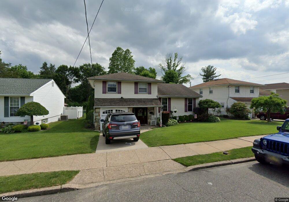
9711 Laramie Rd Philadelphia, PA 19115
Bustleton NeighborhoodEstimated Value: $495,096 - $612,000
--
Bed
--
Bath
1,614
Sq Ft
$346/Sq Ft
Est. Value
About This Home
This home is located at 9711 Laramie Rd, Philadelphia, PA 19115 and is currently estimated at $557,774, approximately $345 per square foot. 9711 Laramie Rd is a home located in Philadelphia County with nearby schools including Greenberg Joseph School, George Washington High School, and St. Albert the Great School.
Ownership History
Date
Name
Owned For
Owner Type
Purchase Details
Closed on
Sep 14, 2006
Sold by
Weiner Samuel E
Bought by
Kent Joseph M and Kent Christi A
Current Estimated Value
Home Financials for this Owner
Home Financials are based on the most recent Mortgage that was taken out on this home.
Original Mortgage
$324,000
Outstanding Balance
$193,725
Interest Rate
6.59%
Mortgage Type
Purchase Money Mortgage
Estimated Equity
$364,049
Purchase Details
Closed on
Jan 31, 2006
Sold by
Hankin Louis E and Hankin Sandra T
Bought by
Weiner Samuel E
Home Financials for this Owner
Home Financials are based on the most recent Mortgage that was taken out on this home.
Original Mortgage
$212,000
Interest Rate
7.87%
Mortgage Type
Fannie Mae Freddie Mac
Create a Home Valuation Report for This Property
The Home Valuation Report is an in-depth analysis detailing your home's value as well as a comparison with similar homes in the area
Home Values in the Area
Average Home Value in this Area
Purchase History
| Date | Buyer | Sale Price | Title Company |
|---|---|---|---|
| Kent Joseph M | $360,000 | None Available | |
| Weiner Samuel E | $265,000 | None Available |
Source: Public Records
Mortgage History
| Date | Status | Borrower | Loan Amount |
|---|---|---|---|
| Open | Kent Joseph M | $324,000 | |
| Previous Owner | Weiner Samuel E | $212,000 |
Source: Public Records
Tax History Compared to Growth
Tax History
| Year | Tax Paid | Tax Assessment Tax Assessment Total Assessment is a certain percentage of the fair market value that is determined by local assessors to be the total taxable value of land and additions on the property. | Land | Improvement |
|---|---|---|---|---|
| 2025 | $4,766 | $438,300 | $87,660 | $350,640 |
| 2024 | $4,766 | $438,300 | $87,660 | $350,640 |
| 2023 | $4,766 | $340,500 | $68,100 | $272,400 |
| 2022 | $3,756 | $295,500 | $68,100 | $227,400 |
| 2021 | $4,386 | $0 | $0 | $0 |
| 2020 | $4,386 | $0 | $0 | $0 |
| 2019 | $4,199 | $0 | $0 | $0 |
| 2018 | $3,803 | $0 | $0 | $0 |
| 2017 | $3,803 | $0 | $0 | $0 |
| 2016 | $3,383 | $0 | $0 | $0 |
| 2015 | $3,239 | $0 | $0 | $0 |
| 2014 | -- | $271,700 | $81,677 | $190,023 |
| 2012 | -- | $38,880 | $9,710 | $29,170 |
Source: Public Records
Map
Nearby Homes
- 114 Almatt Place
- 0 Welsh Rd Unit 310 PAPH2537678
- 421 Jonathan Place
- 9810 Bridle Rd
- 9902 Player Dr
- 9812 Ferndale St
- 1861 Lippincott Rd
- 9231 Grace Ln
- 9933 Medway Rd
- 9825 Verree Rd
- 9945 Jeanes St
- 9762 Redd Rambler Terrace
- 116 Delia Ln
- 727 Sherrie Rd
- 637 Charette Rd
- 134 Alburger Ave
- 1060 Welsh Rd
- 123 Pocasset Rd
- 9962 Woodfern Rd
- 9949 Woodfern Rd
- 9709 Laramie Rd
- 9713 Laramie Rd
- 9707 Laramie Rd
- 9715 Laramie Rd
- 9712 Laramie Rd
- 9714 Laramie Rd
- 9710 Laramie Rd
- 9705 Laramie Rd
- 9717 Laramie Rd
- 507 Welsh Rd Unit 13
- 9708 Laramie Rd
- 9716 Laramie Rd
- 594 Remsen Rd
- 9719 Laramie Rd
- 505 Welsh Rd
- 503 Welsh Rd
- 9718 Laramie Rd
- 448 Myers Cir
- 501 Welsh Rd
- 593 Remsen Rd