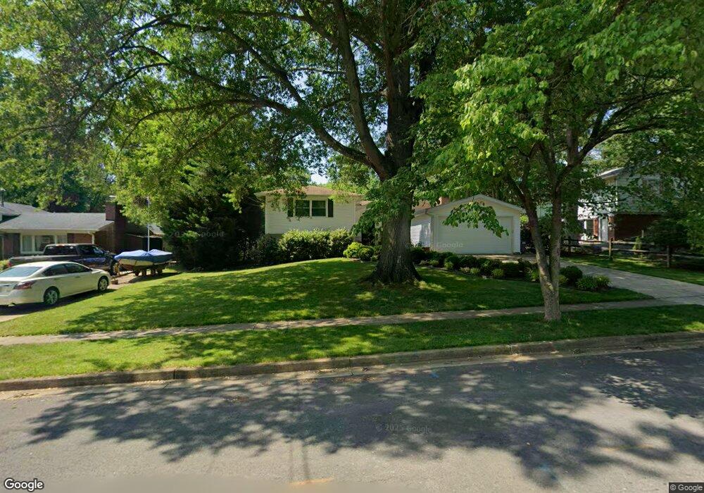
9715 Saint Andrews Dr Fairfax, VA 22030
Estimated Value: $901,474 - $916,000
4
Beds
4
Baths
2,416
Sq Ft
$376/Sq Ft
Est. Value
About This Home
This home is located at 9715 Saint Andrews Dr, Fairfax, VA 22030 and is currently estimated at $908,619, approximately $376 per square foot. 9715 Saint Andrews Dr is a home located in Fairfax City with nearby schools including Daniels Run Elementary School, Johnson Middle School, and Fairfax High.
Ownership History
Date
Name
Owned For
Owner Type
Purchase Details
Closed on
May 6, 1998
Sold by
Duchelle Stephen F
Bought by
Kobee Robert M and Kobee Irina V
Current Estimated Value
Home Financials for this Owner
Home Financials are based on the most recent Mortgage that was taken out on this home.
Original Mortgage
$162,400
Outstanding Balance
$31,594
Interest Rate
7.05%
Mortgage Type
New Conventional
Estimated Equity
$877,025
Create a Home Valuation Report for This Property
The Home Valuation Report is an in-depth analysis detailing your home's value as well as a comparison with similar homes in the area
Home Values in the Area
Average Home Value in this Area
Purchase History
| Date | Buyer | Sale Price | Title Company |
|---|---|---|---|
| Kobee Robert M | $203,000 | -- |
Source: Public Records
Mortgage History
| Date | Status | Borrower | Loan Amount |
|---|---|---|---|
| Open | Kobee Robert M | $162,400 |
Source: Public Records
Tax History Compared to Growth
Tax History
| Year | Tax Paid | Tax Assessment Tax Assessment Total Assessment is a certain percentage of the fair market value that is determined by local assessors to be the total taxable value of land and additions on the property. | Land | Improvement |
|---|---|---|---|---|
| 2025 | $9,226 | $874,500 | $236,000 | $638,500 |
| 2024 | $8,177 | $793,900 | $220,700 | $573,200 |
| 2023 | $8,289 | $808,700 | $211,700 | $597,000 |
| 2022 | $8,168 | $808,700 | $211,700 | $597,000 |
| 2021 | $7,593 | $706,300 | $211,700 | $494,600 |
| 2020 | $7,064 | $657,100 | $211,700 | $445,400 |
| 2019 | $6,821 | $642,700 | $211,700 | $431,000 |
| 2018 | $6,732 | $635,100 | $209,700 | $425,400 |
| 2017 | $3,165 | $616,100 | $203,600 | $412,500 |
| 2016 | $3,008 | $603,400 | $199,700 | $403,700 |
| 2015 | $5,737 | $601,200 | $195,900 | $405,300 |
| 2014 | $5,228 | $577,500 | $188,300 | $389,200 |
Source: Public Records
Map
Nearby Homes
- 9917 Colony Rd
- 3506 Queen Anne Dr
- 3536 Sutton Heights Cir
- 3546 Sutton Heights Cir
- 3790 Lyndhurst Dr Unit 103
- 3501 Redwood Ct
- 9904 Great Oaks Way
- 3805 Carolyn Ave
- 3607 Heritage Ln
- 9368 Tovito Dr
- 9353 Tovito Dr
- 3886 Bradwater St
- 9450 Silver King Ct Unit 203
- 9450 Silver King Ct Unit 308
- 9350 Tovito Dr
- 10005 Spring Lake Terrace
- 3975 Lyndhurst Dr Unit 103
- 3410 Andover Dr
- 3831 Farrcroft Dr
- 10087 Daniels Run Way
- 9717 Saint Andrews Dr
- 9713 Saint Andrews Dr
- 3614 Cornell Rd
- 3612 Cornell Rd
- 9719 Saint Andrews Dr
- 9711 Saint Andrews Dr
- 3616 Cornell Rd
- 3610 Cornell Rd
- 9714 Saint Andrews Dr
- 9712 Saint Andrews Dr
- 9716 Saint Andrews Dr
- 3618 Cornell Rd
- 9721 Saint Andrews Dr
- 9710 Saint Andrews Dr
- 3608 Cornell Rd
- 3615 Cornell Rd
- 3613 Cornell Rd
- 9708 Saint Andrews Dr
- 9720 Saint Andrews Dr
- 9723 Saint Andrews Dr