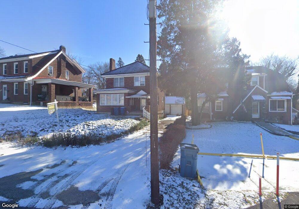
9716 Frankstown Rd Pittsburgh, PA 15235
Penn Hills Township NeighborhoodEstimated Value: $185,064 - $266,000
3
Beds
1
Bath
1,781
Sq Ft
$120/Sq Ft
Est. Value
About This Home
This home is located at 9716 Frankstown Rd, Pittsburgh, PA 15235 and is currently estimated at $214,266, approximately $120 per square foot. 9716 Frankstown Rd is a home located in Allegheny County with nearby schools including Penn Hills Elementary School, Linton Middle School, and Penn Hills Senior High School.
Ownership History
Date
Name
Owned For
Owner Type
Purchase Details
Closed on
Jul 28, 2023
Sold by
Stotts Tyrone
Bought by
Lsg57 Llc
Current Estimated Value
Purchase Details
Closed on
Nov 9, 2007
Sold by
Vidunas Michael F
Bought by
Stotts Tyrone
Home Financials for this Owner
Home Financials are based on the most recent Mortgage that was taken out on this home.
Original Mortgage
$90,000
Interest Rate
6.41%
Mortgage Type
New Conventional
Create a Home Valuation Report for This Property
The Home Valuation Report is an in-depth analysis detailing your home's value as well as a comparison with similar homes in the area
Home Values in the Area
Average Home Value in this Area
Purchase History
| Date | Buyer | Sale Price | Title Company |
|---|---|---|---|
| Lsg57 Llc | $15,000 | -- | |
| Lsg57 Llc | $15,000 | -- | |
| Stotts Tyrone | $100,000 | -- |
Source: Public Records
Mortgage History
| Date | Status | Borrower | Loan Amount |
|---|---|---|---|
| Previous Owner | Stotts Tyrone | $90,000 |
Source: Public Records
Tax History Compared to Growth
Tax History
| Year | Tax Paid | Tax Assessment Tax Assessment Total Assessment is a certain percentage of the fair market value that is determined by local assessors to be the total taxable value of land and additions on the property. | Land | Improvement |
|---|---|---|---|---|
| 2025 | $2,999 | $71,800 | $12,100 | $59,700 |
| 2024 | $2,999 | $71,800 | $12,100 | $59,700 |
| 2023 | $2,247 | $53,800 | $12,100 | $41,700 |
| 2022 | $2,220 | $53,800 | $12,100 | $41,700 |
| 2021 | $2,677 | $53,800 | $12,100 | $41,700 |
| 2020 | $2,143 | $53,800 | $12,100 | $41,700 |
| 2019 | $2,143 | $53,800 | $12,100 | $41,700 |
| 2018 | $254 | $53,800 | $12,100 | $41,700 |
| 2017 | $1,963 | $53,800 | $12,100 | $41,700 |
| 2016 | $254 | $53,800 | $12,100 | $41,700 |
| 2015 | $254 | $53,800 | $12,100 | $41,700 |
| 2014 | $1,846 | $53,800 | $12,100 | $41,700 |
Source: Public Records
Map
Nearby Homes
- 9620 Emerson St
- 9600 Frankstown Rd
- 143 Howard St
- 2173 Sampson St
- 231 Evaline St
- 111 Clinton Dr
- 225 Bon Air Rd
- 117 Johnston Rd
- 2722 Graham Blvd
- 9216 Florida Ave Unit 9218
- 3013 Hebron Dr
- 507 Bon Air Rd
- 1885 Graham Blvd
- 10214 Frankstown Rd
- 10207 Frankstown Rd
- 614 Churchill Ave
- 10085 Grandview Ave
- 852 Hawthorne Dr
- 1730 Graham Blvd
- 2241 Laketon Rd
- Lot 216R Woodwind Dr Unit 216R
- Lot 216R Woodwind Dr
- 9712 Frankstown Rd
- 9720 Frankstown Rd
- 9708 Frankstown Rd
- 9704 Frankstown Rd
- 9800 Frankstown Rd
- 103 Henderson St
- 9725 Frankstown Rd
- 100 Lavern St
- 9700 Frankstown Rd
- 9804 Frankstown Rd
- 105 Henderson St
- 104 Henderson St
- 107 Henderson St
- 9703 Frankstown Rd
- 102 Lavern St
- 9808 Frankstown Rd
- 104 Lavern St
- 106 Henderson St