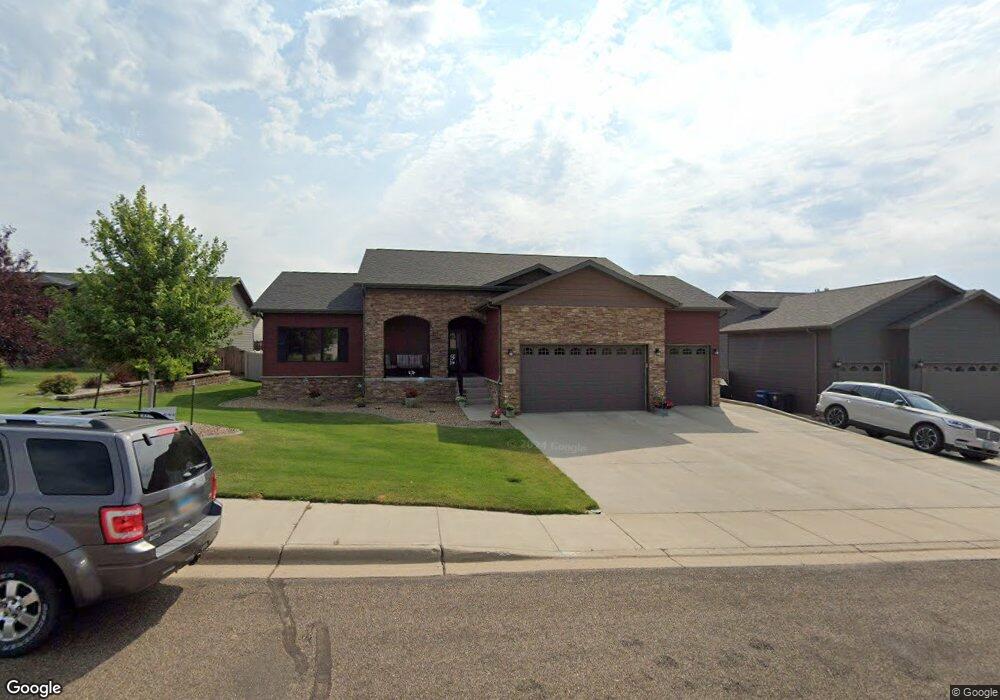
972 Belle Ct Dickinson, ND 58601
Estimated Value: $483,731 - $524,000
4
Beds
1
Bath
1,661
Sq Ft
$307/Sq Ft
Est. Value
About This Home
This home is located at 972 Belle Ct, Dickinson, ND 58601 and is currently estimated at $510,577, approximately $307 per square foot. 972 Belle Ct is a home with nearby schools including Trinity Elementary School West, Trinity Catholic Schools, and Trinity Elementary School East.
Ownership History
Date
Name
Owned For
Owner Type
Purchase Details
Closed on
Dec 21, 2020
Sold by
Haller Danny L and Haller Nicole
Bought by
Haller Danny L and Haller Nicole
Current Estimated Value
Home Financials for this Owner
Home Financials are based on the most recent Mortgage that was taken out on this home.
Original Mortgage
$283,250
Outstanding Balance
$249,741
Interest Rate
2.8%
Mortgage Type
New Conventional
Estimated Equity
$260,836
Purchase Details
Closed on
Dec 13, 2012
Sold by
Jkdt Enterprises Llc
Bought by
Haller Danny L
Home Financials for this Owner
Home Financials are based on the most recent Mortgage that was taken out on this home.
Original Mortgage
$331,600
Interest Rate
3.36%
Mortgage Type
New Conventional
Create a Home Valuation Report for This Property
The Home Valuation Report is an in-depth analysis detailing your home's value as well as a comparison with similar homes in the area
Home Values in the Area
Average Home Value in this Area
Purchase History
| Date | Buyer | Sale Price | Title Company |
|---|---|---|---|
| Haller Danny L | -- | None Listed On Document | |
| Haller Danny L | -- | None Available |
Source: Public Records
Mortgage History
| Date | Status | Borrower | Loan Amount |
|---|---|---|---|
| Open | Haller Danny L | $283,250 | |
| Previous Owner | Haller Danny L | $331,600 |
Source: Public Records
Tax History
| Year | Tax Paid | Tax Assessment Tax Assessment Total Assessment is a certain percentage of the fair market value that is determined by local assessors to be the total taxable value of land and additions on the property. | Land | Improvement |
|---|---|---|---|---|
| 2025 | $4,040 | $401,500 | $45,700 | $355,800 |
| 2024 | $5,055 | $401,500 | $45,700 | $355,800 |
| 2023 | $3,961 | $401,500 | $45,700 | $355,800 |
| 2022 | $3,740 | $187,950 | $0 | $0 |
| 2021 | $4,494 | $358,500 | $45,700 | $312,800 |
| 2020 | $4,572 | $358,500 | $45,700 | $312,800 |
| 2019 | $4,610 | $358,500 | $45,700 | $312,800 |
| 2017 | $3,258 | $358,500 | $45,700 | $312,800 |
| 2015 | $3,258 | $372,100 | $46,300 | $325,800 |
| 2014 | $2,450 | $259,100 | $46,300 | $212,800 |
| 2013 | -- | $293,200 | $46,300 | $246,900 |
Source: Public Records
Map
Nearby Homes
- 881 Mustang Ave
- 816 17th Ave E
- 873 25th Ave E
- 0 14th Ave E Unit 24-492
- 1377 8th St E
- 1161 6th St E
- 0 17 65 Acres
- 1163 Lincoln St
- 390 Baker Ave
- 0 Lot 1 Block 5 East Dale 4th Unit 25-1094
- 0 9th St E
- 0 Unit 25-1093
- 263 Adams Ave
- 930 Shinagle Dr
- 0 Lot 3 Block 5 East Dale 4th Unit 25-1092
- 977 Shinagle Dr
- 858 Elm Ave
- 891 Dell Ave
- 973 Dell Ave
- 847 11th St E
- 960 Belle Ct
- 986 Belle Ct
- 971 Pheasant Run Ave
- 959 Pheasant Run Ave
- 996 Belle Ct
- 971 Belle Ct
- 959 Belle Ct
- 985 Belle Ct
- 995 Pheasant Run Ave
- 995 Belle Ct
- 2017 Canyon Dr
- 1995 Canyon Dr
- 972 Mustang Ave
- 972 Pheasant Run Ave
- 960 Mustang Ave
- 956 Pheasant Run Ave
- 996 Pheasant Run Ave
- 986 Pheasant Run Ave
- 942 Pheasant Run Ave
- 934 Mustang Ave
Your Personal Tour Guide
Ask me questions while you tour the home.