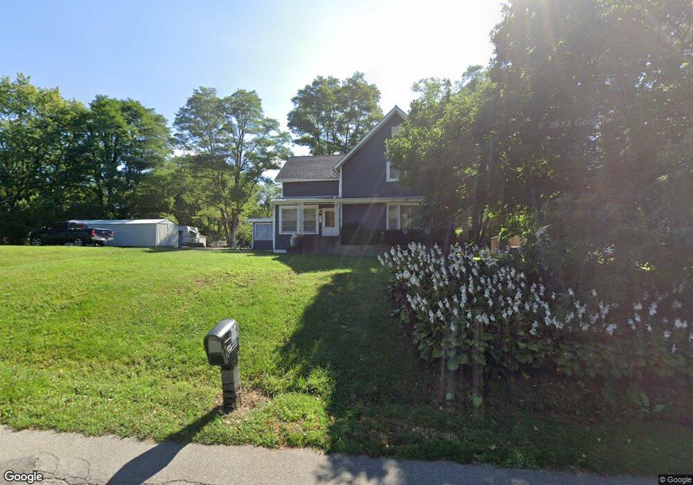
972 N Main St Roanoke, IN 46783
Estimated Value: $239,333 - $267,000
3
Beds
1
Bath
2,376
Sq Ft
$108/Sq Ft
Est. Value
About This Home
This home is located at 972 N Main St, Roanoke, IN 46783 and is currently estimated at $256,333, approximately $107 per square foot. 972 N Main St is a home located in Huntington County with nearby schools including Roanoke Elementary School, Crestview Middle School, and Huntington North High School.
Ownership History
Date
Name
Owned For
Owner Type
Purchase Details
Closed on
Dec 11, 2007
Sold by
Stamper James D and Keever Marsha
Bought by
Collins Shane and Collins Melissa
Current Estimated Value
Home Financials for this Owner
Home Financials are based on the most recent Mortgage that was taken out on this home.
Original Mortgage
$55,479
Outstanding Balance
$35,134
Interest Rate
6.31%
Mortgage Type
FHA
Estimated Equity
$221,199
Create a Home Valuation Report for This Property
The Home Valuation Report is an in-depth analysis detailing your home's value as well as a comparison with similar homes in the area
Home Values in the Area
Average Home Value in this Area
Purchase History
| Date | Buyer | Sale Price | Title Company |
|---|---|---|---|
| Collins Shane | -- | Landamerica Lawyers Title |
Source: Public Records
Mortgage History
| Date | Status | Borrower | Loan Amount |
|---|---|---|---|
| Open | Collins Shane | $55,479 |
Source: Public Records
Tax History Compared to Growth
Tax History
| Year | Tax Paid | Tax Assessment Tax Assessment Total Assessment is a certain percentage of the fair market value that is determined by local assessors to be the total taxable value of land and additions on the property. | Land | Improvement |
|---|---|---|---|---|
| 2024 | $1,770 | $175,500 | $31,500 | $144,000 |
| 2023 | $1,706 | $164,000 | $31,500 | $132,500 |
| 2022 | $1,610 | $154,400 | $31,500 | $122,900 |
| 2021 | $1,429 | $136,000 | $26,300 | $109,700 |
| 2020 | $1,245 | $125,500 | $26,300 | $99,200 |
| 2019 | $1,147 | $113,300 | $26,300 | $87,000 |
| 2018 | $1,180 | $113,400 | $26,300 | $87,100 |
| 2017 | $1,132 | $112,400 | $26,300 | $86,100 |
| 2016 | $1,007 | $111,500 | $26,300 | $85,200 |
| 2014 | $913 | $105,300 | $26,300 | $79,000 |
| 2013 | $913 | $105,700 | $26,300 | $79,400 |
Source: Public Records
Map
Nearby Homes
- 836 N Seminary St
- 775 N Seminary St
- 715 N Seminary St
- 180 W 6th St
- 599 N Seminary St
- 1047 Stevens Ct
- 183 W Vine St
- 366 Hillside Ave
- 548 Frederick Crossing
- 602 Nancyk Crossing
- tbd Kilsoquah
- TBD Feighner Rd
- 680 Helms Orange Dr
- 765 Waxwing Ct
- 451 Rockwell Ave
- 4565 E Station Rd
- 4543 E 1200 N
- 7140 N US Highway 24 E
- 3069 E 1200 N
- 0 Ginger Rd
- 909 Locust Dr
- 996 N Main St
- 961 N Main St
- 987 N Main St
- 144 Oak Park Dr
- 1010 N Main St
- 950 Oak Park Dr
- 934 Oak Park Dr
- 970 Oak Park Dr
- 984 Oak Park Dr
- 131 Oak Park Dr
- 182 Oak Park Dr
- 944 Locust Dr
- 159 Oak Park Dr
- 986 Oak Park Dr
- 882 Locust Dr
- 879 N Main St
- 183 Oak Park Dr
- 1018 N Main St
- 945 Oak Park Dr