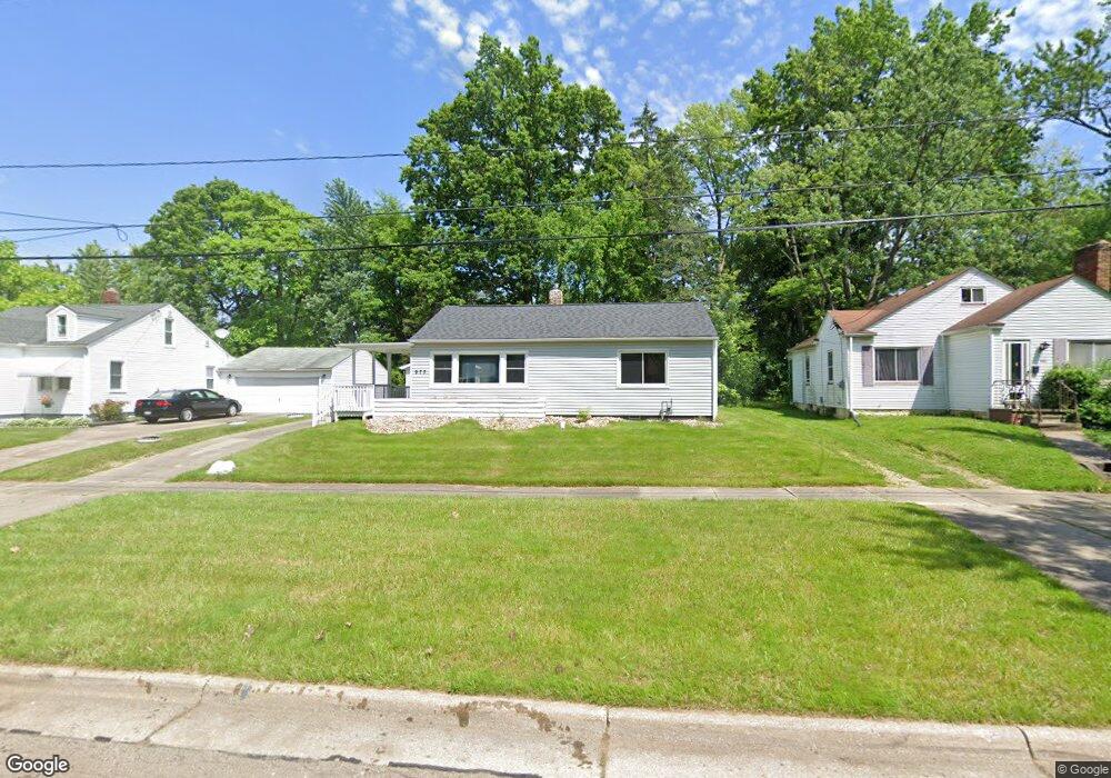
973 Hardesty Blvd Akron, OH 44320
West Akron NeighborhoodEstimated Value: $88,462 - $120,000
2
Beds
2
Baths
962
Sq Ft
$107/Sq Ft
Est. Value
About This Home
This home is located at 973 Hardesty Blvd, Akron, OH 44320 and is currently estimated at $102,616, approximately $106 per square foot. 973 Hardesty Blvd is a home located in Summit County with nearby schools including Emmanuel Christian Academy and Julie Billiart School Akron.
Ownership History
Date
Name
Owned For
Owner Type
Purchase Details
Closed on
Aug 7, 2020
Sold by
Summit County Land Reutilization Corpora
Bought by
Williams Gerald
Current Estimated Value
Purchase Details
Closed on
Aug 4, 2020
Sold by
Summit County Land Reutilization Corpora
Bought by
Williams Gerald
Purchase Details
Closed on
Jan 29, 2020
Sold by
Baity Lemorris and Baity Lemorris N
Bought by
Summit County Land Reutilization Corp
Purchase Details
Closed on
Jul 1, 2003
Sold by
Walters Bessie
Bought by
Baity Lemorris N
Create a Home Valuation Report for This Property
The Home Valuation Report is an in-depth analysis detailing your home's value as well as a comparison with similar homes in the area
Home Values in the Area
Average Home Value in this Area
Purchase History
| Date | Buyer | Sale Price | Title Company |
|---|---|---|---|
| Williams Gerald | -- | None Listed On Document | |
| Williams Gerald | -- | None Listed On Document | |
| Summit County Land Reutilization Corp | -- | None Available | |
| Baity Lemorris N | $61,700 | -- |
Source: Public Records
Tax History
| Year | Tax Paid | Tax Assessment Tax Assessment Total Assessment is a certain percentage of the fair market value that is determined by local assessors to be the total taxable value of land and additions on the property. | Land | Improvement |
|---|---|---|---|---|
| 2025 | $1,384 | $20,528 | $5,870 | $14,658 |
| 2024 | $1,160 | $20,528 | $5,870 | $14,658 |
| 2023 | $1,160 | $20,528 | $5,870 | $14,658 |
| 2022 | $913 | $12,439 | $3,556 | $8,883 |
| 2021 | $914 | $12,439 | $3,556 | $8,883 |
| 2020 | $81 | $12,440 | $3,560 | $8,880 |
| 2019 | $1,614 | $13,100 | $4,610 | $8,490 |
| 2018 | $1,019 | $13,100 | $4,610 | $8,490 |
| 2017 | $1,048 | $13,100 | $4,610 | $8,490 |
| 2016 | $1,049 | $13,290 | $4,610 | $8,680 |
| 2015 | $1,048 | $13,290 | $4,610 | $8,680 |
| 2014 | $1,762 | $13,290 | $4,610 | $8,680 |
| 2013 | $1,434 | $15,890 | $4,610 | $11,280 |
Source: Public Records
Map
Nearby Homes
- 926 Winton Ave
- 934 Packard Dr
- 869 Packard Dr
- 970 Mercer Ave
- 1126 Orlando Ave
- 957 Mercer Ave
- 852 Storer Ave
- 892-894 Storer Ave
- 1088 Packard Dr
- 801 Storer Ave
- 1194 Greenwood Ave
- 1040 Mercer Ave
- 1188 Hardesty Blvd
- 761 Glendora Ave
- 615 Noah Ave
- 616 Noble Ave
- 1248 Greenwood Ave
- 1291 Roslyn Ave
- VL Mercer Ave
- 687 Moreley Ave
- 969 Hardesty Blvd
- 983 Hardesty Blvd
- 965 Hardesty Blvd
- 991 Hardesty Blvd
- 959 Hardesty Blvd
- 978 Dover Ave
- 974 Dover Ave
- 982 Dover Ave
- 970 Dover Ave
- 976 Hardesty Blvd
- 982 Hardesty Blvd
- 972 Hardesty Blvd
- 966 Dover Ave
- 966 Hardesty Blvd
- 990 Dover Ave
- 990 Hardesty Blvd
- 997 Hardesty Blvd
- 960 Dover Ave
- 960 Hardesty Blvd
- 992 Hardesty Blvd
Your Personal Tour Guide
Ask me questions while you tour the home.