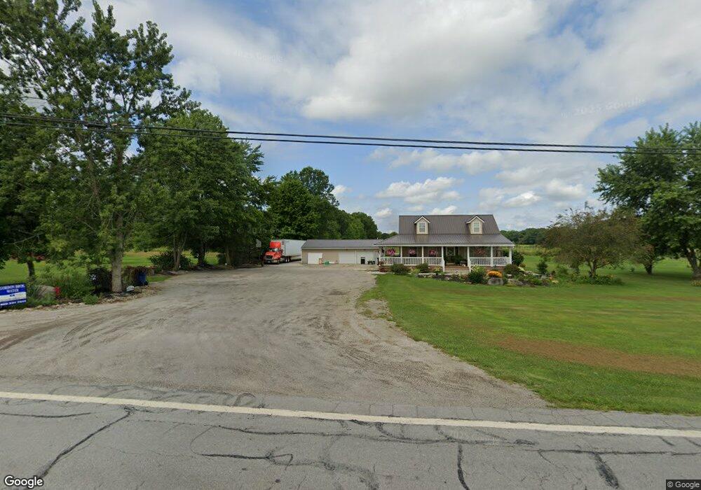
973 State Route 14 Deerfield, OH 44411
Estimated Value: $274,105 - $328,000
3
Beds
2
Baths
1,544
Sq Ft
$191/Sq Ft
Est. Value
About This Home
This home is located at 973 State Route 14, Deerfield, OH 44411 and is currently estimated at $294,776, approximately $190 per square foot. 973 State Route 14 is a home located in Portage County with nearby schools including Southeast High School.
Ownership History
Date
Name
Owned For
Owner Type
Purchase Details
Closed on
Jun 18, 2014
Sold by
Benedict Dale L and Benedict Amanda S
Bought by
Benedict Dale L and Benedict Amanda S
Current Estimated Value
Home Financials for this Owner
Home Financials are based on the most recent Mortgage that was taken out on this home.
Original Mortgage
$104,000
Outstanding Balance
$30,999
Interest Rate
3.3%
Mortgage Type
New Conventional
Estimated Equity
$263,777
Purchase Details
Closed on
Jul 30, 2003
Sold by
Murphy Charles B and Smith Sally A
Bought by
Benedict Dale L and Bailey Amanda S
Home Financials for this Owner
Home Financials are based on the most recent Mortgage that was taken out on this home.
Original Mortgage
$117,830
Interest Rate
6.18%
Mortgage Type
Construction
Purchase Details
Closed on
Feb 12, 2003
Sold by
Smith Sally A and Murphy Charles B
Bought by
Murphy Separate Acres Llc
Purchase Details
Closed on
Jan 1, 1990
Bought by
Murphy William B
Create a Home Valuation Report for This Property
The Home Valuation Report is an in-depth analysis detailing your home's value as well as a comparison with similar homes in the area
Home Values in the Area
Average Home Value in this Area
Purchase History
| Date | Buyer | Sale Price | Title Company |
|---|---|---|---|
| Benedict Dale L | -- | First American Title Ins Co | |
| Benedict Dale L | $25,000 | -- | |
| Murphy Charles B | -- | -- | |
| Murphy Separate Acres Llc | -- | -- | |
| Murphy William B | -- | -- |
Source: Public Records
Mortgage History
| Date | Status | Borrower | Loan Amount |
|---|---|---|---|
| Open | Benedict Dale L | $104,000 | |
| Previous Owner | Benedict Dale L | $117,830 |
Source: Public Records
Tax History Compared to Growth
Tax History
| Year | Tax Paid | Tax Assessment Tax Assessment Total Assessment is a certain percentage of the fair market value that is determined by local assessors to be the total taxable value of land and additions on the property. | Land | Improvement |
|---|---|---|---|---|
| 2024 | $3,050 | $87,750 | $8,370 | $79,380 |
| 2023 | $2,573 | $67,140 | $5,990 | $61,150 |
| 2022 | $2,674 | $67,140 | $5,990 | $61,150 |
| 2021 | $2,565 | $63,810 | $5,990 | $57,820 |
| 2020 | $2,056 | $49,150 | $5,990 | $43,160 |
| 2019 | $2,061 | $49,150 | $5,990 | $43,160 |
| 2018 | $1,971 | $44,420 | $5,740 | $38,680 |
| 2017 | $1,971 | $44,420 | $5,740 | $38,680 |
| 2016 | $1,963 | $44,420 | $5,740 | $38,680 |
| 2015 | $2,017 | $44,420 | $5,740 | $38,680 |
| 2014 | $2,007 | $44,420 | $5,740 | $38,680 |
| 2013 | $1,987 | $44,420 | $5,740 | $38,680 |
Source: Public Records
Map
Nearby Homes
- 1060 State Route 14
- 9663 Berlin Heights Dr
- 1731 Ohio 225
- 0 Ohio 14
- 1864 State Route 225
- 10569 Shadyside Ln
- 20871 N Benton Rd W
- 10745 Leffingwell Rd
- 2332 McClintocksburg Rd
- 105 Hartzell Rd
- 2171 Alliance Rd
- 5925 Bedell Rd
- 2953 State Route 225
- 1440 Porter Rd
- 10985 Johnson Rd
- 11030 12th St
- V/L State Route 225
- 2880 State Route 14
- 0 Knoll St NE
- 16715 W Western Reserve Rd
- 913 Bandy Rd
- 1071 State Route 14
- 890 Bandy Rd
- 1085 State Route 14
- 1062 State Route 14
- 1111 State Route 14
- 1096 State Route 14
- 865 State Route 14
- 831 Bandy Rd
- 1129 State Route 14
- 819 Bandy Rd
- 9553 Bridgeview Dr
- 820 Bandy Rd
- 820 Bandy Rd
- 9591 Bridgeview Dr
- 9586 Bridgeview Dr
- 0 Bridgeview Dr
- 1175 State Route 14
- 1182 State Route 14
- 1153 State Route 14