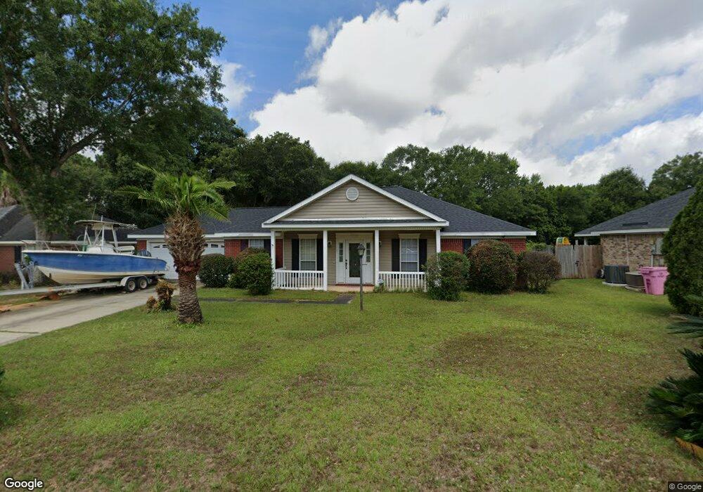
9730 Oak Forrest Dr Mobile, AL 36695
Baker NeighborhoodEstimated Value: $221,734 - $261,000
3
Beds
2
Baths
1,800
Sq Ft
$134/Sq Ft
Est. Value
About This Home
This home is located at 9730 Oak Forrest Dr, Mobile, AL 36695 and is currently estimated at $240,934, approximately $133 per square foot. 9730 Oak Forrest Dr is a home located in Mobile County with nearby schools including Elsie Collier Elementary School, Bernice J Causey Middle School, and Baker High School.
Ownership History
Date
Name
Owned For
Owner Type
Purchase Details
Closed on
Feb 29, 2000
Sold by
John Howard Homes Ltd
Bought by
Smith Vincent L and Smith Hildred B
Current Estimated Value
Home Financials for this Owner
Home Financials are based on the most recent Mortgage that was taken out on this home.
Original Mortgage
$90,953
Outstanding Balance
$30,825
Interest Rate
8.29%
Mortgage Type
FHA
Estimated Equity
$210,109
Create a Home Valuation Report for This Property
The Home Valuation Report is an in-depth analysis detailing your home's value as well as a comparison with similar homes in the area
Home Values in the Area
Average Home Value in this Area
Purchase History
| Date | Buyer | Sale Price | Title Company |
|---|---|---|---|
| Smith Vincent L | -- | -- |
Source: Public Records
Mortgage History
| Date | Status | Borrower | Loan Amount |
|---|---|---|---|
| Open | Smith Vincent L | $90,953 |
Source: Public Records
Tax History Compared to Growth
Tax History
| Year | Tax Paid | Tax Assessment Tax Assessment Total Assessment is a certain percentage of the fair market value that is determined by local assessors to be the total taxable value of land and additions on the property. | Land | Improvement |
|---|---|---|---|---|
| 2024 | $911 | $18,700 | $4,000 | $14,700 |
| 2023 | $911 | $18,000 | $4,000 | $14,000 |
| 2022 | $710 | $16,020 | $4,000 | $12,020 |
| 2021 | $698 | $15,770 | $4,000 | $11,770 |
| 2020 | $730 | $16,440 | $3,200 | $13,240 |
| 2019 | $735 | $16,540 | $0 | $0 |
| 2018 | $752 | $16,880 | $0 | $0 |
| 2017 | $755 | $15,500 | $0 | $0 |
| 2016 | $693 | $15,660 | $0 | $0 |
| 2013 | -- | $16,800 | $0 | $0 |
Source: Public Records
Map
Nearby Homes
- 9510 Gaslight Ct
- 1120 Colonial Hills Dr
- 1100 Wellington Ct S
- 9410 Ashwood Ct
- 9556 Bridgeton Ct
- 1261 Comstock Ct
- 11900 Airport Blvd
- 9601 Royal Woods Dr S
- 1345 Camden Ct
- 9751 Pine Knoll Rd
- 1306 Summerchase Ct
- 960 Abilene Dr W
- 1081 Hillside Ct
- 10153 Tarawood Ct
- 811 Royal Woods Dr W
- 10164 Waterford Way
- 789 Royal Woods Dr W Unit 7
- 1151 Seven Hills Curve S
- 10061 Sasser Ln
- 1125 Wakefield Dr W
- 9740 Oak Forrest Dr
- 9720 Oak Forrest Dr
- 9725 Oak Forrest Dr
- 9710 Oak Forrest Dr
- 9735 Oak Forrest Dr
- 9715 Oak Forrest Dr
- 9750 Oak Forrest Dr Unit 3
- 9705 Oak Forrest Dr
- 9705 Oak Forrest Dr
- 9755 Oak Forrest Dr
- 9760 Oak Forrest Dr
- 9631 Cheyney Ct
- 9695 Oak Forrest Dr
- 9765 Oak Forrest Dr
- 9690 Oak Forrest Dr
- 9770 Oak Forrest Dr
- 9685 Oak Forrest Dr
- 9632 Cheyney Ct
- 9621 Cheyney Ct
- 9775 Oak Forrest Dr