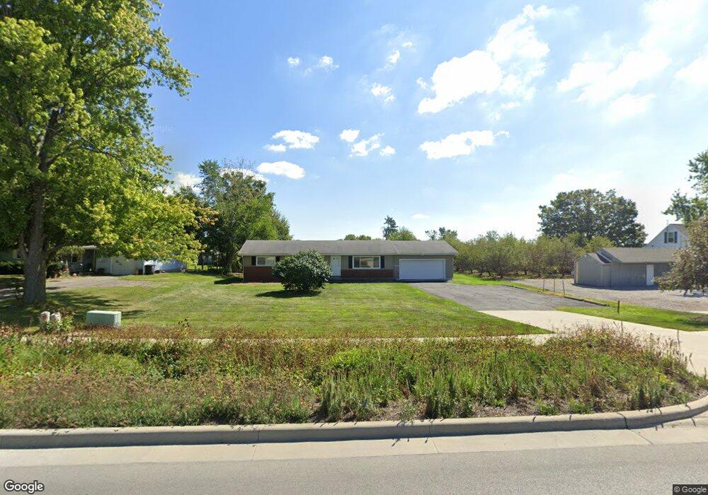
9732 Maysville Rd Fort Wayne, IN 46815
Northeast Fort Wayne NeighborhoodEstimated Value: $201,208 - $255,000
3
Beds
2
Baths
1,200
Sq Ft
$185/Sq Ft
Est. Value
About This Home
This home is located at 9732 Maysville Rd, Fort Wayne, IN 46815 and is currently estimated at $222,302, approximately $185 per square foot. 9732 Maysville Rd is a home located in Allen County with nearby schools including Arlington Elementary School, Jefferson Middle School, and Northrop High School.
Ownership History
Date
Name
Owned For
Owner Type
Purchase Details
Closed on
Mar 31, 2016
Sold by
White Exner Enterprises Llc
Bought by
City Of Fort Wayne
Current Estimated Value
Purchase Details
Closed on
May 23, 2003
Sold by
White Tracy L
Bought by
White Exner Enterprises Llc
Purchase Details
Closed on
May 31, 2002
Sold by
Turner Bruce E
Bought by
White Tracy L
Home Financials for this Owner
Home Financials are based on the most recent Mortgage that was taken out on this home.
Original Mortgage
$91,710
Interest Rate
5.87%
Create a Home Valuation Report for This Property
The Home Valuation Report is an in-depth analysis detailing your home's value as well as a comparison with similar homes in the area
Home Values in the Area
Average Home Value in this Area
Purchase History
| Date | Buyer | Sale Price | Title Company |
|---|---|---|---|
| City Of Fort Wayne | $16,105 | None Available | |
| White Exner Enterprises Llc | -- | Three Rivers Title Co Inc | |
| White Tracy L | -- | Commonwealth Land Title Co |
Source: Public Records
Mortgage History
| Date | Status | Borrower | Loan Amount |
|---|---|---|---|
| Previous Owner | White Tracy L | $91,710 |
Source: Public Records
Tax History Compared to Growth
Tax History
| Year | Tax Paid | Tax Assessment Tax Assessment Total Assessment is a certain percentage of the fair market value that is determined by local assessors to be the total taxable value of land and additions on the property. | Land | Improvement |
|---|---|---|---|---|
| 2024 | $3,267 | $146,700 | $53,200 | $93,500 |
| 2022 | $2,431 | $106,500 | $39,100 | $67,400 |
| 2021 | $1,728 | $75,100 | $14,800 | $60,300 |
| 2020 | $1,657 | $73,200 | $14,800 | $58,400 |
| 2019 | $1,679 | $74,200 | $25,100 | $49,100 |
| 2018 | $1,750 | $76,800 | $25,100 | $51,700 |
| 2017 | $1,682 | $72,700 | $25,100 | $47,600 |
| 2016 | $1,632 | $71,200 | $25,800 | $45,400 |
| 2014 | $1,537 | $70,300 | $27,500 | $42,800 |
| 2013 | $1,530 | $70,100 | $39,800 | $30,300 |
Source: Public Records
Map
Nearby Homes
- 9619 Maysville Rd
- 10206 Maysville Rd
- 4920 Wheelock Rd
- 4124 Cadena Ln
- 5630 Cutters Creek
- 3641 Cardinal Ln
- 9510 Skipjack Cove
- 3310 Brantley Dr
- 8413 Sagimore Ct
- 8109 Imperial Plaza Dr
- 6223 Treasure Cove
- 5134 W Arlington Park Blvd
- 4521 Schwartz Rd
- 6326 Treasure Cove
- 6329 Treasure Cove
- 8308 Chapel Bend Dr
- 8130 Park State Dr
- 6015 Running Brook Ln
- 8513 Maple Bluff Ct
- 3910 Nantucket Dr
- 9744 Maysville Rd
- 9720 Maysville Rd
- 9808 Maysville Rd
- 9817 Stellhorn Rd
- 9828 Maysville Rd
- 9855 Stellhorn Rd
- 9631 Maysville Rd
- 9840 Maysville Rd
- 9739 Maysville Rd
- 9925 Stellhorn Rd
- 9827 Maysville Rd
- 9933 Stellhorn Rd
- 9609 Maysville Rd
- 9868 Maysville Rd
- 10017 Stellhorn Rd
- 9904 Maysville Rd
- 10031 Stellhorn Rd
- 9916 Maysville Rd
- 10105 Stellhorn Rd
- 9928 Maysville Rd