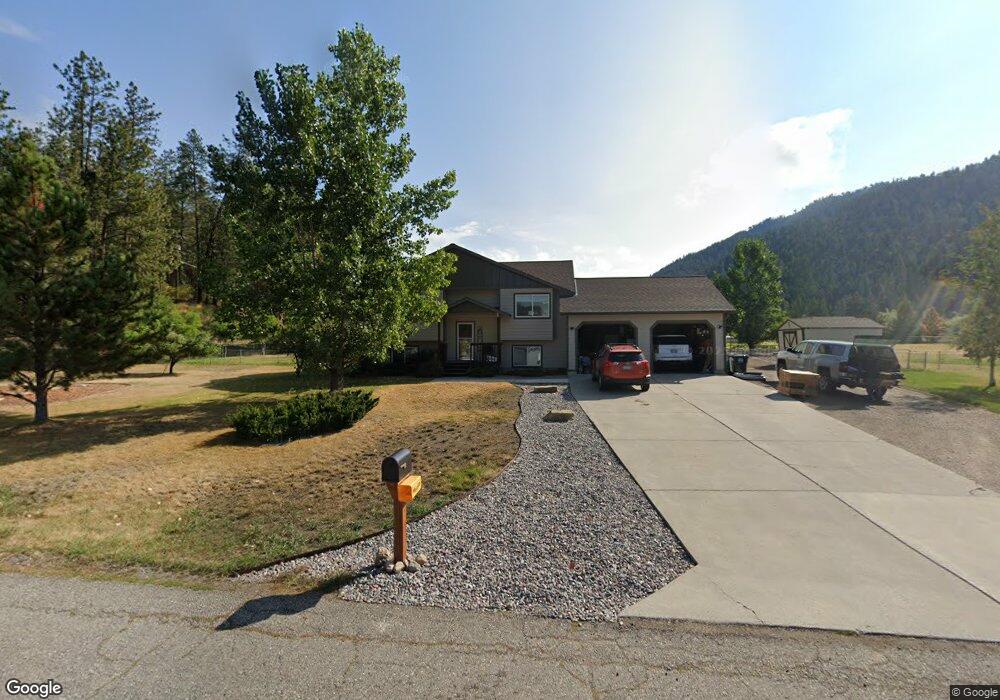
9738 Neighbor Way Clinton, MT 59825
Clinton NeighborhoodEstimated Value: $518,000 - $858,394
4
Beds
3
Baths
2,172
Sq Ft
$323/Sq Ft
Est. Value
About This Home
This home is located at 9738 Neighbor Way, Clinton, MT 59825 and is currently estimated at $701,599, approximately $323 per square foot. 9738 Neighbor Way is a home located in Missoula County with nearby schools including Clinton Elementary School and Sentinel High School.
Ownership History
Date
Name
Owned For
Owner Type
Purchase Details
Closed on
Jan 23, 2013
Sold by
Thorson Brooke
Bought by
Thorson Brooke and Thorson Joshua
Current Estimated Value
Purchase Details
Closed on
Jul 15, 2009
Sold by
Widhalm Brooke
Bought by
Thorson Brooke
Home Financials for this Owner
Home Financials are based on the most recent Mortgage that was taken out on this home.
Original Mortgage
$238,500
Outstanding Balance
$155,185
Interest Rate
5.25%
Mortgage Type
Unknown
Estimated Equity
$546,414
Purchase Details
Closed on
Sep 17, 2007
Sold by
Taylor Robert Louis
Bought by
Widhalm Brooke
Home Financials for this Owner
Home Financials are based on the most recent Mortgage that was taken out on this home.
Original Mortgage
$235,000
Interest Rate
6.67%
Mortgage Type
Unknown
Create a Home Valuation Report for This Property
The Home Valuation Report is an in-depth analysis detailing your home's value as well as a comparison with similar homes in the area
Home Values in the Area
Average Home Value in this Area
Purchase History
| Date | Buyer | Sale Price | Title Company |
|---|---|---|---|
| Thorson Brooke | -- | None Available | |
| Thorson Brooke | -- | Stm | |
| Widhalm Brooke | -- | Mt |
Source: Public Records
Mortgage History
| Date | Status | Borrower | Loan Amount |
|---|---|---|---|
| Open | Thorson Brooke | $238,500 | |
| Previous Owner | Widhalm Brooke | $235,000 |
Source: Public Records
Tax History Compared to Growth
Tax History
| Year | Tax Paid | Tax Assessment Tax Assessment Total Assessment is a certain percentage of the fair market value that is determined by local assessors to be the total taxable value of land and additions on the property. | Land | Improvement |
|---|---|---|---|---|
| 2025 | $4,030 | $568,700 | $136,735 | $431,965 |
| 2024 | $4,619 | $476,900 | $91,660 | $385,240 |
| 2023 | $3,955 | $476,900 | $91,660 | $385,240 |
| 2022 | $3,155 | $315,000 | $0 | $0 |
| 2021 | $3,079 | $315,000 | $0 | $0 |
| 2020 | $2,950 | $291,500 | $0 | $0 |
| 2019 | $2,935 | $291,500 | $0 | $0 |
| 2018 | $2,286 | $237,300 | $0 | $0 |
| 2017 | $2,303 | $237,300 | $0 | $0 |
| 2016 | $2,104 | $227,600 | $0 | $0 |
| 2015 | $1,965 | $227,600 | $0 | $0 |
| 2014 | $2,029 | $131,917 | $0 | $0 |
Source: Public Records
Map
Nearby Homes
- 22255 Wallace Creek Rd
- 20622 Us Highway 10 E
- 11055 Silver St
- Nhn Us Highway 10 E
- Lot 13 Pamin Loop
- NKA Dirty Ike Creek Rd
- 25575 Patter Spur Rd S
- Lot 15 Muddler Ct
- Lot 17 Caddisfly Ct
- Lot 16 Stonefly Rd
- Lot 11 Stonefly Rd
- Lot 9 Stonefly Rd
- Lot 12 Stonefly Rd
- 24570 Stonefly Rd
- Lot 2 Caddisfly Ct
- 14297 Caddisfly Ct
- 48 Rock Creek Rd
- Nhn Bonita Ranger Station Rd
- 27235 Lazy Springs Rd
- 5830 Memory Ln
- 8682 Wallace Cr Lookout Lode
- 9800 Neighbor Way
- 21350 Wallace Creek Rd
- 9721 Neighbor Way
- 21475 Wallace Creek Rd
- 24750 Wallace Creek Rd
- 21030 Handley Loop
- 9781 Neighbor Way
- 21035 Handley Loop
- 21021 Handley Loop
- 21227 Wallace Creek Rd
- 21007 Handley Loop
- 20996 Handley Loop
- 21054 Handley Loop
- 21505 Wallace Creek Rd
- 21049 Handley Loop
- 21360 Wallace Creek Rd
- 20993 Handley Loop
- 20982 Handley Loop
- 21135 Wallace Creek Rd