Estimated Value: $571,000 - $655,000
--
Bed
--
Bath
--
Sq Ft
5,097
Sq Ft Lot
About This Home
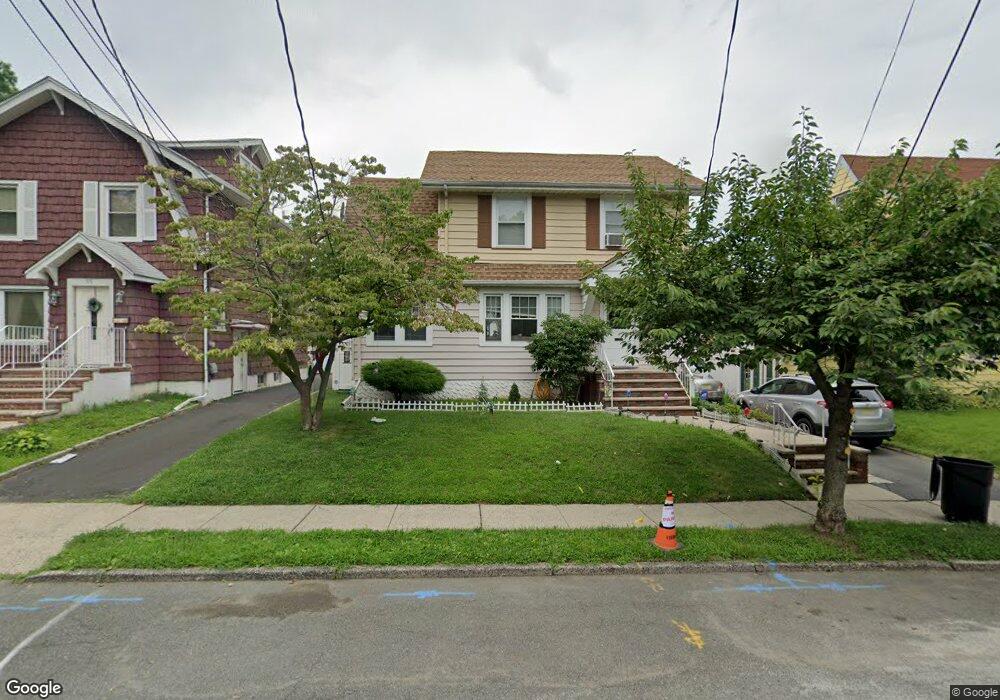
This home is located at 974 Balsam Way, Union, NJ 07083 and is currently estimated at $628,328. 974 Balsam Way is a home located in Union County with nearby schools including Livingston Elementary School, Union High School, and St Michael Parish School.
Ownership History
Date
Name
Owned For
Owner Type
Purchase Details
Closed on
Aug 6, 2003
Sold by
Lawton John
Current Estimated Value
Home Financials for this Owner
Home Financials are based on the most recent Mortgage that was taken out on this home.
Original Mortgage
$252,000
Outstanding Balance
$110,604
Interest Rate
5.69%
Estimated Equity
$517,725
Purchase Details
Closed on
Oct 12, 1993
Sold by
Lawton Mary
Bought by
Lawton John and Lawton Ruth
Home Financials for this Owner
Home Financials are based on the most recent Mortgage that was taken out on this home.
Original Mortgage
$126,000
Interest Rate
6.79%
Create a Home Valuation Report for This Property
The Home Valuation Report is an in-depth analysis detailing your home's value as well as a comparison with similar homes in the area
Home Values in the Area
Average Home Value in this Area
Purchase History
| Date | Buyer | Sale Price | Title Company |
|---|---|---|---|
| -- | $280,000 | -- | |
| Lawton John | $140,000 | -- |
Source: Public Records
Mortgage History
| Date | Status | Borrower | Loan Amount |
|---|---|---|---|
| Open | -- | $252,000 | |
| Previous Owner | Lawton John | $126,000 |
Source: Public Records
Tax History Compared to Growth
Tax History
| Year | Tax Paid | Tax Assessment Tax Assessment Total Assessment is a certain percentage of the fair market value that is determined by local assessors to be the total taxable value of land and additions on the property. | Land | Improvement |
|---|---|---|---|---|
| 2025 | $9,343 | $41,800 | $20,000 | $21,800 |
| 2024 | $9,058 | $41,800 | $20,000 | $21,800 |
| 2023 | $9,058 | $41,800 | $20,000 | $21,800 |
| 2022 | $8,743 | $41,800 | $20,000 | $21,800 |
| 2021 | $8,531 | $41,800 | $20,000 | $21,800 |
| 2020 | $8,361 | $41,800 | $20,000 | $21,800 |
| 2019 | $8,248 | $41,800 | $20,000 | $21,800 |
| 2018 | $8,108 | $41,800 | $20,000 | $21,800 |
| 2017 | $7,988 | $41,800 | $20,000 | $21,800 |
| 2016 | $7,793 | $41,800 | $20,000 | $21,800 |
| 2015 | $7,664 | $41,800 | $20,000 | $21,800 |
| 2014 | $7,492 | $41,800 | $20,000 | $21,800 |
Source: Public Records
Map
Nearby Homes
- 1040 Cranbrook Rd
- 1370 Beverly Rd
- 365 Broadwell Ave
- 875 Salem Rd
- 328 Minute Arms Rd
- 969 Arnet Ave
- 1393 Cornell Place
- 1322 Marcella Dr
- 631 Golf Terrace
- 1267 Erhardt St
- 795 Colonial Arms Rd
- 717 Winchester Ave
- 142 Eastern Pkwy
- 286 Mclean Place
- 169 Valley View Rd
- 553 Harvard Ave
- 790 Green Ln Unit A1
- 378 Burroughs Terrace
- 557 Yale Ave
- 314 Fitzpatrick St
- 980 Balsam Way
- 970 Balsam Way
- 982 Balsam Way
- 979 Greenwood Rd
- 985 Greenwood Rd
- 973 Greenwood Rd
- 986 Balsam Way
- 971 Balsam Way
- 975 Balsam Way
- 979 Balsam Way
- 981 Balsam Way
- 1496 Morris Ave Unit G
- 983 Balsam Way
- 964 Midland Blvd
- 968 Midland Blvd
- 984 Greenwood Rd
- 980 Greenwood Rd
- 972 Midland Blvd
- 976 Greenwood Rd
- 976 Midland Blvd