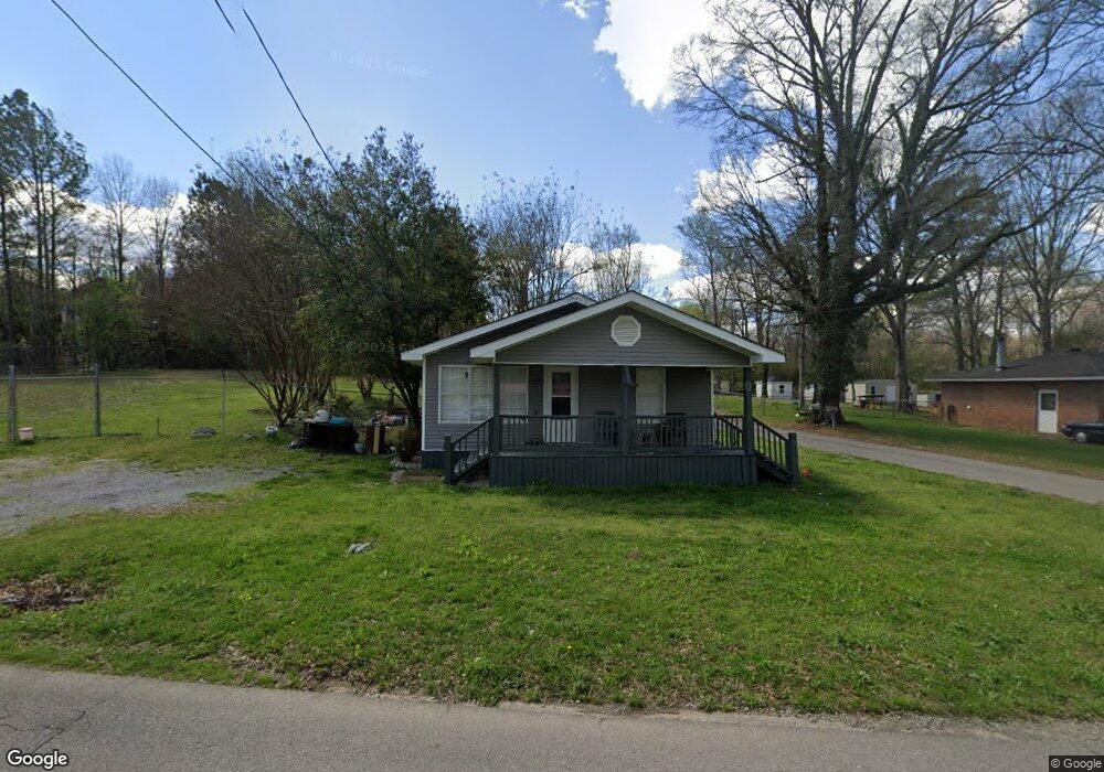
9740 Ellis Rd Warrior, AL 35180
Estimated Value: $84,932 - $153,000
2
Beds
2
Baths
728
Sq Ft
$150/Sq Ft
Est. Value
About This Home
This home is located at 9740 Ellis Rd, Warrior, AL 35180 and is currently estimated at $109,233, approximately $150 per square foot. 9740 Ellis Rd is a home located in Jefferson County with nearby schools including Warrior Elementary School, North Jefferson Middle School, and Mortimer Jordan High School.
Ownership History
Date
Name
Owned For
Owner Type
Purchase Details
Closed on
Mar 7, 2023
Sold by
Api Solutions Llc
Bought by
Shafiq Muhammad
Current Estimated Value
Purchase Details
Closed on
Jul 1, 2020
Sold by
Mcdaniel Delisa
Bought by
Api Solutions Llc
Purchase Details
Closed on
Mar 9, 2004
Sold by
The Bank
Bought by
Mcdaniel Delisa and Api Solutions
Home Financials for this Owner
Home Financials are based on the most recent Mortgage that was taken out on this home.
Original Mortgage
$30,000
Interest Rate
5.88%
Mortgage Type
Purchase Money Mortgage
Create a Home Valuation Report for This Property
The Home Valuation Report is an in-depth analysis detailing your home's value as well as a comparison with similar homes in the area
Home Values in the Area
Average Home Value in this Area
Purchase History
| Date | Buyer | Sale Price | Title Company |
|---|---|---|---|
| Shafiq Muhammad | $40,000 | -- | |
| Api Solutions Llc | $44,300 | -- | |
| Mcdaniel Delisa | $45,000 | -- |
Source: Public Records
Mortgage History
| Date | Status | Borrower | Loan Amount |
|---|---|---|---|
| Previous Owner | Mcdaniel Delisa | $30,000 |
Source: Public Records
Tax History Compared to Growth
Tax History
| Year | Tax Paid | Tax Assessment Tax Assessment Total Assessment is a certain percentage of the fair market value that is determined by local assessors to be the total taxable value of land and additions on the property. | Land | Improvement |
|---|---|---|---|---|
| 2024 | $654 | $11,260 | -- | -- |
| 2022 | $515 | $8,860 | $2,840 | $6,020 |
| 2021 | $515 | $8,860 | $2,840 | $6,020 |
| 2020 | $515 | $8,860 | $2,840 | $6,020 |
| 2019 | $515 | $8,860 | $0 | $0 |
| 2018 | $460 | $7,920 | $0 | $0 |
| 2017 | $460 | $7,920 | $0 | $0 |
| 2016 | $460 | $7,920 | $0 | $0 |
| 2015 | $460 | $7,920 | $0 | $0 |
| 2014 | $402 | $7,820 | $0 | $0 |
| 2013 | $402 | $7,820 | $0 | $0 |
Source: Public Records
Map
Nearby Homes
- The Toccoa 1 Plan at Bellehurst
- The Ramsey II 1 Plan at Bellehurst
- The Harvey 1 Plan at Bellehurst
- The Logan 1 Plan at Bellehurst
- The Laurel 1 Plan at Bellehurst
- The Milton II 1 Plan at Bellehurst
- The Milton I 1 Plan at Bellehurst
- The Kimbrell II 1 Plan at Bellehurst
- 158 Bellehurst Dr
- 162 Bellehurst Dr
- 70 Ledlow Rd
- 157 Bellehurst Dr
- 163 Bellehurst Dr
- 100 Bellehurst Dr
- 234 Bellehurst Dr
- 206 Bellehurst Dr
- 222 Bellehurst Dr
- 500 Smith Glen Pkwy
- 462 Smith Glen Pkwy
- 458 Smith Glen Pkwy
- 236 Manning St
- 9732 Ellis Rd
- 9861 Old Highway 31
- 9736 Ellis Rd
- 9876 Old Highway 31
- 228 Manning St
- 9876 U S 31
- 9728 Ellis Rd
- 224 Manning St
- 143 Crane St
- 9776 Ellis Rd
- 9714 Ellis Rd
- 220 Manning St
- 9700 Ellis Rd
- 9861 U S Highway 31
- 9775 Ellis Rd
- 9916 Old Highway 31
- 9833 U S 31
- 212 Manning St
- 150 Crane St