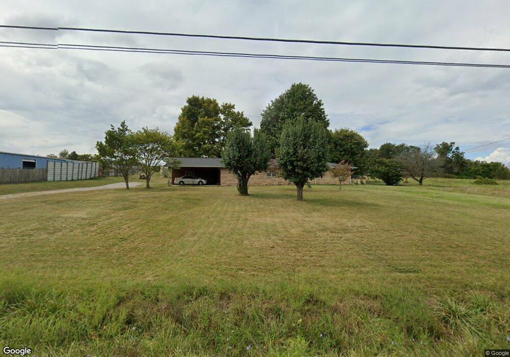
9743 Highway 127 N Crossville, TN 38571
Estimated Value: $163,000 - $321,669
--
Bed
2
Baths
2,040
Sq Ft
$135/Sq Ft
Est. Value
About This Home
This home is located at 9743 Highway 127 N, Crossville, TN 38571 and is currently estimated at $274,417, approximately $134 per square foot. 9743 Highway 127 N is a home located in Cumberland County with nearby schools including North Cumberland Elementary School, Stone Memorial High School, and Liberty Christian Academy.
Ownership History
Date
Name
Owned For
Owner Type
Purchase Details
Closed on
May 29, 2025
Sold by
Bradley Robert Lynn
Bought by
State Of Tennessee
Current Estimated Value
Purchase Details
Closed on
Jun 13, 2023
Sold by
Reed Inus C
Bought by
Bradley Robert Lynn
Purchase Details
Closed on
Jul 20, 2017
Sold by
Reed Inus C and Reed James J
Bought by
Brothers Pamela R and Reed Inus C
Purchase Details
Closed on
Dec 20, 2012
Sold by
Reed James J
Bought by
Baisley Bobby L and Allred Damon
Create a Home Valuation Report for This Property
The Home Valuation Report is an in-depth analysis detailing your home's value as well as a comparison with similar homes in the area
Home Values in the Area
Average Home Value in this Area
Purchase History
| Date | Buyer | Sale Price | Title Company |
|---|---|---|---|
| State Of Tennessee | $70,361 | None Listed On Document | |
| State Of Tennessee | $70,361 | None Listed On Document | |
| Bradley Robert Lynn | $270,000 | None Listed On Document | |
| Bradley Robert Lynn | $270,000 | None Listed On Document | |
| Brothers Pamela R | -- | None Available | |
| Baisley Bobby L | $50,000 | -- |
Source: Public Records
Tax History Compared to Growth
Tax History
| Year | Tax Paid | Tax Assessment Tax Assessment Total Assessment is a certain percentage of the fair market value that is determined by local assessors to be the total taxable value of land and additions on the property. | Land | Improvement |
|---|---|---|---|---|
| 2024 | $639 | $56,275 | $11,100 | $45,175 |
| 2023 | $639 | $56,275 | $0 | $0 |
| 2022 | $639 | $56,275 | $11,100 | $45,175 |
| 2021 | $560 | $35,750 | $11,100 | $24,650 |
| 2020 | $560 | $35,750 | $11,100 | $24,650 |
| 2019 | $560 | $35,750 | $11,100 | $24,650 |
| 2018 | $560 | $35,750 | $11,100 | $24,650 |
| 2017 | $560 | $35,750 | $11,100 | $24,650 |
| 2016 | $527 | $34,475 | $11,100 | $23,375 |
| 2015 | $516 | $34,475 | $11,100 | $23,375 |
| 2014 | $516 | $34,488 | $0 | $0 |
Source: Public Records
Map
Nearby Homes
- 90 Byers Ln
- 1100 Gray Fox Dr
- 268 Plateau Rd
- 8903 U S 127
- 8903 Highway 127 N
- 601 Foxwood Dr
- 10 Black Bear Ct
- 0 Catoosa Ridge Dr Unit 1317380
- 0 Catoosa Ridge Dr Unit 1317379
- 0 Catoosa Ridge Dr Unit 1317378
- 0 Catoosa Ridge Dr Unit 1317347
- 0 Catoosa Ridge Dr Unit 1317345
- 0 Catoosa Ridge Dr Unit 1317343
- 0 Catoosa Ridge Dr Unit 1287629
- 0 Catoosa Ridge Dr Unit 1253971
- 0 Catoosa Ridge Dr Unit 1252274
- 13 Whittenburg Rd
- 11229 Highway 127 N
- 8304 U S 127
- 9743 Hwy 127 N
- 9732 Highway 127 N
- 9732 Highway 127 N
- 9699 Highway 127 N
- 9800 Highway 127 N
- 9842 Highway 127 N
- 9866 Hwy 127
- 9829 Highway 127 N
- 9903 Highway 127 N
- 9912 Highway 127 N
- 195 Norris Rd
- 9577 Highway 127 N
- 78 Mayfair Dr
- 159 Mayfair Dr
- 9942 Highway 127 N
- 9204 Hwy 127 N
- 213 Mayfair Dr
- 0 Mayfair Dr
- 9483 Highway 127 N
- 9536 Highway 127 N