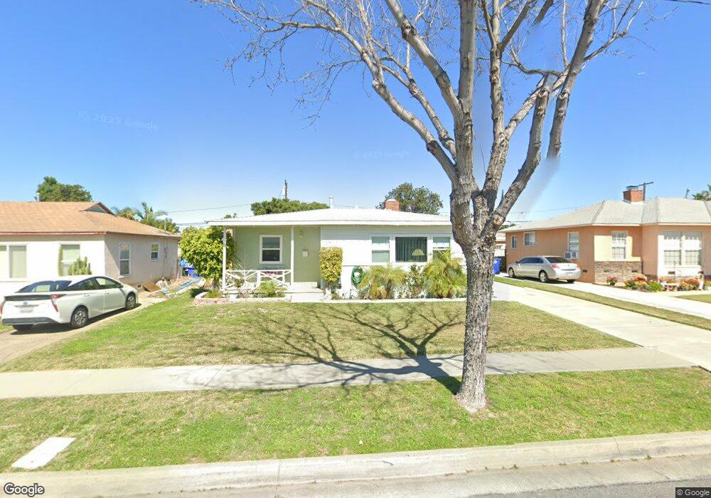
9747 Ben Hur Ave Whittier, CA 90604
South Whittier NeighborhoodEstimated Value: $719,632 - $759,000
3
Beds
1
Bath
1,045
Sq Ft
$703/Sq Ft
Est. Value
About This Home
This home is located at 9747 Ben Hur Ave, Whittier, CA 90604 and is currently estimated at $734,408, approximately $702 per square foot. 9747 Ben Hur Ave is a home located in Los Angeles County with nearby schools including Mulberry Elementary School, Hillview Middle School, and California High School.
Ownership History
Date
Name
Owned For
Owner Type
Purchase Details
Closed on
Mar 10, 2013
Sold by
Wilson Ross I
Bought by
Wilson Ross I and Wilson Deborah J
Current Estimated Value
Purchase Details
Closed on
Apr 28, 1998
Sold by
Alacche Alex S
Bought by
Wilson Ross I and Wilson Deborah J
Home Financials for this Owner
Home Financials are based on the most recent Mortgage that was taken out on this home.
Original Mortgage
$135,225
Outstanding Balance
$23,303
Interest Rate
7.06%
Estimated Equity
$711,105
Create a Home Valuation Report for This Property
The Home Valuation Report is an in-depth analysis detailing your home's value as well as a comparison with similar homes in the area
Home Values in the Area
Average Home Value in this Area
Purchase History
| Date | Buyer | Sale Price | Title Company |
|---|---|---|---|
| Wilson Ross I | -- | None Available | |
| Wilson Ross I | $146,000 | Benefit Land Title |
Source: Public Records
Mortgage History
| Date | Status | Borrower | Loan Amount |
|---|---|---|---|
| Open | Wilson Ross I | $135,225 |
Source: Public Records
Tax History
| Year | Tax Paid | Tax Assessment Tax Assessment Total Assessment is a certain percentage of the fair market value that is determined by local assessors to be the total taxable value of land and additions on the property. | Land | Improvement |
|---|---|---|---|---|
| 2025 | $3,048 | $233,097 | $138,904 | $94,193 |
| 2024 | $3,048 | $228,528 | $136,181 | $92,347 |
| 2023 | $2,997 | $224,048 | $133,511 | $90,537 |
| 2022 | $2,932 | $219,656 | $130,894 | $88,762 |
| 2021 | $2,873 | $215,350 | $128,328 | $87,022 |
| 2019 | $2,814 | $208,965 | $124,523 | $84,442 |
| 2018 | $2,683 | $204,869 | $122,082 | $82,787 |
| 2016 | $2,536 | $196,916 | $117,343 | $79,573 |
| 2015 | $2,517 | $193,959 | $115,581 | $78,378 |
| 2014 | $2,487 | $190,160 | $113,317 | $76,843 |
Source: Public Records
Map
Nearby Homes
- 10035 Ben Hur Ave
- 10044 Ben Hur Ave
- 14021 Fernview St
- 9834 Ahmann Ave
- 9931 Rufus Ave
- 14255 Broadway
- 14315 Broadway Unit 210
- 13856 Mulberry Dr
- 13840 Danbrook Dr
- 13924 Anola St
- 10344 Parise Dr
- 8901 Ocean View Ave
- 10415 Valley View Ave
- 9308 Tarryton Ave
- 9551 Barkerville Ave
- 14723 Terryknoll Dr
- 13838 Cornishcrest Rd
- 14744 Terryknoll Dr
- 10903 Theis Ave
- 13561 Close St
- 9753 Ben Hur Ave
- 9741 Ben Hur Ave
- 9737 Ben Hur Ave
- 9759 Ben Hur Ave
- 9630 Rufus Ave
- 9638 Rufus Ave
- 9624 Rufus Ave
- 9620 Rufus Ave
- 9648 Rufus Ave
- 9731 Ben Hur Ave
- 9763 Ben Hur Ave
- 9748 Ben Hur Ave
- 9742 Ben Hur Ave
- 9754 Ben Hur Ave
- 9738 Ben Hur Ave
- 9614 Rufus Ave
- 9725 Ben Hur Ave
- 9760 Ben Hur Ave
- 9732 Ben Hur Ave
- 14211 Oval Dr
Your Personal Tour Guide
Ask me questions while you tour the home.