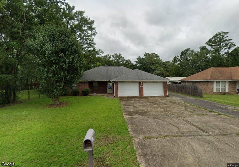
9756 Donchester Cir Moss Point, MS 39562
Estimated Value: $155,000 - $191,000
3
Beds
2
Baths
1,691
Sq Ft
$106/Sq Ft
Est. Value
About This Home
This home is located at 9756 Donchester Cir, Moss Point, MS 39562 and is currently estimated at $179,586, approximately $106 per square foot. 9756 Donchester Cir is a home located in Jackson County with nearby schools including Kreole Primary Elementary School, Escatawpa Upper Elementary School, and Magnolia Middle School.
Ownership History
Date
Name
Owned For
Owner Type
Purchase Details
Closed on
Jun 14, 2013
Sold by
Davis Judy C and Reid Robert Terry
Bought by
Carr Ii Calvin M
Current Estimated Value
Purchase Details
Closed on
May 21, 2010
Sold by
Brumfield Elizabeth R
Bought by
Carr Ii Calvin M
Home Financials for this Owner
Home Financials are based on the most recent Mortgage that was taken out on this home.
Original Mortgage
$70,500
Interest Rate
5.03%
Mortgage Type
Land Contract Argmt. Of Sale
Create a Home Valuation Report for This Property
The Home Valuation Report is an in-depth analysis detailing your home's value as well as a comparison with similar homes in the area
Home Values in the Area
Average Home Value in this Area
Purchase History
| Date | Buyer | Sale Price | Title Company |
|---|---|---|---|
| Carr Ii Calvin M | -- | -- | |
| Carr Ii Calvin M | -- | -- |
Source: Public Records
Mortgage History
| Date | Status | Borrower | Loan Amount |
|---|---|---|---|
| Previous Owner | Carr Ii Calvin M | $70,500 | |
| Previous Owner | Carr Ii Calvin M | $47,000 |
Source: Public Records
Tax History
| Year | Tax Paid | Tax Assessment Tax Assessment Total Assessment is a certain percentage of the fair market value that is determined by local assessors to be the total taxable value of land and additions on the property. | Land | Improvement |
|---|---|---|---|---|
| 2025 | $1,299 | $13,251 | $788 | $12,463 |
| 2024 | $1,299 | $12,601 | $768 | $11,833 |
| 2023 | $1,220 | $12,601 | $768 | $11,833 |
| 2022 | $1,221 | $12,601 | $768 | $11,833 |
| 2021 | $1,231 | $12,675 | $768 | $11,907 |
| 2020 | $1,087 | $11,346 | $668 | $10,678 |
| 2019 | $1,059 | $11,346 | $668 | $10,678 |
| 2018 | $1,072 | $11,457 | $668 | $10,789 |
| 2017 | $1,065 | $11,457 | $668 | $10,789 |
| 2016 | $548 | $11,457 | $668 | $10,789 |
| 2015 | $465 | $100,900 | $6,680 | $94,220 |
| 2014 | $511 | $10,497 | $668 | $9,829 |
| 2013 | $991 | $15,746 | $1,002 | $14,744 |
Source: Public Records
Map
Nearby Homes
- 9621 Donchester Cir
- 9504 Kimberly Cir
- 0 Mississippi 613
- 9277 Riverlodge Dr
- 10428 Riverbend Cir
- 3225 Riverbend Rd
- 10 Ac Donniebrook Ln
- 3700 Cochran Ave
- 8629 Mississippi 613
- 4316 Knowlcrest Dr
- 8304 Austeria St
- 4221 Knowles Ave
- 4113 Mimosa Dr
- 3724 Dowlwood Rd
- 3700 Dowlwood Rd
- 0 Hwy 613 Hwy Unit 4127039
- 0 Hwy 613 Hwy Unit 4137821
- 0 Hwy 613 Hwy Unit 4129036
- 0 Saracennia Rd
- 000 Saracennia Rd
- 9752 Donchester Cir
- 0 Donchester Cir
- 3413 Prescott Dr
- 9608 Wilkerson Cir
- 9757 Donchester Cir
- 9753 Donchester Cir
- 9612 Wilkerson Cir
- 9749 Donchester Cir
- 9616 Wilkerson Cir
- 3501 Prescott Dr
- 9741 Donchester Cir
- 9740 Donchester Cir
- 9605 Wilkerson Cir
- 9613 Wilkerson Cir
- 3320 Prescott Dr
- 9721 Donchester Cir
- 9613 Donchester Cir
- 9705 Donchester Cir
- 3505 Prescott Dr
- 9700 Wilkerson Cir
Your Personal Tour Guide
Ask me questions while you tour the home.