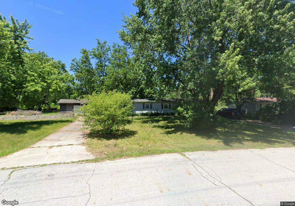
9768 N Bunker Hill Rd Unit 2 Demotte, IN 46310
Estimated Value: $168,000 - $258,000
3
Beds
2
Baths
1,296
Sq Ft
$158/Sq Ft
Est. Value
About This Home
This home is located at 9768 N Bunker Hill Rd Unit 2, Demotte, IN 46310 and is currently estimated at $205,087, approximately $158 per square foot. 9768 N Bunker Hill Rd Unit 2 is a home located in Newton County with nearby schools including North Newton Junior/Senior High School.
Ownership History
Date
Name
Owned For
Owner Type
Purchase Details
Closed on
Oct 20, 2011
Sold by
Secretary Of Housing And Urban Developme
Bought by
Ashburn Ronnie C and Ashburn Carlene J
Current Estimated Value
Home Financials for this Owner
Home Financials are based on the most recent Mortgage that was taken out on this home.
Original Mortgage
$25,200
Outstanding Balance
$2,385
Interest Rate
4.12%
Estimated Equity
$202,702
Create a Home Valuation Report for This Property
The Home Valuation Report is an in-depth analysis detailing your home's value as well as a comparison with similar homes in the area
Home Values in the Area
Average Home Value in this Area
Purchase History
| Date | Buyer | Sale Price | Title Company |
|---|---|---|---|
| Ashburn Ronnie C | -- | -- |
Source: Public Records
Mortgage History
| Date | Status | Borrower | Loan Amount |
|---|---|---|---|
| Open | Ashburn Ronnie C | $25,200 |
Source: Public Records
Tax History Compared to Growth
Tax History
| Year | Tax Paid | Tax Assessment Tax Assessment Total Assessment is a certain percentage of the fair market value that is determined by local assessors to be the total taxable value of land and additions on the property. | Land | Improvement |
|---|---|---|---|---|
| 2024 | $2,178 | $137,800 | $12,100 | $125,700 |
| 2023 | $2,668 | $153,900 | $12,100 | $141,800 |
| 2022 | $1,805 | $92,500 | $12,100 | $80,400 |
| 2021 | $1,696 | $84,800 | $11,200 | $73,600 |
| 2020 | $1,622 | $78,200 | $11,200 | $67,000 |
| 2019 | $1,440 | $69,500 | $11,200 | $58,300 |
| 2018 | $1,430 | $71,500 | $11,200 | $60,300 |
| 2017 | $1,200 | $60,000 | $9,800 | $50,200 |
| 2016 | $1,012 | $50,600 | $9,800 | $40,800 |
| 2014 | $232 | $61,000 | $11,500 | $49,500 |
| 2013 | $232 | $64,400 | $11,500 | $52,900 |
Source: Public Records
Map
Nearby Homes
- 4827 E 1040 N
- 10447 N 477 E
- 9691 N Ahlgrim St
- 5338 E Lawler Ct Unit 67
- 29.029 Acres E 900 N
- 10955 NW Makeever Dr
- 10901 N 555 E
- 10792 N 600 E
- 9606 Candlewick Rd W
- 7809 N 1200 W
- 11327 N 550 E Unit 7
- 0 St Road 55
- 10603 Georgetown Dr
- 11546 Georgetown Dr
- 2790 E 1059 N
- 11565 Sherwood Dr
- 2555 E 1071 N
- 11404 Chateau Ln
- 11535 Sandhill Trail
- 2549 E 1100 N
- 9768 N Bunker Hill Rd
- 9760 N Bunker Hill Rd
- 9760 Bunker Hill Dr
- 9784 N Bunker Hill Rd
- 9761 N Bunker Hill Rd
- 4877 E 988 N
- 9752 N Bunker Hill Rd
- 9804 N 490 E
- 9804 N 490 E Unit 50
- 9768 N 490 E
- 9741 N Bunker Hill Rd
- 9736 N Bunker Hill Rd Unit 57
- 9736 N Bunker Hill Rd
- 9823 N 480 E
- 9746 N 490 E
- 9861 N 490 E
- 9819 N 490 E
- 9729 Bunker Hill Dr
- 9726 N Bunker Hill Rd
- 9729 N Bunker Hill Rd
