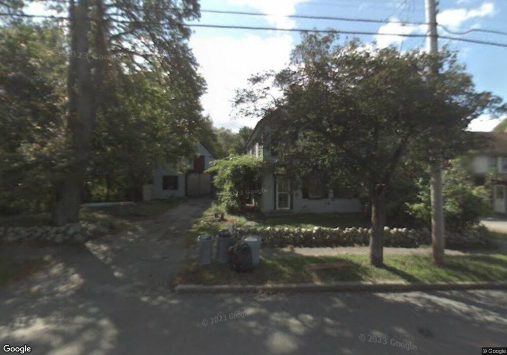
978 Union St Rockland, MA 02370
Estimated Value: $701,000 - $861,281
3
Beds
3
Baths
2,238
Sq Ft
$336/Sq Ft
Est. Value
About This Home
This home is located at 978 Union St, Rockland, MA 02370 and is currently estimated at $752,320, approximately $336 per square foot. 978 Union St is a home located in Plymouth County with nearby schools including Rockland Senior High School, Calvary Chapel Academy, and St Bridget School.
Ownership History
Date
Name
Owned For
Owner Type
Purchase Details
Closed on
Apr 28, 2014
Sold by
Smith John P
Bought by
Smith John P and Smith Jacob W
Current Estimated Value
Home Financials for this Owner
Home Financials are based on the most recent Mortgage that was taken out on this home.
Original Mortgage
$130,000
Outstanding Balance
$37,259
Interest Rate
3.37%
Mortgage Type
New Conventional
Estimated Equity
$715,061
Purchase Details
Closed on
Dec 3, 1976
Bought by
Smith John P and Smith Jacob W
Create a Home Valuation Report for This Property
The Home Valuation Report is an in-depth analysis detailing your home's value as well as a comparison with similar homes in the area
Home Values in the Area
Average Home Value in this Area
Purchase History
| Date | Buyer | Sale Price | Title Company |
|---|---|---|---|
| Smith John P | -- | -- | |
| Smith John P | -- | -- | |
| Smith John P | -- | -- | |
| Smith John P | -- | -- |
Source: Public Records
Mortgage History
| Date | Status | Borrower | Loan Amount |
|---|---|---|---|
| Open | Smith John P | $130,000 | |
| Closed | Smith John P | $130,000 |
Source: Public Records
Tax History Compared to Growth
Tax History
| Year | Tax Paid | Tax Assessment Tax Assessment Total Assessment is a certain percentage of the fair market value that is determined by local assessors to be the total taxable value of land and additions on the property. | Land | Improvement |
|---|---|---|---|---|
| 2025 | $10,511 | $768,900 | $231,000 | $537,900 |
| 2024 | $3,620 | $257,500 | $217,900 | $39,600 |
| 2023 | $6,639 | $436,200 | $210,400 | $225,800 |
| 2022 | $6,360 | $379,700 | $182,900 | $196,800 |
| 2021 | $5,851 | $338,600 | $166,300 | $172,300 |
| 2020 | $5,644 | $322,500 | $158,400 | $164,100 |
| 2019 | $5,510 | $307,500 | $150,900 | $156,600 |
| 2018 | $5,256 | $288,500 | $150,900 | $137,600 |
| 2017 | $5,106 | $276,300 | $150,900 | $125,400 |
| 2016 | $4,915 | $265,800 | $145,100 | $120,700 |
| 2015 | $4,847 | $254,700 | $135,600 | $119,100 |
| 2014 | $4,581 | $249,800 | $133,000 | $116,800 |
Source: Public Records
Map
Nearby Homes
- 775 Union St
- 35-37 Salem St
- 737-739 Union St
- 94 Leisurewoods Dr
- 86 Leisurewoods Dr Unit 279
- 5 Juniper Cir
- 3 Hickory Cir
- 83 Summit St
- 45 Leisurewoods Dr
- 12 Dyer St Unit 12
- 14 Dyer St Unit 14
- 11 Dyer St Unit 11
- 13 Dyer St Unit 13
- 17-23 Dyer St Unit 17
- 27 Fir Rd
- 18 Midfield Dr
- 3 Dogwood Cir Unit 95
- 40 Fir Rd Unit 386
- 5 Forsythia Ln
- 1 Canterbury Ln
- 986 Union St
- 970 Union St
- 990 Union St Unit 994
- 994 Union St Unit Second Floor
- 994 Union St Unit Quaint 2nd flr 1 bed
- 979 Union St
- LOT 231 Split Boulder Rd
- 1000 Union St
- 956 Union St
- 989 Union St
- 997 Union St
- 959 Union St
- 18 Oregon Ave
- 1001 Union St
- 1008 Union St Unit 1010
- 24 Forest St
- 1007 Union St
- 949 Union St
- 942 Union St
- 22 Oregon Ave