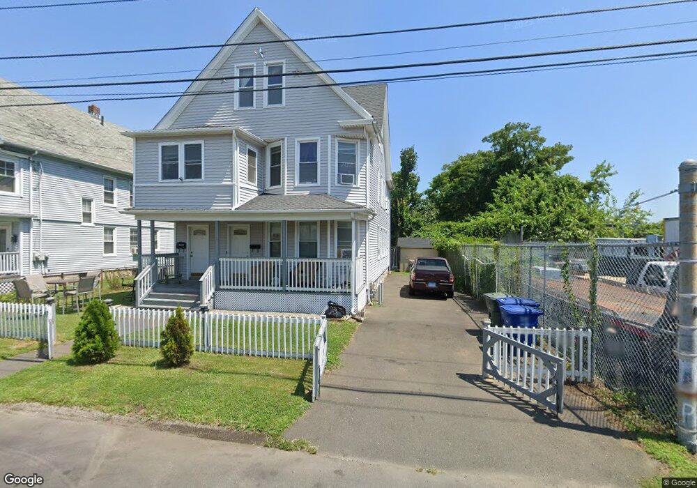
98-100 Davenport St Bridge Port, CT 06607
East End NeighborhoodEstimated Value: $313,000 - $499,000
5
Beds
2
Baths
2,224
Sq Ft
$181/Sq Ft
Est. Value
About This Home
This home is located at 98-100 Davenport St, Bridge Port, CT 06607 and is currently estimated at $402,709, approximately $181 per square foot. 98-100 Davenport St is a home located in Fairfield County with nearby schools including Jettie S. Tisdale School and Harding High School.
Ownership History
Date
Name
Owned For
Owner Type
Purchase Details
Closed on
Jun 5, 2012
Sold by
Rossi Wendy
Bought by
Santos Victor
Current Estimated Value
Home Financials for this Owner
Home Financials are based on the most recent Mortgage that was taken out on this home.
Original Mortgage
$132,554
Outstanding Balance
$91,840
Interest Rate
3.9%
Mortgage Type
New Conventional
Estimated Equity
$310,869
Purchase Details
Closed on
Jun 11, 2001
Sold by
Arone John
Bought by
Rossi Wendy
Purchase Details
Closed on
Jul 13, 2000
Sold by
Silva Joseph John
Bought by
Arone John
Create a Home Valuation Report for This Property
The Home Valuation Report is an in-depth analysis detailing your home's value as well as a comparison with similar homes in the area
Home Values in the Area
Average Home Value in this Area
Purchase History
| Date | Buyer | Sale Price | Title Company |
|---|---|---|---|
| Santos Victor | -- | -- | |
| Santos Victor | -- | -- | |
| Rossi Wendy | $35,000 | -- | |
| Rossi Wendy | $35,000 | -- | |
| Arone John | $35,000 | -- | |
| Arone John | $35,000 | -- |
Source: Public Records
Mortgage History
| Date | Status | Borrower | Loan Amount |
|---|---|---|---|
| Open | Arone John | $132,554 | |
| Closed | Arone John | $132,554 |
Source: Public Records
Tax History Compared to Growth
Tax History
| Year | Tax Paid | Tax Assessment Tax Assessment Total Assessment is a certain percentage of the fair market value that is determined by local assessors to be the total taxable value of land and additions on the property. | Land | Improvement |
|---|---|---|---|---|
| 2025 | $6,896 | $158,700 | $29,130 | $129,570 |
| 2024 | $6,896 | $158,700 | $29,130 | $129,570 |
| 2023 | $6,896 | $158,700 | $29,130 | $129,570 |
| 2022 | $6,896 | $158,700 | $29,130 | $129,570 |
| 2021 | $6,896 | $158,700 | $29,130 | $129,570 |
| 2020 | $5,576 | $103,270 | $16,300 | $86,970 |
| 2019 | $5,576 | $103,270 | $16,300 | $86,970 |
| 2018 | $5,615 | $103,270 | $16,300 | $86,970 |
| 2017 | $5,615 | $103,270 | $16,300 | $86,970 |
| 2016 | $5,615 | $103,270 | $16,300 | $86,970 |
| 2015 | $5,816 | $137,830 | $27,940 | $109,890 |
| 2014 | $5,816 | $137,830 | $27,940 | $109,890 |
Source: Public Records
Map
Nearby Homes
- 179 Read St
- 1440 Stratford Ave
- 1034 Connecticut Ave
- 68 Edwin St Unit 70
- 306 Carroll Ave
- 363 Carroll Ave Unit 365
- 408 Union Ave
- 320 Union Ave
- 785 Connecticut Ave Unit 2
- 580 Wilmot Ave Unit 2
- 610 Wilmot Ave Unit 4
- 591 Wilmot Ave Unit 3
- 566 Wilmot Ave Unit 4
- 819 Connecticut Ave Unit 6
- 49 Bunnell St Unit 51
- 54 6th St
- 643 Newfield Ave Unit 645
- 221 Bunnell St
- 205 Smith St
- 40 5th St
- 104 Davenport St Unit 106
- 98 Davenport St Unit 100
- 103 Davenport St
- 10 Beatrice St Unit 3
- 111 Davenport St
- 18 Beatrice St
- 46 Beatrice St
- 148 Davenport St
- 21 Beatrice St Unit 23
- 147 Davenport St
- 17 Beatrice St
- 154 Davenport St Unit 156
- 41 Beatrice St Unit 43
- 41-43 Beatrice St
- 162-164 Davenport St
- 162 Davenport St Unit 164
- 160 Carrie St
- 170 Davenport St Unit 172
- 170 Davenport St Unit 2
- 152 Carrie St Unit 2