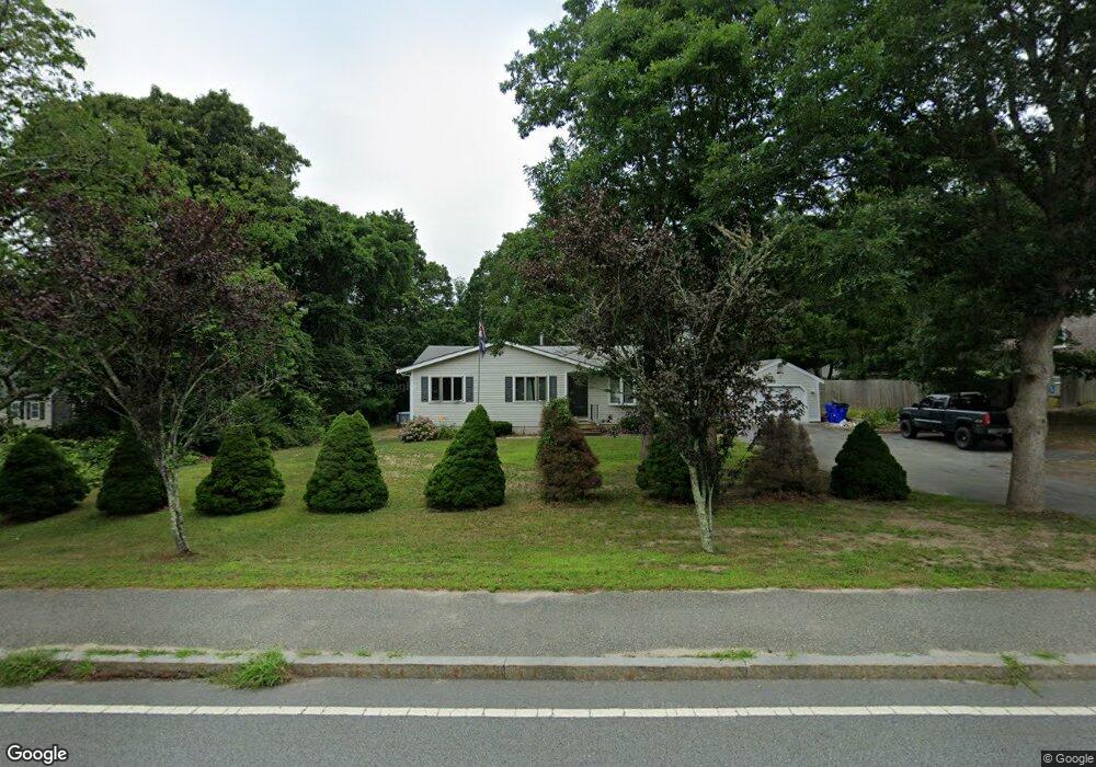
98 Barlows Landing Rd Pocasset, MA 02559
Pocasset NeighborhoodEstimated Value: $577,000 - $595,000
3
Beds
3
Baths
1,001
Sq Ft
$582/Sq Ft
Est. Value
About This Home
This home is located at 98 Barlows Landing Rd, Pocasset, MA 02559 and is currently estimated at $583,023, approximately $582 per square foot. 98 Barlows Landing Rd is a home located in Barnstable County with nearby schools including Bourne High School, Cadence Academy Preschool - Bourne, and St Margaret Regional School.
Ownership History
Date
Name
Owned For
Owner Type
Purchase Details
Closed on
Mar 27, 2018
Sold by
Neal John W
Bought by
Jomaco Ret and Neal
Current Estimated Value
Purchase Details
Closed on
Feb 7, 2017
Sold by
Staiger Laura and Ennis Peter J
Bought by
Neal John W
Purchase Details
Closed on
Sep 1, 2010
Sold by
Obrien Joseph A
Bought by
Staiger Laura E
Home Financials for this Owner
Home Financials are based on the most recent Mortgage that was taken out on this home.
Original Mortgage
$144,000
Interest Rate
4.55%
Mortgage Type
Purchase Money Mortgage
Purchase Details
Closed on
Nov 15, 1994
Sold by
Nolan Ruth I and Pagno Rita M
Bought by
Obrien Joseph A
Home Financials for this Owner
Home Financials are based on the most recent Mortgage that was taken out on this home.
Original Mortgage
$85,600
Interest Rate
8.78%
Mortgage Type
Purchase Money Mortgage
Create a Home Valuation Report for This Property
The Home Valuation Report is an in-depth analysis detailing your home's value as well as a comparison with similar homes in the area
Home Values in the Area
Average Home Value in this Area
Purchase History
| Date | Buyer | Sale Price | Title Company |
|---|---|---|---|
| Jomaco Ret | -- | -- | |
| Neal John W | $170,000 | -- | |
| Staiger Laura E | $180,000 | -- | |
| Staiger Laura E | $180,000 | -- | |
| Obrien Joseph A | $107,000 | -- | |
| Obrien Joseph A | $107,000 | -- |
Source: Public Records
Mortgage History
| Date | Status | Borrower | Loan Amount |
|---|---|---|---|
| Previous Owner | Staiger Laura E | $144,000 | |
| Previous Owner | Obrien Joseph A | $85,600 |
Source: Public Records
Tax History Compared to Growth
Tax History
| Year | Tax Paid | Tax Assessment Tax Assessment Total Assessment is a certain percentage of the fair market value that is determined by local assessors to be the total taxable value of land and additions on the property. | Land | Improvement |
|---|---|---|---|---|
| 2025 | $3,568 | $456,900 | $194,400 | $262,500 |
| 2024 | $3,564 | $444,400 | $194,400 | $250,000 |
| 2023 | $3,451 | $391,700 | $172,000 | $219,700 |
| 2022 | $3,306 | $327,700 | $152,200 | $175,500 |
| 2021 | $3,222 | $299,200 | $138,600 | $160,600 |
| 2020 | $3,137 | $292,100 | $137,200 | $154,900 |
| 2019 | $2,984 | $283,900 | $137,200 | $146,700 |
| 2018 | $2,786 | $264,300 | $130,700 | $133,600 |
| 2017 | $2,697 | $261,800 | $129,500 | $132,300 |
| 2016 | $2,552 | $251,200 | $123,300 | $127,900 |
| 2015 | $2,343 | $232,700 | $104,800 | $127,900 |
Source: Public Records
Map
Nearby Homes
- 94 Barlows Landing Rd
- 104 Barlows Landing Rd
- 112 Barlow's Landing
- 3 Gunstock Cir
- 90 Barlows Landing Rd
- 108 Barlows Landing Rd
- 2 Gunstock Cir
- 4 Gunstock Cir
- 7 Pryer Dr
- 1 Pryer Dr (Year Round)
- 103 Barlows Landing Rd
- 1 Pryer Dr
- 112 Barlows Landing Rd
- 1 Gunstock Cir
- 112 Barlows Landing Rd
- 108 Barlow
- 9 Pryer Dr
- 5 Gunstock Cir
- 109 Barlows Landing Rd
- 25 Pryer Dr