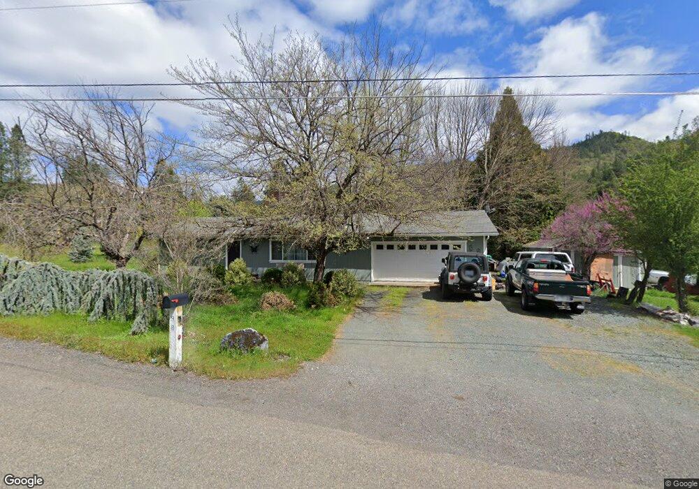
98 Matney Ln Rogue River, OR 97537
Estimated Value: $388,776 - $435,000
3
Beds
2
Baths
1,422
Sq Ft
$287/Sq Ft
Est. Value
About This Home
This home is located at 98 Matney Ln, Rogue River, OR 97537 and is currently estimated at $407,925, approximately $286 per square foot. 98 Matney Ln is a home located in Jackson County with nearby schools including South Valley Academy, Rogue River Elementary School, and Rogue River Junior/Senior High School.
Ownership History
Date
Name
Owned For
Owner Type
Purchase Details
Closed on
May 27, 2008
Sold by
Fisher David and Lone Pine Trust #4
Bought by
Ferguson Ken R
Current Estimated Value
Home Financials for this Owner
Home Financials are based on the most recent Mortgage that was taken out on this home.
Original Mortgage
$165,000
Interest Rate
5.87%
Mortgage Type
Seller Take Back
Purchase Details
Closed on
Apr 18, 2005
Sold by
Regnaud Lorraine A
Bought by
Fisher David and Lone Pine Trust #4
Purchase Details
Closed on
Mar 5, 2002
Sold by
Regnaud Lorraine A
Bought by
Regnaud Glenn H and Regnaud Lorraine A
Home Financials for this Owner
Home Financials are based on the most recent Mortgage that was taken out on this home.
Original Mortgage
$33,000
Interest Rate
6.94%
Create a Home Valuation Report for This Property
The Home Valuation Report is an in-depth analysis detailing your home's value as well as a comparison with similar homes in the area
Home Values in the Area
Average Home Value in this Area
Purchase History
| Date | Buyer | Sale Price | Title Company |
|---|---|---|---|
| Ferguson Ken R | $185,000 | First American | |
| Fisher David | $220,000 | First American | |
| Regnaud Glenn H | -- | First American Title Ins Co |
Source: Public Records
Mortgage History
| Date | Status | Borrower | Loan Amount |
|---|---|---|---|
| Closed | Ferguson Ken R | $165,000 | |
| Previous Owner | Regnaud Glenn H | $33,000 |
Source: Public Records
Tax History Compared to Growth
Tax History
| Year | Tax Paid | Tax Assessment Tax Assessment Total Assessment is a certain percentage of the fair market value that is determined by local assessors to be the total taxable value of land and additions on the property. | Land | Improvement |
|---|---|---|---|---|
| 2025 | $2,163 | $194,210 | $98,930 | $95,280 |
| 2024 | $2,163 | $188,560 | $89,710 | $98,850 |
| 2023 | $2,093 | $183,070 | $87,100 | $95,970 |
| 2022 | $1,981 | $183,070 | $87,100 | $95,970 |
| 2021 | $1,922 | $177,740 | $84,570 | $93,170 |
| 2020 | $1,874 | $172,570 | $82,100 | $90,470 |
| 2019 | $1,826 | $162,670 | $77,390 | $85,280 |
| 2018 | $1,777 | $157,940 | $75,140 | $82,800 |
| 2017 | $1,734 | $157,940 | $75,140 | $82,800 |
| 2016 | $1,689 | $148,880 | $70,830 | $78,050 |
| 2015 | $1,635 | $148,880 | $70,830 | $78,050 |
| 2014 | $1,580 | $140,340 | $66,750 | $73,590 |
Source: Public Records
Map
Nearby Homes
- 50 Tenney Dr
- 57 Matney Ln
- 1913 Wards Creek Rd
- 970 Wards Creek Rd
- 500 Tenney Dr
- 431 Robbins Ave
- 429 Robbins Ave
- 5525 Red Tail Ln
- 5500 Red Tail Ln
- 2661 Wards Creek Rd
- 182 Wards Creek Rd
- 713 Brookside Cir
- 105 Brolin Ct
- 305 Woodville Way
- 300 Woodville Way
- 1380 Rogue River Hwy
- 1424 Rogue River Hwy
- 904 Broadway St Unit 503
- 111 Cedar St
- TL 1303 E Main St
- 1450 Burbridge Dr
- 79 Matney Ln
- 1480 Burbridge Dr
- 1425 Burbridge Dr
- 1385 Burbridge Dr
- 1360 Burbridge Dr
- 78 Matney Ln
- 1500 Burbridge Dr
- 1345 Burbridge Dr
- 1340 Burbridge Dr
- 1475 Burbridge Dr
- 55 Tenney Dr
- 77 Tenney Dr
- 1325 Burbridge Dr
- 1320 Burbridge Dr
- 81 Tenney Dr
- 1514 Burbridge Dr
- 29 Tenney Dr
- 1617 Wards Creek Rd
- 1617 Wards Creek Rd