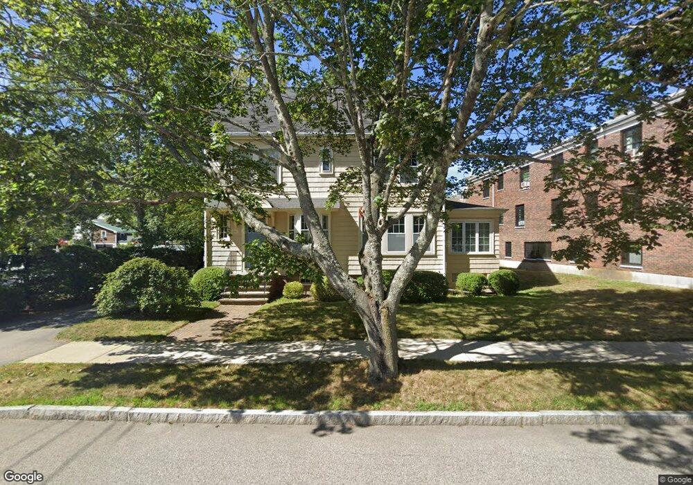
98 Miller Ave Unit 1 Portsmouth, NH 03801
Estimated Value: $670,000 - $795,000
2
Beds
2
Baths
1,185
Sq Ft
$607/Sq Ft
Est. Value
About This Home
This home is located at 98 Miller Ave Unit 1, Portsmouth, NH 03801 and is currently estimated at $719,887, approximately $607 per square foot. 98 Miller Ave Unit 1 is a home located in Rockingham County with nearby schools including Little Harbour School, Portsmouth Middle School, and Portsmouth High School.
Ownership History
Date
Name
Owned For
Owner Type
Purchase Details
Closed on
Apr 8, 2005
Sold by
Claire Rangnow T
Bought by
Arend Joshua B
Current Estimated Value
Home Financials for this Owner
Home Financials are based on the most recent Mortgage that was taken out on this home.
Original Mortgage
$256,000
Outstanding Balance
$44,067
Interest Rate
5%
Mortgage Type
Adjustable Rate Mortgage/ARM
Estimated Equity
$675,820
Create a Home Valuation Report for This Property
The Home Valuation Report is an in-depth analysis detailing your home's value as well as a comparison with similar homes in the area
Home Values in the Area
Average Home Value in this Area
Purchase History
| Date | Buyer | Sale Price | Title Company |
|---|---|---|---|
| Arend Joshua B | $321,000 | -- |
Source: Public Records
Mortgage History
| Date | Status | Borrower | Loan Amount |
|---|---|---|---|
| Open | Arend Joshua B | $256,000 |
Source: Public Records
Tax History Compared to Growth
Tax History
| Year | Tax Paid | Tax Assessment Tax Assessment Total Assessment is a certain percentage of the fair market value that is determined by local assessors to be the total taxable value of land and additions on the property. | Land | Improvement |
|---|---|---|---|---|
| 2024 | $7,476 | $668,700 | $0 | $668,700 |
| 2023 | $7,039 | $436,400 | $0 | $436,400 |
| 2022 | $6,633 | $436,400 | $0 | $436,400 |
| 2021 | $6,559 | $436,400 | $0 | $436,400 |
| 2020 | $6,415 | $436,400 | $0 | $436,400 |
| 2019 | $6,485 | $436,400 | $0 | $436,400 |
| 2018 | $6,468 | $414,300 | $0 | $414,300 |
| 2017 | $6,152 | $414,300 | $0 | $414,300 |
| 2016 | $5,932 | $348,100 | $0 | $348,100 |
| 2015 | $5,845 | $348,100 | $0 | $348,100 |
| 2014 | $5,989 | $330,900 | $0 | $330,900 |
| 2013 | $6,276 | $350,400 | $0 | $350,400 |
| 2012 | $6,150 | $350,400 | $0 | $350,400 |
Source: Public Records
Map
Nearby Homes
- 34 Highland St
- 21 Madison St
- 238 Austin St
- 161 Wibird St
- 5 Old Parish Way
- 198 Islington St Unit 6
- 115 Court St
- 4 Rock St Unit B
- 51 Islington St Unit 406
- 332 Hanover St
- 92 Brewster St
- 210 South St
- 490 Islington St Unit 1
- 90 Fleet St Unit 4-5
- 199 Mcdonough St
- 70 Maplewood Ave Unit 305
- 70 Maplewood Ave Unit 202
- 70 Maplewood Ave Unit 204
- 70 Maplewood Ave Unit 303
- 70 Maplewood Ave Unit 302
- 98 Miller Ave Unit 2
- 10 Merrimac St Unit 4
- 10 Merrimac St Unit 5
- 10 Merrimac St Unit 6
- 10 Merrimac St Unit 8
- 10 Merrimac St Unit 2
- 10 Merrimac St Unit 7
- 10 Merrimac St Unit 3
- 40 Merrimac St Unit 3
- 40 Merrimac St Unit 2
- 40 Merrimac St Unit 1
- 263 Rockland St
- 67 Miller Ave
- 65 Broad St
- 133 Miller Ave
- 293 Rockland St
- 81 Merrimac St Unit 2B
- 81 Merrimac St Unit 2A
- 83 Merrimac St Unit 2A
- 81 Merrimac St Unit 2