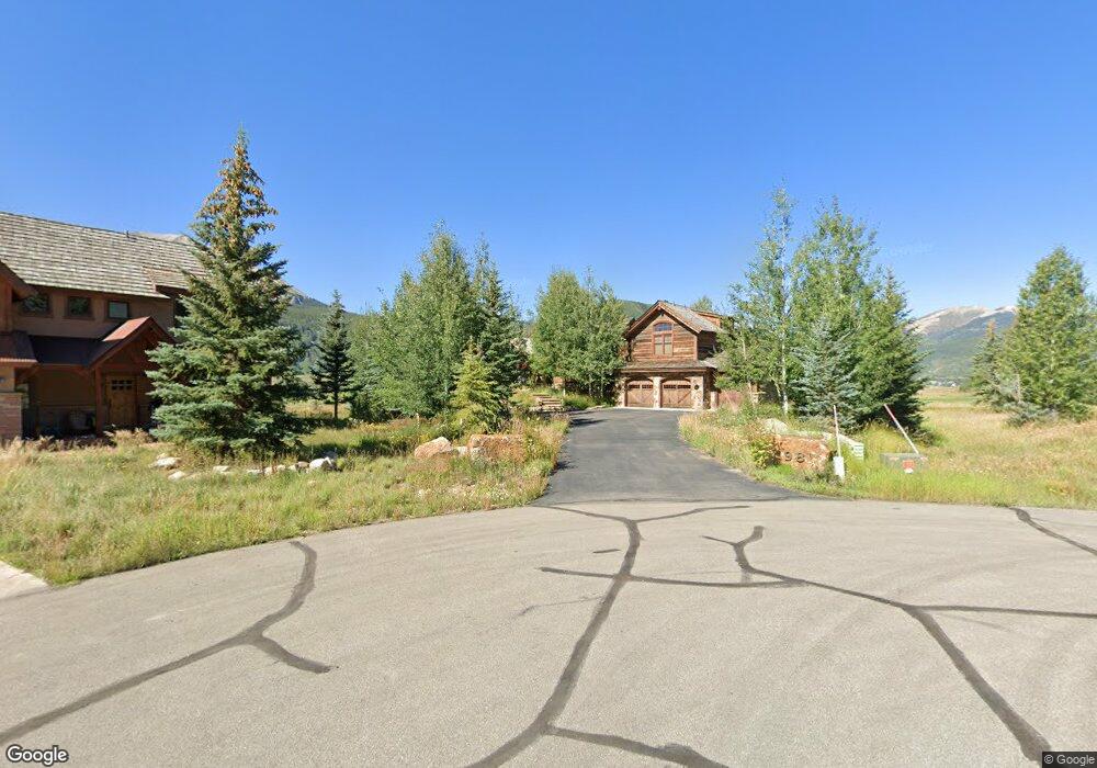
98 Mulligan Dr Crested Butte, CO 81224
Estimated Value: $2,761,000 - $5,193,000
5
Beds
9
Baths
2,984
Sq Ft
$1,450/Sq Ft
Est. Value
About This Home
This home is located at 98 Mulligan Dr, Crested Butte, CO 81224 and is currently estimated at $4,326,849, approximately $1,450 per square foot. 98 Mulligan Dr is a home located in Gunnison County with nearby schools including Gunnison Elementary School, Crested Butte Community School, and Gunnison Middle School.
Ownership History
Date
Name
Owned For
Owner Type
Purchase Details
Closed on
Apr 26, 2022
Sold by
Linda N Mcdonald Trust
Bought by
Douglas I Mcdonald Trust
Current Estimated Value
Purchase Details
Closed on
Jul 5, 2007
Sold by
Mcdonald Douglas Ian and Mcdonald Linda Neal
Bought by
The Douglas I Mcdonald Trust
Purchase Details
Closed on
Oct 11, 2005
Sold by
Kuzio Julie A
Bought by
Kuzio Mark S
Purchase Details
Closed on
Apr 26, 2005
Sold by
Ostlund Alan J and Ostlund Jacquelilne A
Bought by
Mcdonald Douglas Ian and Mcdonald Linda Neal
Purchase Details
Closed on
May 18, 1998
Sold by
Crank William V
Bought by
Ostlund Alan J
Create a Home Valuation Report for This Property
The Home Valuation Report is an in-depth analysis detailing your home's value as well as a comparison with similar homes in the area
Home Values in the Area
Average Home Value in this Area
Purchase History
| Date | Buyer | Sale Price | Title Company |
|---|---|---|---|
| Douglas I Mcdonald Trust | -- | None Listed On Document | |
| The Douglas I Mcdonald Trust | -- | None Available | |
| Kuzio Mark S | -- | First Gunnison Title 7 Escro | |
| Mcdonald Douglas Ian | $570,000 | Title Company Of Crested But | |
| Ostlund Alan J | $160,000 | -- |
Source: Public Records
Tax History Compared to Growth
Tax History
| Year | Tax Paid | Tax Assessment Tax Assessment Total Assessment is a certain percentage of the fair market value that is determined by local assessors to be the total taxable value of land and additions on the property. | Land | Improvement |
|---|---|---|---|---|
| 2024 | $21,177 | $281,210 | $44,320 | $236,890 |
| 2023 | $21,177 | $277,520 | $43,740 | $233,780 |
| 2022 | $18,593 | $208,240 | $23,280 | $184,960 |
| 2021 | $17,115 | $214,240 | $23,950 | $190,290 |
| 2020 | $12,190 | $144,810 | $20,110 | $124,700 |
| 2019 | $12,021 | $144,810 | $20,110 | $124,700 |
| 2018 | $11,787 | $131,030 | $17,500 | $113,530 |
| 2017 | $0 | $131,030 | $17,500 | $113,530 |
| 2016 | $12,061 | $138,730 | $19,900 | $118,830 |
Source: Public Records
Map
Nearby Homes
- 402 Eagle Ln
- 262 Larkspur Loop
- 115 Larkspur Loop
- 166 & 168 Coyote Cir
- 365 Larkspur Loop
- 429 Larkspur Loop
- 140 Alpine Ct
- 315 Par Ln
- 64 Vista Ct
- 88 Vista Ct
- 17 Short Dr
- 350 Country Club Dr Unit 217A
- 350 Country Club Dr Unit 218A
- 350 Country Club Dr Unit 402A
- 179 Aspen Ln
- 491 Slate River Dr
- 22 Links Ln
- 412 Ridge Rd
- 322 Wapiti
- 434 Country Club Dr
- 86 Mulligan Dr
- 1 Mulligan Dr
- 101 Mulligan Dr
- 217 Fairway Dr
- 217 Fairway Dr Unit LOT S92 SKYLAND INIT
- 233 Fairway Dr
- 68 Mulligan Dr
- 81 Mulligan Dr
- 199 Fairway Dr
- 249 Fairway Dr
- 40 Mulligan Dr
- 0 Mulligan Dr
- 53 Mulligan Dr
- S94 Fairway Dr
- 181 Fairway Dr
- 181 Fairway Dr Unit Lot S-90, Skyland
- 0 Fairway Dr Unit 766554
- 0 Fairway Dr Unit 762047
- 0 Fairway Dr Unit 761514
- 0 Fairway Dr Unit 760908