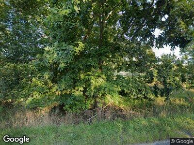
98 Route 899 Clarington, PA 15828
Estimated Value: $60,720 - $182,000
--
Bed
--
Bath
768
Sq Ft
$174/Sq Ft
Est. Value
About This Home
This home is located at 98 Route 899, Clarington, PA 15828 and is currently estimated at $133,680, approximately $174 per square foot. 98 Route 899 is a home located in Jefferson County with nearby schools including Hickory Grove Elementary School, Northside Elementary School, and Pinecreek Elementary School.
Ownership History
Date
Name
Owned For
Owner Type
Purchase Details
Closed on
Sep 4, 2012
Sold by
Kuntz Benjamin N and Confer Emily N
Bought by
Snyder Michale L
Current Estimated Value
Home Financials for this Owner
Home Financials are based on the most recent Mortgage that was taken out on this home.
Original Mortgage
$70,009
Outstanding Balance
$50,589
Interest Rate
3.62%
Mortgage Type
New Conventional
Estimated Equity
$84,224
Purchase Details
Closed on
Feb 21, 2006
Sold by
Rex Brady B and Rex Jessica N
Bought by
Kuntz Benjamin N and Confer Emily M
Home Financials for this Owner
Home Financials are based on the most recent Mortgage that was taken out on this home.
Original Mortgage
$60,800
Interest Rate
6.15%
Mortgage Type
New Conventional
Create a Home Valuation Report for This Property
The Home Valuation Report is an in-depth analysis detailing your home's value as well as a comparison with similar homes in the area
Home Values in the Area
Average Home Value in this Area
Purchase History
| Date | Buyer | Sale Price | Title Company |
|---|---|---|---|
| Snyder Michale L | $72,175 | None Available | |
| Kuntz Benjamin N | $64,000 | None Available |
Source: Public Records
Mortgage History
| Date | Status | Borrower | Loan Amount |
|---|---|---|---|
| Open | Snyder Michale L | $70,009 | |
| Previous Owner | Luntz Benjamin N | $57,562 | |
| Previous Owner | Kuntz Benjamin N | $60,800 | |
| Previous Owner | Rex Brady B | $7,000 |
Source: Public Records
Tax History Compared to Growth
Tax History
| Year | Tax Paid | Tax Assessment Tax Assessment Total Assessment is a certain percentage of the fair market value that is determined by local assessors to be the total taxable value of land and additions on the property. | Land | Improvement |
|---|---|---|---|---|
| 2024 | $1,662 | $34,390 | $2,310 | $32,080 |
| 2023 | $1,627 | $34,390 | $2,310 | $32,080 |
| 2022 | $1,515 | $31,360 | $2,370 | $28,990 |
| 2021 | $1,456 | $31,360 | $2,370 | $28,990 |
| 2020 | $1,487 | $31,360 | $2,370 | $28,990 |
| 2019 | $1,471 | $31,360 | $2,370 | $28,990 |
| 2018 | $1,440 | $31,360 | $2,370 | $28,990 |
| 2017 | -- | $31,360 | $2,370 | $28,990 |
| 2016 | $1,340 | $31,360 | $2,370 | $28,990 |
| 2015 | -- | $31,360 | $2,370 | $28,990 |
| 2012 | -- | $31,360 | $2,370 | $28,990 |
Source: Public Records
Map
Nearby Homes
- 1074 Ames Cir
- 000 Cathers Run Rd
- 00 Cathers Run Rd
- 000 Fisher Rd
- 13884 Route 36
- 38 Oak Ln
- 0 Haynes Ln
- 1436 Blue Ridge Rd
- 000 Iron Bridge Rd
- 1-B-3 Chaney Rd
- LOT 8 Gobbler Ridge Rd
- 0 Moose Ln
- LOT 7B Moose Ln
- LOT 10C Moose Ln
- 6A Moose Ln
- 16555 Pennsylvania 949
- 386 Backwoods Ln
- 147 Well Rd
- 1965 Caldwell Corner Rd
- 2707 Moore Bridge Rd
