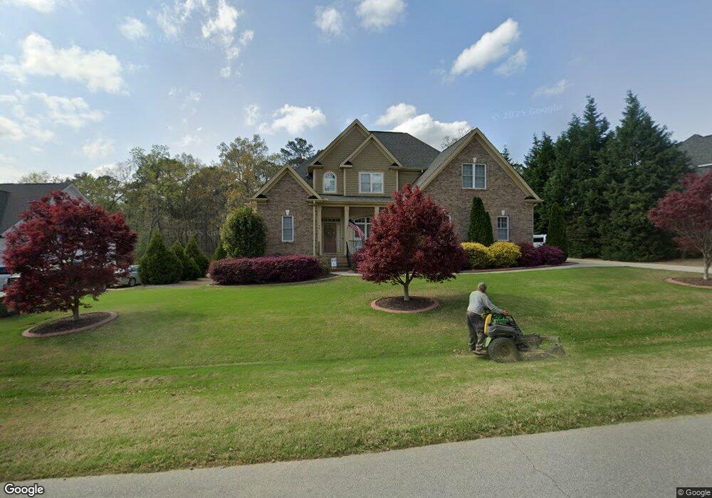
98 Silverside Dr Angier, NC 27501
Pleasant Grove NeighborhoodEstimated Value: $516,522 - $755,000
4
Beds
4
Baths
2,950
Sq Ft
$204/Sq Ft
Est. Value
About This Home
This home is located at 98 Silverside Dr, Angier, NC 27501 and is currently estimated at $603,131, approximately $204 per square foot. 98 Silverside Dr is a home located in Johnston County with nearby schools including McGee's Crossroads Elementary School, McGee's Crossroads Middle School, and West Johnston High School.
Ownership History
Date
Name
Owned For
Owner Type
Purchase Details
Closed on
Feb 26, 2008
Sold by
Chase Brandon Builders Inc
Bought by
Yahraes James L and Yahraes Pamela J
Current Estimated Value
Home Financials for this Owner
Home Financials are based on the most recent Mortgage that was taken out on this home.
Original Mortgage
$398,900
Outstanding Balance
$247,038
Interest Rate
5.63%
Mortgage Type
VA
Estimated Equity
$356,093
Purchase Details
Closed on
Apr 30, 2007
Sold by
Marcus Edwards Development Llc
Bought by
Chase Brandon Builders Inc
Create a Home Valuation Report for This Property
The Home Valuation Report is an in-depth analysis detailing your home's value as well as a comparison with similar homes in the area
Home Values in the Area
Average Home Value in this Area
Purchase History
| Date | Buyer | Sale Price | Title Company |
|---|---|---|---|
| Yahraes James L | $399,000 | None Available | |
| Chase Brandon Builders Inc | $240,000 | None Available |
Source: Public Records
Mortgage History
| Date | Status | Borrower | Loan Amount |
|---|---|---|---|
| Open | Yahraes James L | $398,900 |
Source: Public Records
Tax History
| Year | Tax Paid | Tax Assessment Tax Assessment Total Assessment is a certain percentage of the fair market value that is determined by local assessors to be the total taxable value of land and additions on the property. | Land | Improvement |
|---|---|---|---|---|
| 2025 | $3,674 | $554,050 | $70,000 | $484,050 |
| 2024 | $3,035 | $346,490 | $36,000 | $310,490 |
| 2023 | $2,970 | $346,490 | $36,000 | $310,490 |
| 2022 | $3,069 | $346,490 | $36,000 | $310,490 |
| 2021 | $2,807 | $346,490 | $36,000 | $310,490 |
| 2020 | $3,237 | $346,490 | $36,000 | $310,490 |
| 2019 | $3,219 | $346,490 | $36,000 | $310,490 |
| 2018 | $3,167 | $356,100 | $40,000 | $316,100 |
| 2017 | $3,158 | $356,100 | $40,000 | $316,100 |
| 2016 | $3,212 | $356,100 | $40,000 | $316,100 |
| 2015 | $3,184 | $356,100 | $40,000 | $316,100 |
| 2014 | $3,184 | $356,100 | $40,000 | $316,100 |
Source: Public Records
Map
Nearby Homes
- 197 Silverside Dr
- 105 Pinecrest Dr
- 810 | 850 Wiggins Rd
- 506 Harbor Cove Dr
- 71 Suzanne Dr
- 16 Keystone Ct
- 369 Everland Pkwy
- 264 Harbor Cove Dr
- 3361 Old Fairground Rd
- 444 Everland Pkwy
- 232 Burrage Dr
- 205 Teresa Ct
- 3002 Red Cir
- 131 Regal Pond Dr
- 57 Bowie Ct
- 16622 N Carolina 210
- 40 Broadhead Ct
- 115 S Bream Ct
- 115 S Bream Ct Unit Lot 6
- 106 S Bream Ct Unit Lot 10
- 72 Silverside Dr
- 120 Silverside Dr Unit 47
- 120 Silverside Dr
- 0 Silverside Dr Unit LP551328
- 0 Silverside Dr Unit LP520017
- 0 Silverside Dr Unit LP520014
- 0 Silverside Dr Unit LP520015
- 0 Silverside Dr Unit LP520016
- 0 Silverside Dr Unit LP551329
- 142 Silverside Dr
- 22 Silverside Dr
- 22 Silverside Dr Unit 51
- 142 Silverside Dr Unit 46
- 191 Silverside Dr Unit 41
- 191 Silverside Dr
- 0 Silverside Dr
- 48 Silverside Dr
- 48 Silverside Dr Unit 50
- 325 Brookstone Way Unit 52
- 325 Brookstone Way
Your Personal Tour Guide
Ask me questions while you tour the home.