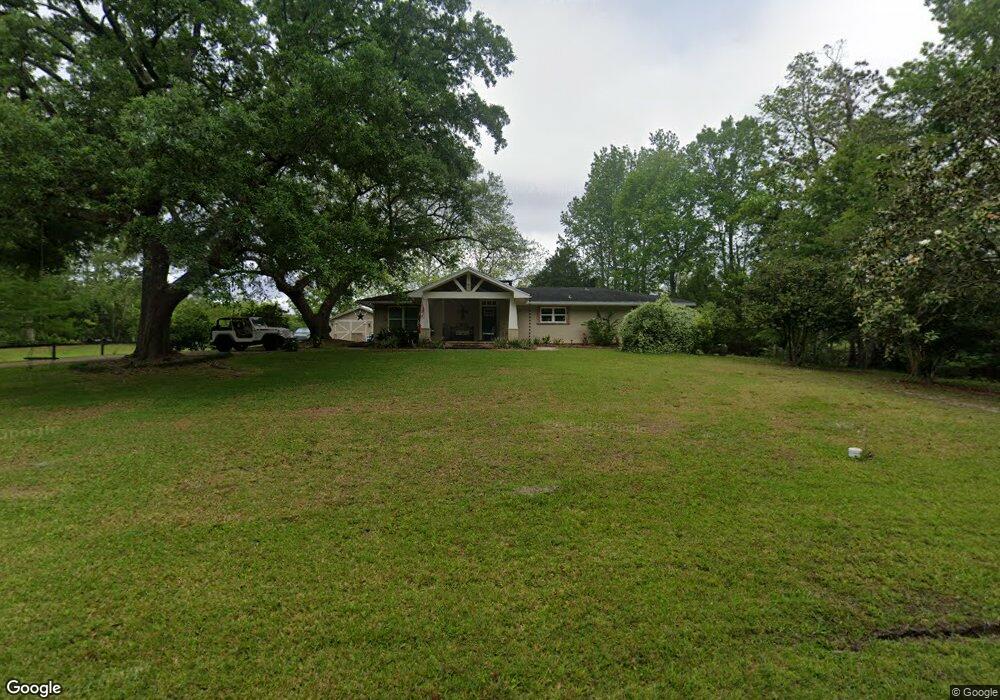
980 Camp Four Jacks Rd Biloxi, MS 39532
Estimated Value: $252,793 - $340,000
3
Beds
1
Bath
2,654
Sq Ft
$108/Sq Ft
Est. Value
About This Home
This home is located at 980 Camp Four Jacks Rd, Biloxi, MS 39532 and is currently estimated at $287,948, approximately $108 per square foot. 980 Camp Four Jacks Rd is a home located in Harrison County with nearby schools including North Bay Elementary School, Biloxi Junior High School, and Biloxi High School.
Ownership History
Date
Name
Owned For
Owner Type
Purchase Details
Closed on
Jul 23, 2021
Sold by
Barlow Craig S and Barlow Pamela P
Bought by
Spencer Misty S and Spencer Patrick M
Current Estimated Value
Purchase Details
Closed on
Dec 29, 2016
Sold by
Duggan Frankie J
Bought by
Spencer Misty S and Spencer Patrick M
Home Financials for this Owner
Home Financials are based on the most recent Mortgage that was taken out on this home.
Original Mortgage
$123,500
Interest Rate
4.13%
Create a Home Valuation Report for This Property
The Home Valuation Report is an in-depth analysis detailing your home's value as well as a comparison with similar homes in the area
Home Values in the Area
Average Home Value in this Area
Purchase History
| Date | Buyer | Sale Price | Title Company |
|---|---|---|---|
| Spencer Misty S | -- | None Available | |
| Spencer Misty S | $130,000 | -- |
Source: Public Records
Mortgage History
| Date | Status | Borrower | Loan Amount |
|---|---|---|---|
| Previous Owner | Spencer Misty S | $123,500 |
Source: Public Records
Tax History
| Year | Tax Paid | Tax Assessment Tax Assessment Total Assessment is a certain percentage of the fair market value that is determined by local assessors to be the total taxable value of land and additions on the property. | Land | Improvement |
|---|---|---|---|---|
| 2025 | $1,454 | $15,693 | $0 | $0 |
| 2024 | $1,362 | $15,002 | $0 | $0 |
| 2023 | $1,324 | $14,793 | $0 | $0 |
| 2022 | $1,324 | $14,793 | $0 | $0 |
| 2021 | $1,324 | $14,793 | $0 | $0 |
| 2020 | $1,211 | $13,753 | $0 | $0 |
| 2019 | $1,173 | $13,403 | $0 | $0 |
| 2018 | $1,173 | $13,403 | $0 | $0 |
| 2017 | $1,173 | $13,403 | $0 | $0 |
| 2015 | $2,316 | $21,071 | $0 | $0 |
| 2014 | -- | $7,500 | $0 | $0 |
| 2013 | -- | $14,048 | $2,300 | $11,748 |
Source: Public Records
Map
Nearby Homes
- 1985 Kornman Dr
- 0 Campbell Road Dr Unit 4027188
- 0 Popps Ferry Rd Unit 4138386
- 0 Popps Ferry Rd Unit 4108141
- 0 Popps Ferry Rd Unit 4108136
- 2106 Lauren Dr
- 0 Jam Ln
- 1884 Courtney Ln
- 856 Rustwood Dr
- 830 Bluewood Dr
- 2091 Carolwood Dr
- 844 Carolee Cir
- 873 Carolee Cir
- 796 Sharon Hills Dr
- 939 Tommy Munro Dr
- 712 Champagne Dr
- 774 Sharon Hills Dr
- 2033 S Hill Dr
- 694 Water's View Dr
- 726 Sharon Hills Dr
- 960 Camp Four Jacks Rd
- 1000 Camp Four Jacks Rd
- 1000 Camp Four Jacks Rd
- 1965 Kornman Dr
- 1016 Camp Four Jacks Rd
- 950 Camp Four Jacks Rd
- 1967 Mitchell Rd
- 1006 Camp Four Jacks Rd
- 944 Camp Four Jacks Rd
- 940 Camp Four Jacks Rd
- 1953 Kornman Dr
- 945 Camp Four Jacks Rd
- 1040 Camp Four Jacks Rd
- 1955 Kornman Dr
- 1963 Kornman Dr
- 1941 Kornman Dr
- 1967 Kornman Dr
- 935 Camp Four Jacks Rd
- 1095 Camp Four Jacks Rd
- 1935 Kornman Dr
Your Personal Tour Guide
Ask me questions while you tour the home.