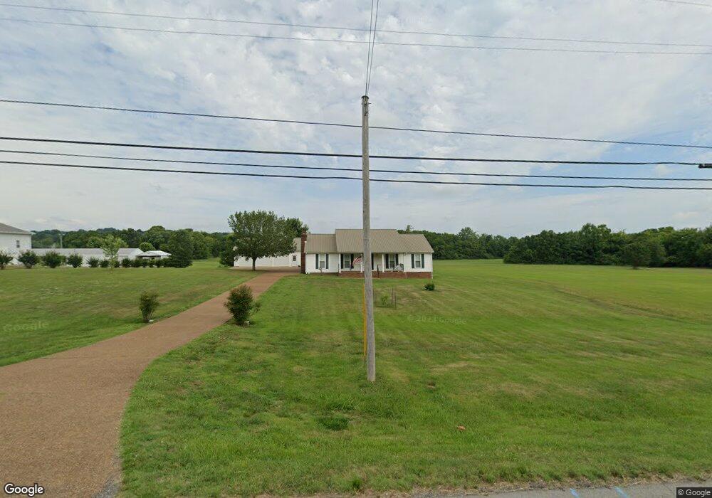
980 Cornersville Rd Lewisburg, TN 37091
Estimated Value: $311,000 - $364,000
--
Bed
2
Baths
1,632
Sq Ft
$204/Sq Ft
Est. Value
About This Home
This home is located at 980 Cornersville Rd, Lewisburg, TN 37091 and is currently estimated at $333,666, approximately $204 per square foot. 980 Cornersville Rd is a home located in Marshall County with nearby schools including Marshall Elementary School, Oak Grove Elementary School, and Westhills Elementary School.
Ownership History
Date
Name
Owned For
Owner Type
Purchase Details
Closed on
Sep 30, 2005
Sold by
Charles Woods and Charles Patsy
Bought by
Terry Dillard and Terry Victoria
Current Estimated Value
Purchase Details
Closed on
Apr 26, 2005
Bought by
Dillard Terry D and Dillard Victoria
Purchase Details
Closed on
Jun 18, 1996
Sold by
Gipson Robert C
Bought by
Wright James F and Wright Jewell L
Purchase Details
Closed on
Oct 28, 1988
Bought by
Gipson Robert C and Gipson Patsy M
Create a Home Valuation Report for This Property
The Home Valuation Report is an in-depth analysis detailing your home's value as well as a comparison with similar homes in the area
Home Values in the Area
Average Home Value in this Area
Purchase History
| Date | Buyer | Sale Price | Title Company |
|---|---|---|---|
| Terry Dillard | $25,000 | -- | |
| Dillard Terry D | $110,100 | -- | |
| Wright James F | $6,000 | -- | |
| Gipson Robert C | $30,000 | -- |
Source: Public Records
Tax History Compared to Growth
Tax History
| Year | Tax Paid | Tax Assessment Tax Assessment Total Assessment is a certain percentage of the fair market value that is determined by local assessors to be the total taxable value of land and additions on the property. | Land | Improvement |
|---|---|---|---|---|
| 2024 | -- | $67,875 | $17,650 | $50,225 |
| 2023 | $2,106 | $67,875 | $17,650 | $50,225 |
| 2022 | $2,106 | $67,875 | $17,650 | $50,225 |
| 2021 | $2,182 | $46,925 | $14,675 | $32,250 |
| 2020 | $2,045 | $46,925 | $14,675 | $32,250 |
| 2019 | $1,979 | $43,950 | $14,675 | $29,275 |
| 2018 | $1,957 | $43,950 | $14,675 | $29,275 |
| 2017 | $1,957 | $43,950 | $14,675 | $29,275 |
| 2016 | $2,125 | $41,500 | $14,675 | $26,825 |
| 2015 | $1,938 | $41,500 | $14,675 | $26,825 |
| 2014 | $1,938 | $41,500 | $14,675 | $26,825 |
Source: Public Records
Map
Nearby Homes
- 1011 Cornersville Rd
- 1205 Maelee Ann Dr
- 125 Southview Dr
- 198 Southview Dr
- 1128 Moreno Ln
- 104 Mackenzie Way
- MEDFORD Plan at King's Landing
- 185 Southview Dr
- 103 Mackenzie Way
- 147 Mackenzie Way
- 149 Mackenzie Way
- 151 Mackenzie Way
- 153 Mackenzie Way
- 155 Mackenzie Way
- 157 Mackenzie Way
- 159 Mackenzie Way
- 301 Weston Dr
- 977 Galloway St
- 313 Pardo Dr
- 1020 Corey Dr
- 900 Cornersville Rd
- 985 Cornersville Rd
- 975 Cornersville Rd
- 965 Cornersville Rd
- 995 Cornersville Rd
- 1021 Cornersville Rd
- 1035 Cornersville Rd
- 1045 Cornersville Rd
- 925 Cornersville Rd
- 1055 Cornersville Rd
- 1085 Cornersville Rd
- 920 Fox Ln
- 920 Fox Ln
- 800 Fox Ln
- 946 Cheryl Dr
- 946 Cheryl Dr
- 940 Cheryl Dr
- 966 Cheryl Dr
- 974 Cheryl Dr
- 990 Cheryl Dr