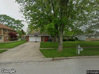
9800 W 136th Ln Cedar Lake, IN 46303
Estimated Value: $246,117 - $348,000
2
Beds
1
Bath
1,284
Sq Ft
$214/Sq Ft
Est. Value
About This Home
This home is located at 9800 W 136th Ln, Cedar Lake, IN 46303 and is currently estimated at $274,779, approximately $214 per square foot. 9800 W 136th Ln is a home with nearby schools including Jane Ball Elementary School, Hanover Central Middle School, and Hanover Central High School.
Ownership History
Date
Name
Owned For
Owner Type
Purchase Details
Closed on
Aug 31, 2020
Sold by
Lighthouse Church Of Cedar Lake
Bought by
Curtis Anthony
Current Estimated Value
Home Financials for this Owner
Home Financials are based on the most recent Mortgage that was taken out on this home.
Original Mortgage
$174,600
Outstanding Balance
$158,526
Interest Rate
2.8%
Mortgage Type
New Conventional
Purchase Details
Closed on
Jul 16, 2018
Sold by
Northwest Indiana Baptist Association
Bought by
Lighthouse Church Of Cedar Lake
Create a Home Valuation Report for This Property
The Home Valuation Report is an in-depth analysis detailing your home's value as well as a comparison with similar homes in the area
Home Values in the Area
Average Home Value in this Area
Purchase History
| Date | Buyer | Sale Price | Title Company |
|---|---|---|---|
| Curtis Anthony | -- | Chicago Title Insurance Co | |
| Curtis Anthony | -- | Chicago Title Insurance Co | |
| Lighthouse Church Of Cedar Lake | -- | None Available | |
| Northwest Indiana Not For Profit | -- | None Available |
Source: Public Records
Mortgage History
| Date | Status | Borrower | Loan Amount |
|---|---|---|---|
| Open | Curtis Anthony | $174,600 | |
| Closed | Curtis Anthony | $174,600 |
Source: Public Records
Tax History Compared to Growth
Tax History
| Year | Tax Paid | Tax Assessment Tax Assessment Total Assessment is a certain percentage of the fair market value that is determined by local assessors to be the total taxable value of land and additions on the property. | Land | Improvement |
|---|---|---|---|---|
| 2024 | $4,884 | $185,400 | $31,300 | $154,100 |
| 2023 | $1,980 | $183,700 | $31,300 | $152,400 |
| 2022 | $1,980 | $177,600 | $31,300 | $146,300 |
| 2021 | $1,759 | $173,000 | $31,300 | $141,700 |
| 2020 | $0 | $174,900 | $31,300 | $143,600 |
| 2019 | $0 | $165,900 | $31,300 | $134,600 |
| 2018 | $0 | $159,000 | $31,300 | $127,700 |
| 2017 | $0 | $153,000 | $31,300 | $121,700 |
| 2016 | $0 | $133,000 | $31,300 | $101,700 |
| 2014 | -- | $123,700 | $31,300 | $92,400 |
| 2013 | -- | $116,300 | $31,300 | $85,000 |
Source: Public Records
Map
Nearby Homes
- 9803 W 136th Ln
- 9950 Beacon Pointe Ln
- 10203 W 135th Place
- 9765 Beacon Pointe Ln
- 10143 Sumter Ct
- 13795 Freedom Way
- 13490 Freedom Way
- 13510 Freedom Way
- 13494 Freedom Way
- 13514 Freedom Way
- 13509 Freedom Way
- 9647 Tradewind Place
- 9906 Richmond Ave
- 13379 Gabriel Dr
- 5856 134th Ave
- 5833 W 134th Ave
- 10174 W 134th Ave
- 10410 Imperial Place
- 13981 Nantucket Dr
- 9130 W 137th Place
- 9800 W 136th Ln
- 9804 W 136th Ln
- 9722 W 136th Ln
- 9801 W 136th Ln
- 9810 W 136th Ln
- 13601 Euclid St
- 9813 W 136th Place
- 9733 W 136th Place
- 9716 W 136th Ln
- Lot 171 Euclid St
- Lot 177 Euclid St
- Lot 184 Euclid St
- Lot 192 Euclid St
- Lot 188 Euclid St
- Lot 187 Euclid St
- Lot 185 Euclid St
- Lot 191 Euclid St
- Lot 183 Euclid St
- Lot 190 Euclid St
- Lot 186 Euclid St