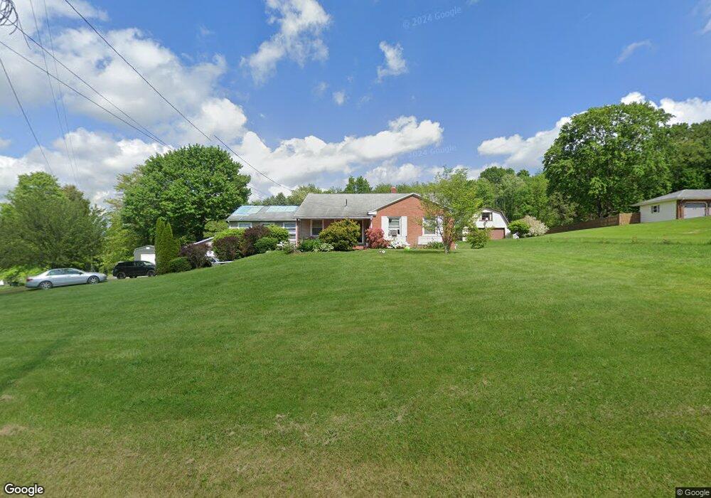
9803 Unity Rd Youngstown, OH 44514
Estimated Value: $220,000 - $302,000
3
Beds
2
Baths
2,001
Sq Ft
$135/Sq Ft
Est. Value
About This Home
This home is located at 9803 Unity Rd, Youngstown, OH 44514 and is currently estimated at $270,718, approximately $135 per square foot. 9803 Unity Rd is a home located in Mahoning County with nearby schools including Springfield Elementary School, Springfield Intermediate Middle School, and Springfield High School.
Ownership History
Date
Name
Owned For
Owner Type
Purchase Details
Closed on
Sep 12, 2022
Sold by
Howley Francis
Bought by
Howley Nancy
Current Estimated Value
Purchase Details
Closed on
Mar 10, 1998
Sold by
Paranzano Thomas M and Paranzino Patricia A
Bought by
Howley Frank E and Howley Nancy J
Purchase Details
Closed on
Jan 27, 1994
Bought by
Paranzino Thos M and P A
Create a Home Valuation Report for This Property
The Home Valuation Report is an in-depth analysis detailing your home's value as well as a comparison with similar homes in the area
Purchase History
| Date | Buyer | Sale Price | Title Company |
|---|---|---|---|
| Howley Nancy | -- | -- | |
| Howley Frank E | $123,000 | -- | |
| Paranzino Thos M | $65,000 | -- |
Source: Public Records
Mortgage History
| Date | Status | Borrower | Loan Amount |
|---|---|---|---|
| Closed | Howley Frank E | $0 |
Source: Public Records
Tax History
| Year | Tax Paid | Tax Assessment Tax Assessment Total Assessment is a certain percentage of the fair market value that is determined by local assessors to be the total taxable value of land and additions on the property. | Land | Improvement |
|---|---|---|---|---|
| 2025 | $3,033 | $67,630 | $5,750 | $61,880 |
| 2024 | $2,333 | $67,630 | $5,750 | $61,880 |
| 2023 | $2,319 | $67,630 | $5,750 | $61,880 |
| 2022 | $1,856 | $50,730 | $5,750 | $44,980 |
| 2021 | $1,870 | $50,730 | $5,750 | $44,980 |
| 2020 | $1,881 | $50,730 | $5,750 | $44,980 |
| 2019 | $1,693 | $45,200 | $5,750 | $39,450 |
| 2018 | $1,672 | $45,200 | $5,750 | $39,450 |
| 2017 | $1,633 | $45,200 | $5,750 | $39,450 |
| 2016 | $1,597 | $43,230 | $4,510 | $38,720 |
| 2015 | $1,554 | $43,230 | $4,510 | $38,720 |
| 2014 | $1,561 | $43,230 | $4,510 | $38,720 |
| 2013 | $1,546 | $43,230 | $4,510 | $38,720 |
Source: Public Records
Map
Nearby Homes
- 9868 Unity Rd
- 4035 Shelly Lynn Dr
- 4025 Shelly Lynn Dr
- 10115 Carrie Ct
- 10105 Carrie Ct
- 170 Sandy Ct Unit 11
- 170 Sandy Ct Unit 7
- 4957 E Calla Rd
- 46 Ohlin Dr
- 9825 Struthers Rd
- 8736 Harvest Glenn Trail Unit 10
- 8740 Harvest Glenn Trail Unit 11
- 8748 Harvest Glenn Trail Unit 13
- 8744 Harvest Glenn Trail Unit 12
- 8732 Harvest Glenn Trail Unit 9
- 8745 Harvest Glenn Trail Unit 14
- 93 Woodland Dr
- 8728 Harvest Glenn Trail Unit 8
- 8737 Harvest Glenn Trail Unit 15
- 8733 Harvest Glenn Trail Unit 16
Your Personal Tour Guide
Ask me questions while you tour the home.